
Château de Puilaurens
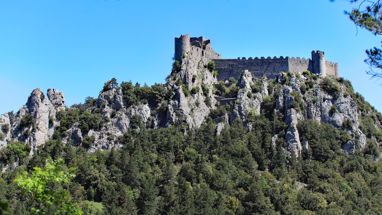
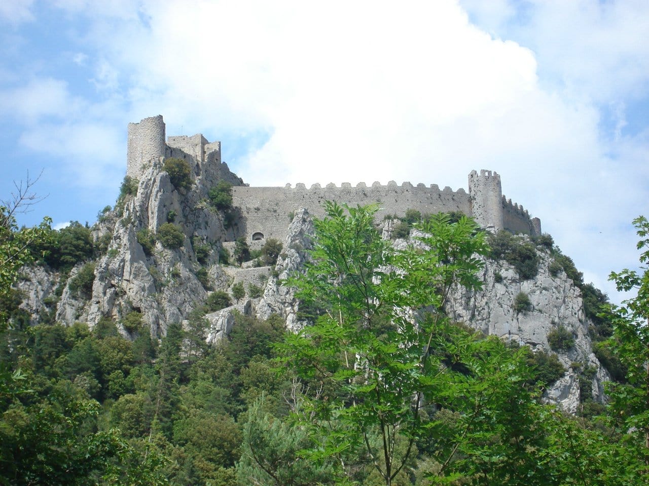
Château de Puilaurens crowns a rocky spur 697 meters above sea level, high over the Boulzane valley, in the commune of Lapradelle-Puilaurens in the Aude, at the gateway to the Fenouillèdes. For four centuries it was the southernmost fortress of the kingdom of France, a royal sentinel watching the frontier with Aragon. Cathars sheltered here in the 1240s, and the castle is still widely called a “Cathar castle,” yet almost every stone a visitor sees today belongs to the royal fortress that Louis IX ordered raised after 1255, not to the modest castrum the Cathars knew.
That distinction is the key to reading Puilaurens honestly. The walls, towers, and crenellations are one of the best-preserved examples of Capetian military architecture in the south, and the site is now a UNESCO World Heritage Site as one of the eight Forteresses royales du Languedoc. Getting there asks for a steep climb through fir forest, and the reward is a fortress that feels almost untouched by the centuries since it was abandoned.
Quick Facts
| Location | Lapradelle-Puilaurens, Aude (Fenouillèdes), Occitanie, France |
| Type | Medieval mountain fortress (royal frontier stronghold) |
| Elevation | 697 m above sea level, on the Mont Ardu |
| Built | Earlier castrum from the 10th–13th c.; rebuilt as a royal fortress after 1255; consolidated 1270–1285 |
| Original builders | Local lords (early castle); the French Crown under Louis IX and Philip III (royal fortress) |
| Condition | Partially ruined, substantially preserved |
| Owner | Commune de Lapradelle-Puilaurens |
| Protection | Monument historique (classified 1902; re-classified 2024), Mérimée PA00102871 |
| UNESCO | Component of the Royal Capetian Fortresses of Languedoc, inscribed 2026 |
| Open | March to November; adult admission €7 (2026) |
| Official site | chateau-puilaurens.com |
From Mont Ardu to a Cathar refuge
The hill was called the Mont Ardu long before the present fortress existed. Puilaurens first appears in the written record in 958, in a charter by which Lothair confirmed a gift of the provostry of Puilaurens to the abbey of Saint-Michel-de-Cuxa. The same document mentions a church of Saint-Laurent serving as a fortified refuge, and it is from this Saint-Laurent that the name Puilaurens most likely descends. No standing masonry can be traced to that early date, and the earliest fortified settlement on the summit is known only from documents and a few unexcavated traces.
By the early 13th century a castrum stood here, a tower and a cluster of buildings on the highest point of the mountain, ringed by a wall, with a small castral village outside it. Its first recorded lord, Pierre Catala, appears as a witness in 1217; his son Roger held the castle in 1242. During the Albigensian Crusade the site became one of many Corbières strongholds that gave shelter to Cathars. The Cathar deacon of the Fenouillèdes, Pierre Paraire, stayed here in the early 1240s, several Cathar Perfects were lodged in 1245 and 1246, and a believer named Saurine Rigaud found refuge in 1240. This is the real Cathar chapter of Puilaurens: a place of refuge, not a heretic fortress. It is worth being precise, because the “Cathar castle” label attaches a religious identity to walls that the Crown had not yet built.
Much of what we know about that Cathar chapter comes from the registers of the Inquisition, where those who sheltered here were later named. Through the 1240s the castle stood within the orbit of Chabert de Barbaira, a faidit lord dispossessed by the crusade who also held nearby Quéribus and protected heretics across the Corbières. The picture that emerges is not of a fortress raised for the faith but of a remote holding whose lords tolerated, and at times hid, the hunted. A small castral village clung to the slopes below, home to the families who served the lords of the rock. When the Crown seized the mountain a decade later, that older world was swept away along with its walls.
A royal frontier fortress
Puilaurens passed to the French Crown around 1250, in the aftermath of the crusade that folded the region into the kingdom. The exact moment of surrender is uncertain and probably coincided with the fall of nearby Quéribus in 1255. In August of that year Louis IX ordered the seneschal of Carcassonne to fortify the castle, and it is those works that gave Puilaurens the form we see now. The royal rebuild was so thorough that it erased almost the entire earlier fortified construction on the summit.
The Treaty of Corbeil, signed in 1258, fixed the border between France and the Crown of Aragon and turned Puilaurens into a frontier post on that new line. A garrison under Odon de Montreuil, with a chaplain and twenty-five sergeants, held the castle by 1259. Further fortification followed under Philip III between 1270 and 1285. For the next four centuries Puilaurens remained the most southerly fortress of the kingdom, resisting Aragonese incursions from its all but unassailable perch.
Puilaurens belongs to the group of royal strongholds traditionally called the “five sons of Carcassonne,” alongside Aguilar, Peyrepertuse, Quéribus, and Termes. These fortresses formed an advanced defensive screen for the great city of Carcassonne, each set on a spectacular height, each rebuilt by the Crown into a homogeneous system of frontier defense.
Puilaurens rarely had to prove itself in the field, since its position made a direct assault almost futile; it turned back Aragonese attempts in 1473 and again in 1495. Its one lapse came in 1636 (some accounts say 1637), during the Franco-Spanish war, when Spanish troops slipped in after part of the garrison had marched off to help defend the coastal fort of Leucate, though the castle was soon recovered. The strategic role ended for good with the Treaty of the Pyrenees in 1659, which pushed the border south into Roussillon and left Puilaurens stranded far behind the new frontier. A token garrison lingered into the late seventeenth century, but the walls were poorly kept, and by the Revolution the fortress stood empty.
The fortress today: what survives
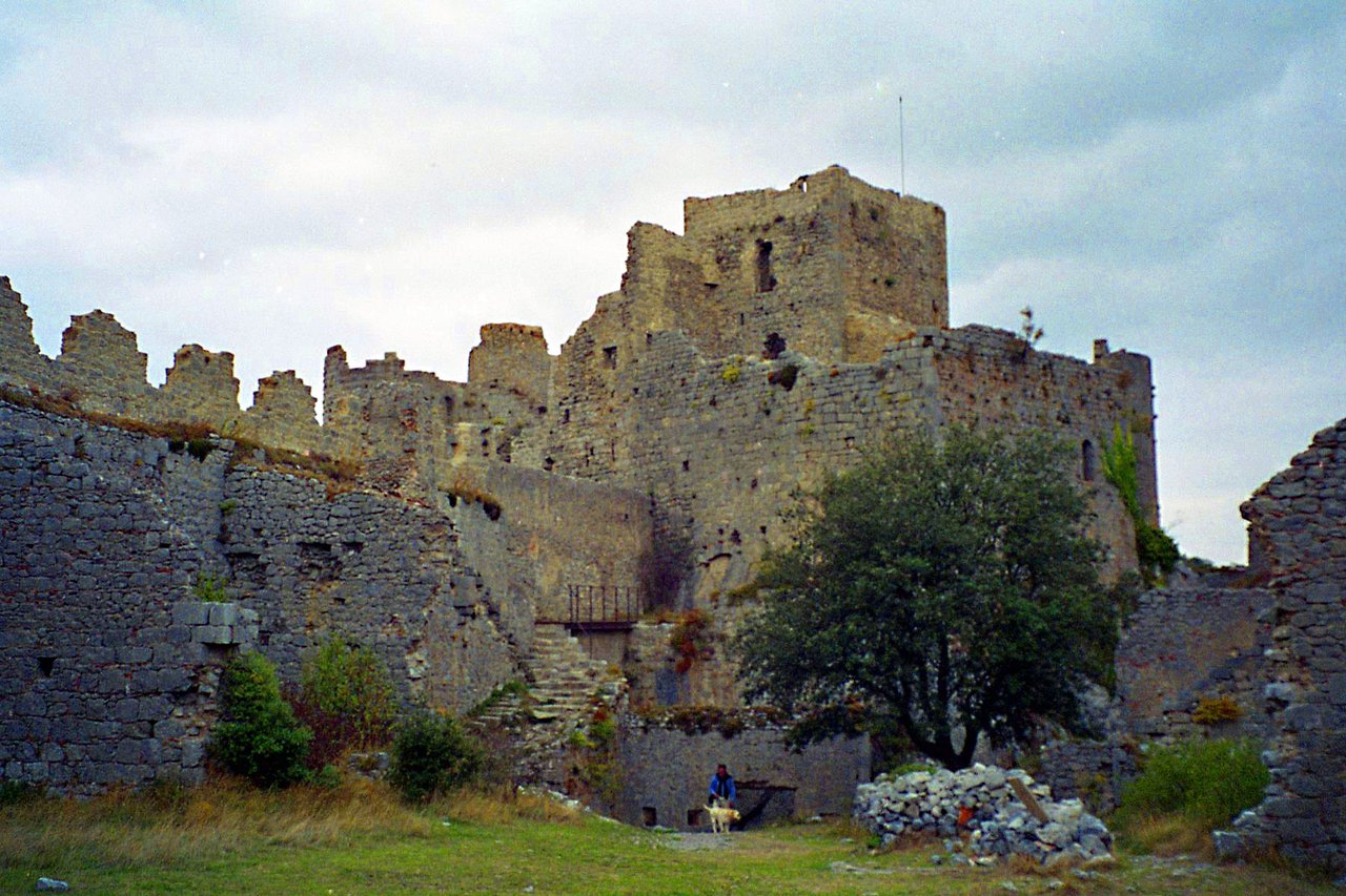
What a visitor walks through today is essentially that royal fortress of the later 13th century, weathered but remarkably complete. Puilaurens is often described as the best-preserved of the Aude citadels, and its plan repays attention. The castle is built as two joined enclosures whose walls follow the contour of the rock. The main enclosure organizes around a large courtyard, roughly 60 by 25 meters, closed by curtain walls eight to ten meters high that still keep much of their crenellation. A second, smaller enclosure holds a square tower, and four round towers guard the whole.
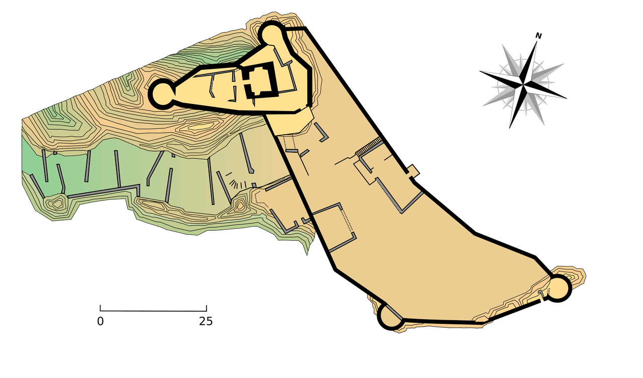
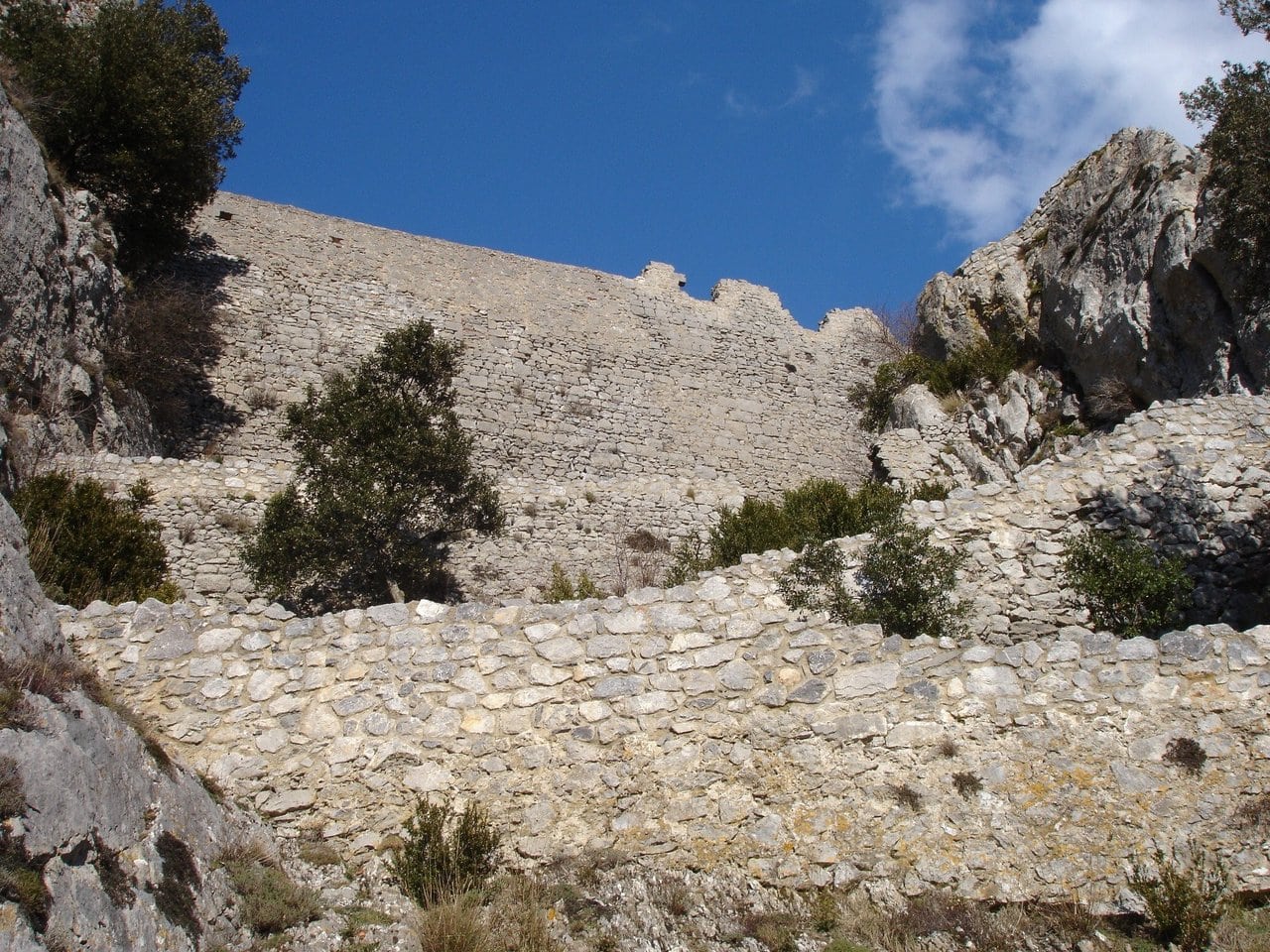
The stonework itself records the rebuild. The two half-round towers of the lower enclosure were left open at the back, in the ‘à la gorge’ manner of Capetian military engineering, and the east tower still carries the bossed ashlar, the pierres à bossage, that marks the royal style of the late thirteenth century. The design did not stand still. In 1595 the duke of Joyeuse adapted Puilaurens for firearms, adding gun loops, reworking the living quarters in the first enclosure, and strengthening the terraced walls that climb beside the chicane. What survives is a layered record of frontier defense across four centuries, from crossbow to cannon, rather than a single medieval moment frozen in stone.
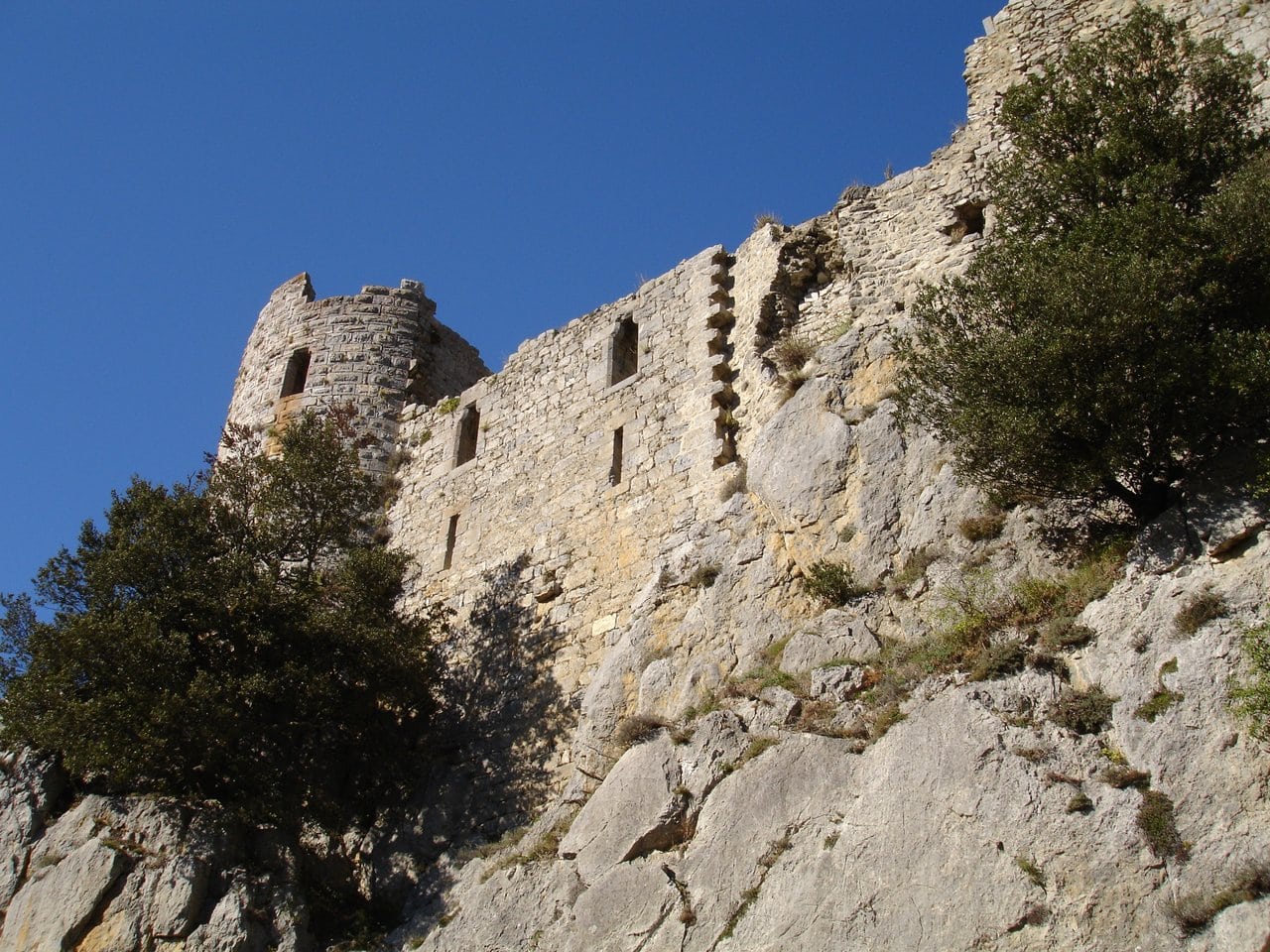
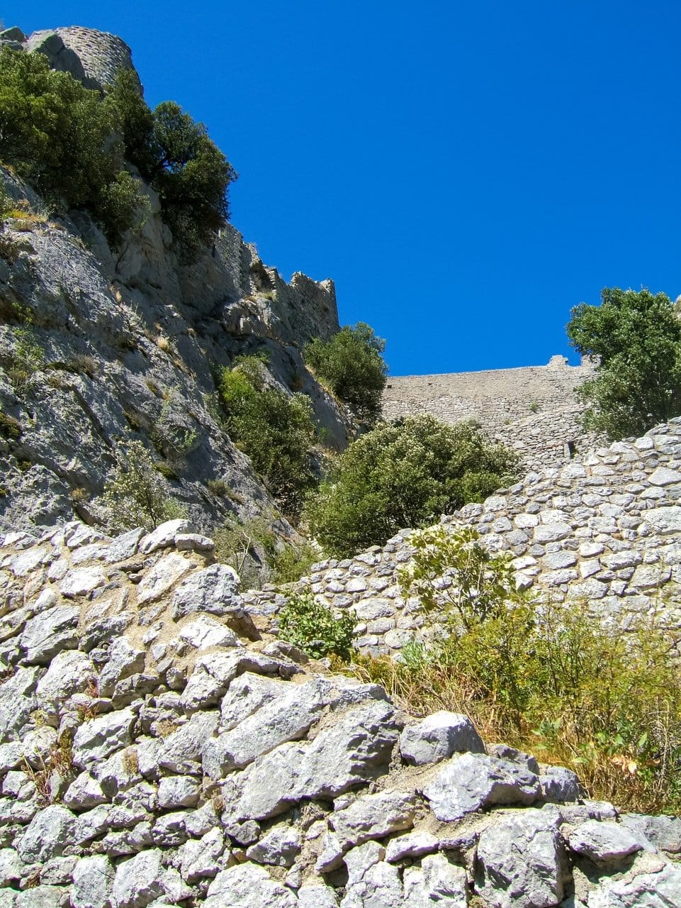
The defensive design is layered and deliberate. A barbican and a series of access chicanes force the approach into tight, exposed turns before the pointed-arch gateway of the 13th century. Along the south front, most exposed to the valley, run arrow slits, gun loops, and the remains of watch posts. A cistern collects water within the walls, a postern opens to the north, and a small door below the east tower leads to a viewpoint outside the fortress, looking over the villages of Puilaurens and Lapradelle and, on a clear day, toward the Pic de Bugarach and the Canigou. The site is often called an archetype of the medieval military mountain citadel, showing defensive systems that evolved from the 13th to the 17th century as weapons changed from crossbows to cannon.
The approach itself is part of the experience. From the reception and car park, a rocky path laid out as a botanical trail climbs through fir forest to the first low walls, gaining about 150 meters over some fifteen to twenty minutes. Interpretive panels along the way and inside the fortress explain its construction and history.
The Tour de la Dame Blanche
The most storied part of the castle is the Tour de la Dame Blanche, the White Lady’s Tower. It holds one genuine architectural curiosity: a speaking-tube carved through the stone, a voice conduit that let occupants communicate between levels of the tower. That feature is documented and physical, an ingenious touch of medieval engineering.
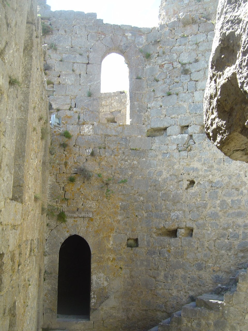
The tower’s name, though, comes from folklore, and the body that presents the site says so itself. Forteresses Royales du Languedoc records that the round tower is called the Tour de la Dame Blanche par la tradition locale, by local tradition, and that the tradition holds that Blanche de Bourbon, whose husband was king of Castile, comes to haunt the place on pale nights, wrapped in white veils. That same page then declines the ghost in the next breath: Nulle trace de fantôme, no trace of a ghost in the vaulted lower chamber, only two arrow loops and the speaking-tube. It is a ghost tale rather than history, and it is easy to confuse the two because they share a tower. The speaking-tube is real; the White Lady is legend. No earliest record for that legend could be established at all, which our reference on haunted castles reports as a blank rather than filling it in.
Puilaurens and UNESCO
Puilaurens is one of the eight components of the Forteresses royales du Languedoc, inscribed on the World Heritage List on 26 July 2026 under the official name Royal Capetian Fortresses of Languedoc. The dossier, formally titled the “System of Fortresses of the Seneschalty of Carcassonne,” was deposited with UNESCO on 31 January 2025 after more than a decade of preparation led by the Aude department. The eight components are the Cité de Carcassonne together with the castles of Aguilar, Lastours, Montségur, Peyrepertuse, Puilaurens, Quéribus, and Termes, spread across the Aude and the Ariège.
The case for the series rests on a single idea: these fortresses form a coherent territorial defense system built by royal power in the 13th century after the Albigensian Crusade, an unusually homogeneous and well-preserved example of medieval military architecture. Puilaurens, cited among the best-preserved of the group, sits squarely within that argument. At its 48th session in Busan, the World Heritage Committee examined the nomination and inscribed the series on 26 July 2026, under criteria (ii) and (iv).
Visiting Château de Puilaurens
The fortress is open for the 2026 season from 21 March to 11 November. Adult admission is €7, children aged 6 to 15 pay €4, and entry is free for under-sixes; reduced rates apply for jobseekers, visitors with disabilities, and holders of certain partner cards. Guided visits and seasonal animations are offered for a supplement and are worth checking on the official site before you travel; the autumn ghost-themed family game runs in daylight, between 11h and 15h. Plan on about an hour and a quarter on site, plus the climb.
Puilaurens sits deep in the southern Aude. Most visitors arrive by the D117, which threads the dramatic Défilé de Pierre-Lys, with Axat and Quillan the nearest towns for lodging, fuel, and meals. From the village of Puilaurens a signposted road leads to the reception and car park; from there the uphill footpath begins. Good shoes and a little stamina help, since the path is steep and rocky. The castle also lies on the Sentier Cathare long-distance trail, between Peyrepertuse and Puivert, so walkers can reach it on foot.
Because the fortress is remote and run by the commune, there is no on-site tour to book in advance; you simply buy your ticket at the reception. For a base within reach of the castle, you can search places to stay near Puilaurens on Booking.com and build a two- or three-castle day around Puilaurens, Quéribus, and Peyrepertuse. For the wider region, GetYourGuide also lists guided Cathar castle day trips from Carcassonne.
Some links on this page are affiliate links, which means StoneKeep Atlas may earn a small commission, at no extra cost to you, if you book through them.
More Views of Château de Puilaurens
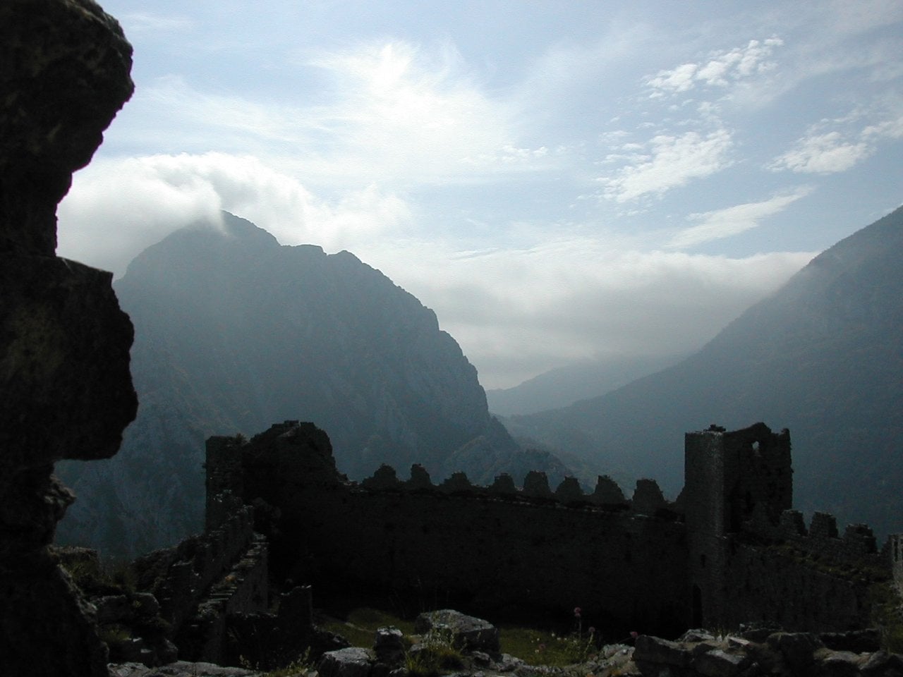
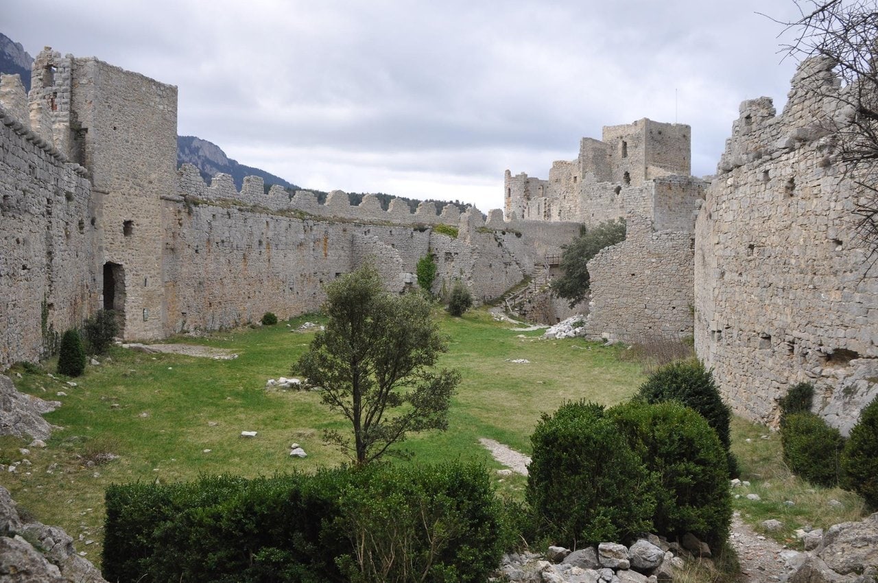
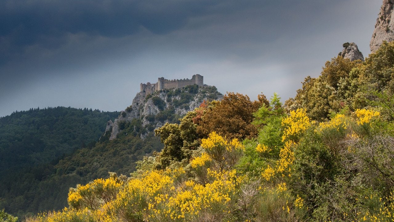
Beyond Château de Puilaurens
Puilaurens is best understood alongside its neighbors on the old Aragonese frontier. The nearby Château de Peyrepertuse and Château de Quéribus complete the classic Cathar-country day from the Aude, while Château de Montségur, in the Ariège, carries the crusade’s most tragic chapter, and the great Carcassonne Castle anchors the whole system as the seat of the royal seneschal. Together with the Château de Foix, these sites map the arc from heresy and refuge to conquest and royal control. For the wider picture of how the Crown fortified this border, see our hub on the Royal Fortresses of Languedoc, and browse the Cathar Castles theme for the human story behind the stones. To the north, in the Montagne Noire behind Carcassonne, the Châteaux de Lastours gather four castles on a single ridge, the deepest Cathar chapter of the group and another of the nominated royal fortresses.
The refuge chapter here is one link in a longer story, told in our guide to the Cathar Castles of Languedoc.
Conclusion
Château de Puilaurens rewards the traveler willing to climb for it. Its remoteness is exactly what preserved it, leaving a royal frontier fortress that reads clearly on the ground, from the switchback approach to the speaking-tube in the White Lady’s Tower. Seen without the romantic haze, it is not a Cathar castle so much as the Crown’s answer to the Cathar country: a stronghold raised to hold a new border and, four centuries later, one of the finest survivals of its kind in the south of France. Inscribed on the World Heritage List in 2026, Puilaurens has earned its place among the great fortresses of the Languedoc.
Principal Sources
- Ministère de la Culture, base Mérimée, notice PA00102871 (Ruines du château, Puilaurens).
- Site officiel du Château de Puilaurens (history, practical information, 2026 season and rates).
- Forteresses royales du Languedoc / Association Mission Patrimoine Mondial and Département de l’Aude (UNESCO serial property, inscribed 2026).
- Henri-Paul Eydoux, “Châteaux des pays de l’Aude,” Congrès archéologique de France, 131e session, Pays de l’Aude (1973).
- Michel Roquebert, works on the Cathar country and the “citadels of vertigo.”
Image credits. The fortress on its crag above the Boulzane: Jcb-caz-11, CC BY-SA 4.0, via Wikimedia Commons; the south front and the Tour de la Dame Blanche: Guillaume Paumier, CC BY 2.5, via Wikimedia Commons; the zigzag approach and access chicanes: Andy Hay, CC BY 2.0, via Wikimedia Commons; the plan of the two joined enceintes: Guillaume Paumier, CC BY 2.5, via Wikimedia Commons; inside the Tour de la Dame Blanche: Anthospace, CC BY-SA 4.0, via Wikimedia Commons; the upper enceinte and its round towers: Jorge Maturana, CC BY-SA 3.0, via Wikimedia Commons; the keep and inner walls from the outer ward: Phillip Capper, CC BY 2.0, via Wikimedia Commons; the fortified entrance: Pinpin, CC BY-SA 3.0, via Wikimedia Commons; the southern curtain along the cliff: Petitemontagnedujura, public domain, via Wikimedia Commons; the interior courtyard toward Mont Ardu: MichelG, CC BY-SA 3.0, via Wikimedia Commons; storm light over the walls: Jcb-caz-11, CC BY-SA 4.0, via Wikimedia Commons. Freely licensed images are resized to fit; otherwise unaltered.