
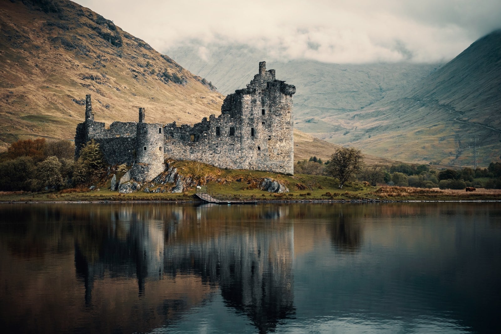
Kilchurn Castle
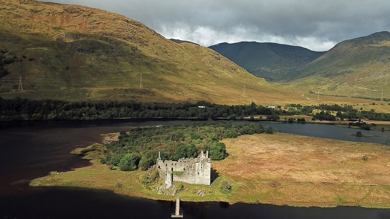
Kilchurn Castle stands roofless at the head of Loch Awe, on a low green peninsula that the water still floods from time to time. It is among the most photographed castles in Scotland, as Historic Environment Scotland says of its own property, and it is also one of the few you cannot go inside: the interior is currently closed for conservation work, and visitors walk up to and around the outside instead. That is not a small distinction. The site is open, free, and available all year; the building is fenced.
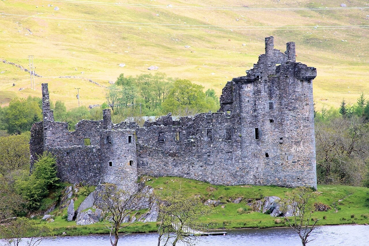
What you walk around is stranger than the postcard suggests. Kilchurn began in the middle of the fifteenth century as the power base of the Campbells of Glenorchy, a family that would become one of the strongest in the West Highlands. It ended its working life as a barracks. The three tall round towers that dominate every photograph are not medieval at all, and the man who built them spent the 1690s adding military accommodation to his own castle while resisting the government’s attempt to garrison it.
Quick Facts
| Location | Lochawe, Dalmally, Argyll and Bute, Scotland |
|---|---|
| Built | Mid-fifteenth century; standing before 1450 |
| Built for | Sir Colin Campbell, first laird of Glenorchy |
| Architectural style | Scottish tower house with later courtyard ranges |
| Castle type | Tower house and courtyard castle |
| Condition | Roofless ruin, consolidated |
| Owner / managed by | In the care of Historic Environment Scotland (guardianship since 1953) |
| Nearest town & station | Dalmally; Loch Awe station |
| Open to public | Yes, year-round (exterior only) |
| Official website | historicenvironment.scot |
History
The Campbells of Glenorchy took their land at the head of Loch Awe in 1432, when Sir Colin Campbell received it from his father Duncan Campbell, and the castle he raised there was standing by the middle of the century. Historic Environment Scotland dates it to the mid-1400s and puts it “probably” before 1450, and the earliest hard evidence is a charter of March 1449, granted by John Stewart, lord of Lorn, and signed at Castrum de Glenurquhay. A charter signed at a castle proves the castle existed. It does not date the walls, and no primary source gives a building year. The precise founding date that circulates widely rests on a parish account written four hundred years after the event.
Sir Colin himself was a Knight of Rhodes. His successors enlarged what he began: Sir Duncan Campbell “biggit the laich hall of Glenurquhay”, as Historic Environment Scotland quotes it, before his death in 1513, and the third and fourth lairds both died at the castle, in 1523 and 1536. Through the sixteenth century the family appointed keepers and constables to hold the place for them, most of them MacGregors. In 1550 John Campbell, fifth of Glenorchy, engaged John M’Conoquhy V’Gregor to provide watchmen and to keep the tower head clean.
In the 1570s Sir Colin, the sixth laird, strengthened the castle by rebuilding its wall heads and adding four angle-turrets at the top of the tower house.
Historic Environment Scotland describes Kilchurn as the family’s power base for “around 150 years.” The family’s own charter room tells a more complicated story about where they lived. In the second half of the sixteenth century the Campbells moved their attention east to Loch Tay, building Balloch, later Taymouth, at one end of it and Finlarig at the other. Cosmo Innes, editing the family papers in 1855, put it bluntly: “Before that time (1550) it had ceased to be the chief or even the usual dwelling of the family.” A castle can remain the administrative center of a lordship long after it stops being anybody’s home, and Kilchurn did.
It was not abandoned, either. An estate receipt of 1643 records payment for reroofing the great tower and the angle-turrets, which tells us the castle was still weathertight nearly a century after the family’s attention had moved on.
From Clan Seat to Garrison
The story usually told about Kilchurn is that the government turned it into a barracks after the Jacobite Rising of 1689. Historic Environment Scotland’s own Statement of Significance says something close to the opposite, and it is the more interesting version.
The Jacobite Rising of 1689 destabilised the highlands, but The Earl of Breadalbane resisted the garrisoning of government troops in Kilchurn. However, during his reconstruction of the castle starting in 1690 the Earl altered the accommodation and added the barrack block along the north curtain.
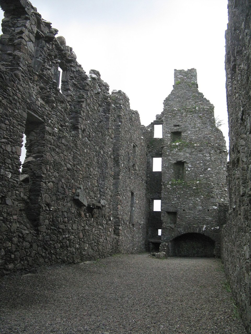
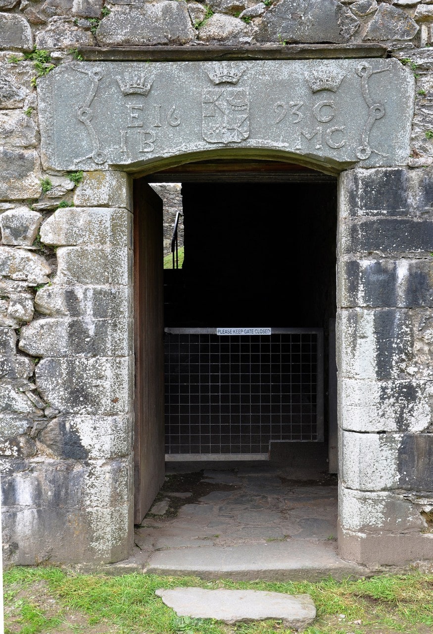
John Campbell, created first Earl of Breadalbane in 1681, was therefore doing two things at once. He kept government soldiers out of his castle, and added the barrack block along its north curtain. The reconstruction ran from 1690 through the end of the decade, and the estate accounts name the men who did it: Andrew Christie, the master mason, kept on through the winter of 1692 while “Sir John grudges him his food”; Thomas Williamson, slater; John Kelly, plasterer. A payment in 1696 covers “Working at harling the walls.” A carved lintel over the entrance still carries the date, split as 16 and 93 on either side of a coroneted shield.
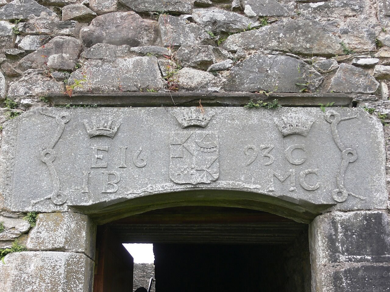
Historic Environment Scotland makes three claims for what he built, and they are three different claims rather than one. Its visitor pages call the result the oldest surviving barracks on the British mainland. Its Statement of Significance calls the 1690s work the site of the first purpose-built barracks in Scotland. The scheduled-monument record is more careful again, describing some of the earliest purpose-built barracks in Europe, and adding that they are more simply built than the tower. Each is sourced. What circulates instead is often a merged superlative that Historic Environment Scotland never wrote.
Then comes the part that rarely gets quoted. Historic Environment Scotland’s own verdict on the whole undertaking is a single sentence: “Little use was ever made of this barrack accommodation.”
Government troops did reach Kilchurn eventually, twice. A government force occupied the castle in 1715, in a rising during which, as the Statement of Significance notes, “like many others, Breadalbane himself acted for both sides.” In 1745 the castle held twelve officers and two hundred militiamen under Captain Colin Campbell of Skipness, posted there to control the movement of Highlanders traveling to join the Rising rather than to fight from the walls.
The estate papers that follow are a record of neglect, not of care. They have the castle going to decay in 1726, ironwork ordered in 1733 “in the case of attack,” and conveniences fitted in 1746 “for the use of the garrison.”
Then it stopped. Occupation ended around the middle of the century, and the storm that followed in the 1760s left the building roofless for good. A parish minister writing in 1845 gave a different cause altogether. About seventy years earlier, he recorded, the castle “was unroofed, and its materials used” to build “farm-houses and offices in the parish”, which “hastened its decay prematurely”. By the end of the eighteenth century the castle had been leased to fishermen, who used it to salt and preserve their catch.
Architectural Highlights
Kilchurn is built of local rubble masonry with dressings of chlorite schist, probably quarried nearby, and what survives is a five-storey tower house at the eastern angle, with a courtyard to the west of it and ranges attached to it. The lowest of those five storeys is a vaulted cellar, which is why some records count four; the difference is a matter of where you start counting rather than a disagreement about the building. That lowest storey held what the Royal Commission called “doubtless a prison on its south-east side.”
Two features get confused constantly, and telling a turret from a corner tower is the key to reading the ruin.
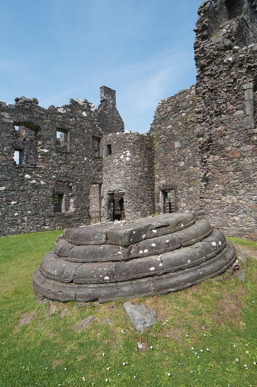
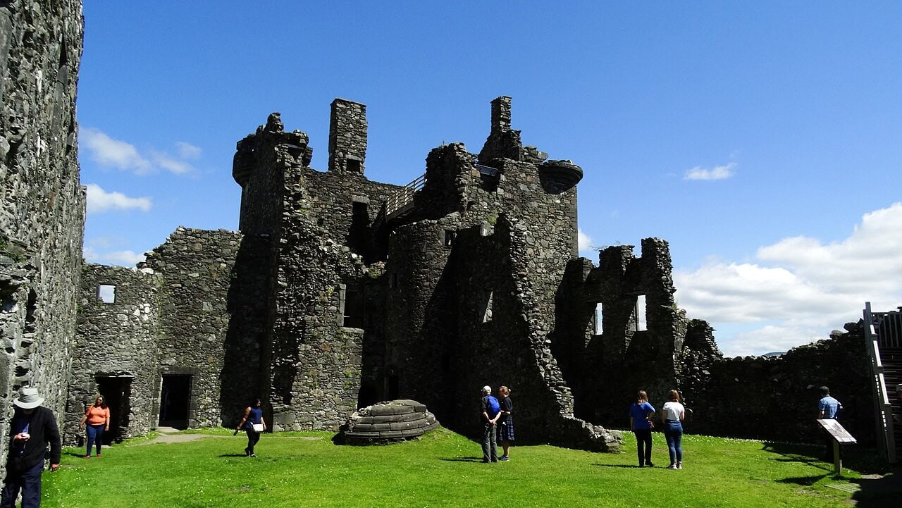
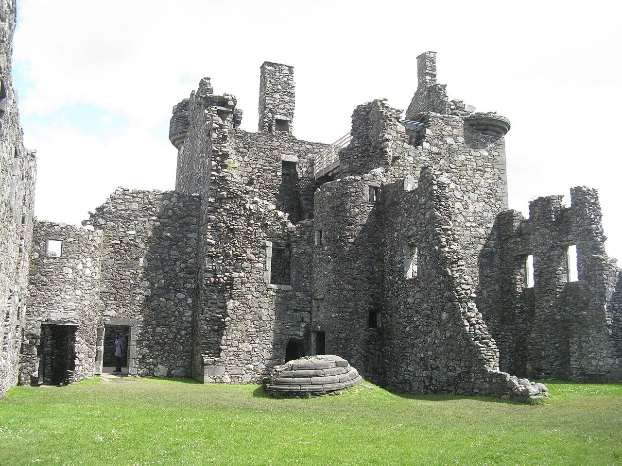
The angle-turrets are the small corbelled ones at the top of the tower house, added by Sir Colin in the 1570s. There were four. Three are still in place. The lower courses of the fourth, the west turret, lie on the ground in the courtyard, as Historic Environment Scotland records. They also lie the wrong way up. No record states it, but the stones show it plainly: a corbelled turret steps progressively outward as it rises, so the surviving turrets’ corbel courses widen toward the top while the fallen mass widens toward the bottom. How it came down is not recorded anywhere. Nor, at present, is it easy to reach: Historic Environment Scotland describes what a visitor may do as walking up to and around the exterior, and it does not say how close the fencing allows anyone to come to the courtyard where the turret lies.
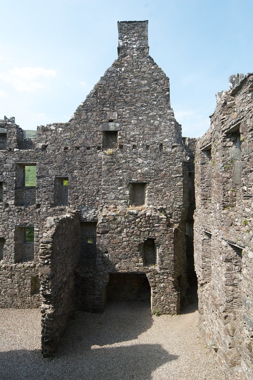
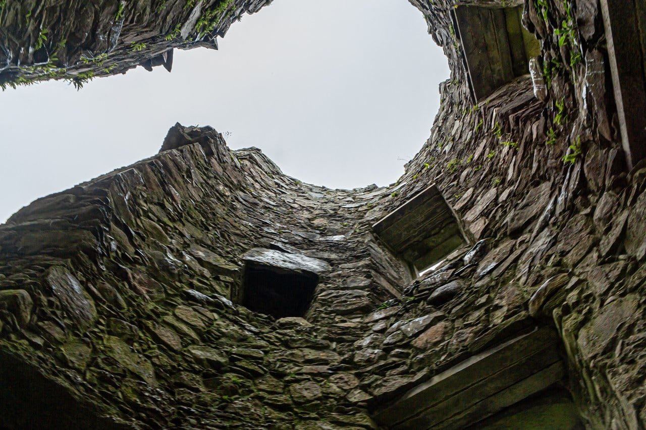
The circular corner towers are a different thing entirely: three of them, full height, rising straight off the rock at the angles of the curtain wall, and they belong to Breadalbane’s reconstruction of the 1690s. Historic Environment Scotland is explicit that the curtain wall’s “present form dates to the final reconstruction in the 1690s.” A castle that reads as medieval from the far shore is, in its most recognizable feature, barracks architecture.
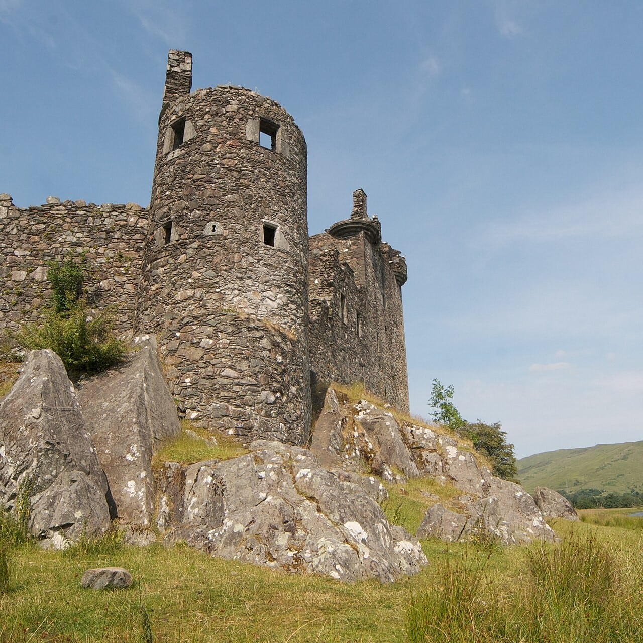
The military detail is modest. The castle is well supplied with pistol loops but has no provision for heavy artillery, and MacGibbon and Ross reached the same verdict when they surveyed it in 1887: the additions were “not built with a view to resist a siege.” They finished the thought in the same breath, and it answers the question the barracks raise: the round towers at the angles and the loop-holes on the ground floor “would, however, suffice to defend the garrison against a sudden attack by Highlanders, which was probably what was to be chiefly apprehended in that inaccessible situation.” What Breadalbane built for was a raid, not an army. Those two Victorian surveyors were unsentimental about the whole place. Kilchurn, they wrote, “presents a striking and imposing appearance at a distance,” but “is somewhat disappointing on closer inspection,” and “the buildings have more the appearance of modern barracks than of an old castle.”
They left a warning that still applies. The 1693 lintel is a replacement, set into a doorway of the fifteenth century, and MacGibbon and Ross noted that the inscription “might be misleading” to anyone using it to date the stonework around it.
This is a consolidated ruin. The Royal Commission recorded that the building “appears to have been extensively patched and consolidated some time after MacGibbon and Ross made their survey (about 1887),” work that led to “the obliteration or alteration of a number of original features.” More work followed in the twentieth century.
The site itself has changed. A survey published in 2018 found that “Loch water levels are lower now than in the past, and the castle knoll would have been an island when it was in use.” The basements flood as well. The 1690s ranges were built outside the natural rock outcrop and therefore with basements below it, and the storm-water system that once handled this is now blocked and broken.
Visiting Kilchurn Castle
List the 8 castles on this map
- Kilchurn Castle — Argyll and Bute, Scotland
- Edinburgh Castle — City of Edinburgh, Scotland
- Eilean Donan Castle — Highland, Scotland
- Stirling Castle — Stirling, Scotland
- Urquhart Castle — Highland, Scotland
- Doune Castle — Stirling, Scotland
- Dunnottar Castle — Aberdeenshire, Scotland
- Dunrobin Castle — Highland, Scotland
Getting there
Kilchurn sits at the northeast end of Loch Awe, about two and a half miles west of Dalmally off the A85. There is no road to the castle, no parking at it, and no sign for it from the main road. Historic Environment Scotland states all three, and Walkhighlands calls the approach unsigned.
In practice you stop at the unsurfaced pull-off where the track leaves the A85, about a kilometer short of the castle, on the south side of the road between the turning for Inveraray and the bridge over the River Orchy. From there the way in passes under the railway viaduct, which is the landmark to walk toward, and then follows the lochside across agricultural land. Walkhighlands measures the route at two kilometers there and back, about forty minutes, with around ten meters of ascent, and calls it an excellent path.
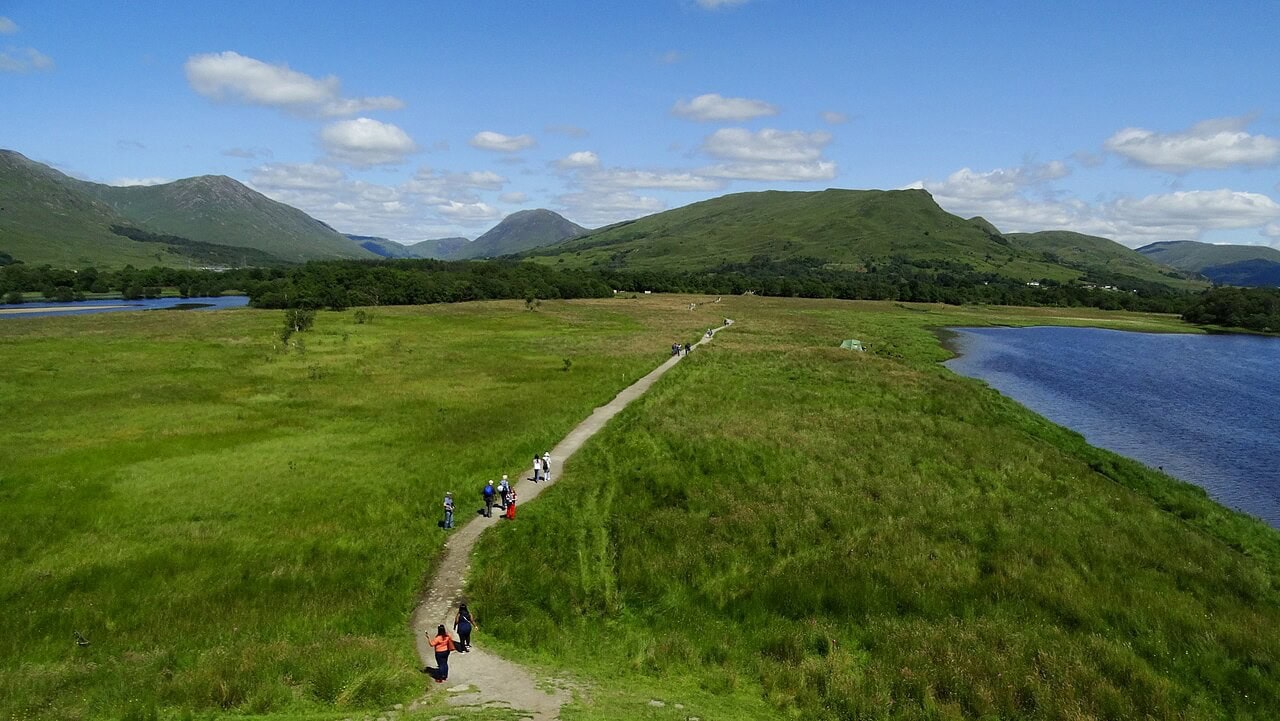
Historic Environment Scotland adds two cautions. The ground floods periodically, so caution is advised, and strong footwear is recommended. The land is a working farm.
Loch Awe station, on the West Highland Line, is about 900 meters from the castle as the crow flies. That sounds like an easy car-free arrival, and it is not. The station lies west-southwest of the castle while the only documented approach comes in from the east-northeast, and the two points are about a mile and a half apart by road. No published walking route connects them. Dalmally station is about 2.8 kilometers away, again straight-line.
Admission
| Entry | Free. Kilchurn is not a ticketed site |
|---|---|
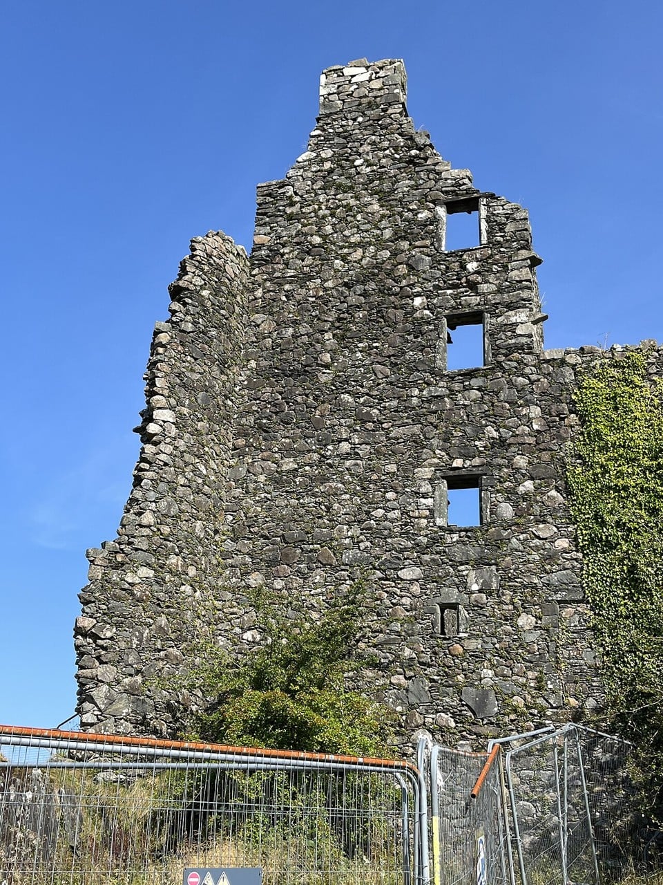
| Interior | Closed for conservation work; protective fencing in place around the castle |
| Exterior | Open year-round, exterior only |
| Reopening | Historic Environment Scotland has published no reopening date |
How long you need
Allow about an hour and a half. Walkhighlands’ forty minutes covers the walking; the rest is the time you will spend circling the outside of the building, which is the whole visit at present. There is no interior route to follow, no interpretation to read at your own pace, and nothing to queue for.
Best time to visit
Kilchurn has no opening hours at all. Exterior access runs all year. The real constraint is the ground rather than the calendar: the approach floods periodically, so the wetter months can put the path under water, and this far north the winter daylight window is short enough to plan around.
Photography
Three things shape what you can photograph here.
The fencing rules out the close exterior compositions that older photographs of Kilchurn are full of. Panels stand at the foot of the walls, and anything tight enough to fill the frame with masonry will include them.
Flying a drone recreationally from land in Historic Environment Scotland’s care requires prior consent applied for at least five working days ahead, along with a valid Civil Aviation Authority certificate, five million pounds of public liability insurance, and a site-specific risk assessment.
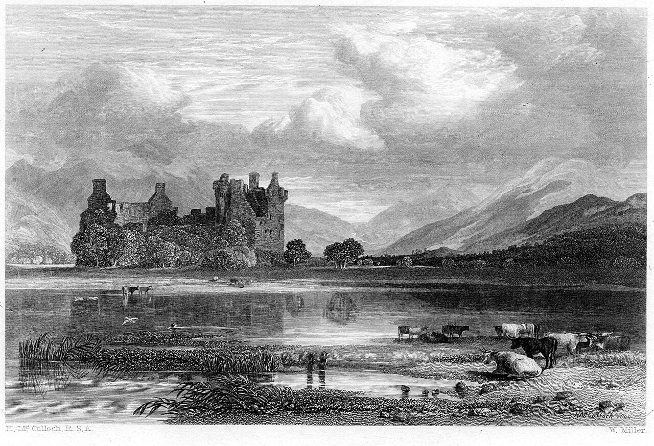
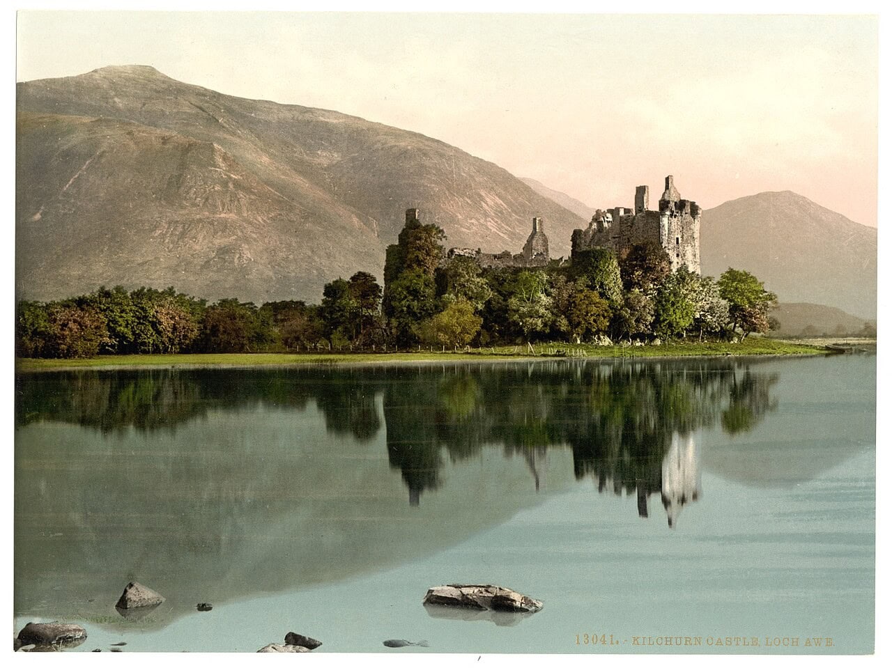
The castle’s orientation decides your hour. It sits at the northeast head of the loch with the water to its southwest, and the approach track brings you in from the east, so morning light falls on the face you walk toward while the same view late in the day is into the sun. One thing worth knowing before you set out: the picture most people arrive with is not the one the walk gives you. The reflected, across-water composition that the photochrom of the 1890s, the Miller engraving and most modern postcards share is taken from the far side of the water, while the track brings you in on the landward side, to the walls rather than to the view of them.
Accessibility
This is a difficult site. There is no vehicular access, no parking at the castle, no signage from the road, and no surfaced route in. The way passes under a railway viaduct and crosses working farmland that floods. Historic Environment Scotland fills in parking and accessibility fields for Carnasserie, further down the coast, and has left both blank here.
Nothing at Kilchurn is ticketed, so there is no entry to book, no pass to buy and no operator to arrive early for. What is bookable is the day around it. Oban, on the coast west of the castle, is where most of the area’s guided tours and day trips start, and the current range can be compared on GetYourGuide. For a base within a few miles of the track, Lochawe and Dalmally are the two nearest villages, and what they have can be compared on Booking.com.
Some links on this page are affiliate links, which means StoneKeep Atlas may earn a small commission, at no extra cost to you, if you book through them.
More Views of Kilchurn Castle
Common Questions
Is Kilchurn Castle open to the public?
Yes, with a limit. Historic Environment Scotland lists the site under “Grounds or exterior access only,” which is a different label from the “Currently closed” it applies to several of its other properties. You can walk up to the castle and all the way around it, free, at any time of year. You cannot go inside.
Why is Kilchurn Castle closed?
The interior is shut for conservation work. Historic Environment Scotland launched a high-level masonry inspection program at some of its sites in 2022, and Kilchurn was inspected in 2024, with a Channel 4 crew present. Historic Environment Scotland has published no start date for the closure, no reopening date, and no statement connecting the two.
Where do you park for Kilchurn Castle?
Not at the castle. Historic Environment Scotland states there is no vehicular access and no parking, and that is true of the monument itself. What exists is an unsurfaced pull-off about a kilometer out along the track, where the access track leaves the A85 on the south side between the Inveraray turning and the River Orchy bridge. It is informal and unsigned, and Walkhighlands reports plenty of room there.
Can you walk to Kilchurn Castle, and how long does it take?
Yes, and the walk is the visit. About forty minutes, for a round trip of two kilometers with roughly ten meters of ascent, on what Walkhighlands calls an excellent path. The way in runs under a railway viaduct and along the lochside over farmland that floods, so strong footwear is sensible and Historic Environment Scotland advises caution.
Is Kilchurn Castle free?
Yes, and it is free in a different way from the Historic Environment Scotland castles you may be pairing it with. Edinburgh, Stirling and Urquhart are ticketed sites, covered by membership or an Explorer Pass. Kilchurn is not ticketed at all, so there is nothing to buy, book, or show on arrival, and neither membership nor an Explorer Pass makes any difference here.
Why was Kilchurn Castle abandoned?
It was already finished as a residence before the famous storm. The castle was abandoned around the middle of the eighteenth century, and the Royal Commission records it as struck by lightning in the 1760s and not subsequently refurbished. Many accounts give a precise year for the strike; no authority does. The order is what matters: the castle stood empty before the storm, not because of it.
Who built Kilchurn Castle?
Sir Colin Campbell, the first laird of Glenorchy and a Knight of Rhodes, who received the land at the head of Loch Awe from his father Duncan Campbell in 1432. His family, the Campbells of Glenorchy, later became Earls of Breadalbane, and it was the first Earl who added the round towers and the barrack range the castle is known for today.
Can you get to Kilchurn Castle by train?
Loch Awe station sits under a kilometer from the castle as the crow flies, and it is a stop on the West Highland Line, unstaffed, with a help point and a shelter rather than a ticket office. Proximity is not the same as access here: no published walking route connects the station to the castle’s approach track, and the two lie on opposite sides of the site, about a mile and a half apart by road.
Beyond Kilchurn Castle
Kilchurn is the first Argyll castle in this collection, and the Scottish castles it sits most naturally beside are the ones that also make you work for the approach. Dunnottar Castle, on the Aberdeenshire coast, is another ruin where the walk in is part of the visit, a cliff-top fortress reached by a steep path and a long flight of steps. Stirling Castle carries the county’s name in an unexpected place: its King’s Old Building holds the regimental museum of the Argyll and Sutherland Highlanders. Doune Castle, a near-intact medieval great house near Stirling, has a screen life of its own, having stood in for other places on film and television for half a century; its guide sets out what was shot there. For the domestic side of the story, the hall and the household rather than the garrison, see our guide to great halls and medieval castle life. If the trip is growing into a tour, our guide to staying in a castle in Scotland covers the country’s castle hotels. Dunnottar, Stirling and Doune are all gathered in our guide to the castles of Scotland.
Conclusion
Kilchurn rewards a visitor who knows what they are looking at, and at present the looking has to be done from the outside. The building in the photographs is two castles wearing one silhouette: a fifteenth-century tower house raised by a Campbell laird, and a set of round towers and a barrack range added some two hundred and forty years later by an Earl who added military accommodation to his own castle while resisting the government’s attempt to garrison it. Very little ever happened in the barracks. Within a lifetime the place was roofless, and within two it was a fish-curing store.
What survives is a consolidated ruin on a knoll that would have been an island, reached on foot across a field that still floods, free to anyone who parks at the roadside and walks in. It is, as Historic Environment Scotland puts it, well visited despite being hard to reach.
Principal Sources
- Ewart, G. Kilchurn Castle: drainage works. Kirkdale Archaeology for Historic Scotland, 1993.
- Historic Environment Scotland. “Kilchurn Castle.” historicenvironment.scot.
- Historic Environment Scotland. “Kilchurn Castle: History and stories.” historicenvironment.scot.
- Historic Environment Scotland. “Kilchurn Castle: Plan your visit.” historicenvironment.scot.
- Historic Environment Scotland. “Kilchurn Castle, Dalmally.” Scheduled monument SM90179, portal.historicenvironment.scot.
- Historic Environment Scotland. Statement of Significance: Kilchurn Castle. Property in Care ID PIC080, last reviewed 2004. historicenvironment.scot.
- Innes, Cosmo, ed. The Black Book of Taymouth. Bannatyne Club, 1855. archive.org.
- MacGibbon, David, and Thomas Ross. The Castellated and Domestic Architecture of Scotland, vol. I. Edinburgh, 1887. archive.org.
- Mills, C., and D. Quelch. “Kilchurn Castle.” Discovery and Excavation in Scotland 19, 2018.
- Paul, James Balfour, ed. The Scots Peerage, vol. 2. Edinburgh, 1905. archive.org.
- Trove (formerly Canmore) / RCAHMS. Site record 23673, Kilchurn Castle. trove.scot.
- Walkhighlands. “Kilchurn Castle, Loch Awe.” walkhighlands.co.uk.
Image credits. Hero, the castle mirrored in Loch Awe: Photo: Jon Ingall / Adobe Stock; the tower house and the long lower range seen from across the water: Photo: Andrew Wood, CC BY-SA 2.0; a mid-nineteenth-century engraving after Horatio McCulloch: Engraving by William Miller, public domain; the roofless interior of the barrack range: Photo: M J Richardson, CC BY-SA 2.0; the carved entrance lintel dated 1693: Photo: Remi Mathis, CC BY-SA 3.0; the fallen angle-turret lying upside down in the courtyard: Photo: Tom Parnell, CC BY-SA 2.0; a circular corner tower rising from the rock: Photo: Tom Parnell, CC BY-SA 2.0; the approach track across the grazing ground: Photo: Colin Park, CC BY-SA 2.0; protective fencing at the foot of the walls, September 2024: Photo: Delane13, CC BY-SA 4.0; the castle at the end of its low peninsula: Photo: Gunther Tschuch, CC BY-SA 4.0. Source: Kilchurn Castle Aerial, Wikimedia Commons; the courtyard in 2019, with the tower house behind: Photo: Colin Park, CC BY-SA 2.0. Source: Kilchurn Castle, Loch Awe - interior - geograph.org.uk - 6333289, Wikimedia Commons; the courtyard front of the tower house: Photo: M J Richardson, CC BY-SA 2.0. Source: Courtyard of Kilchurn Castle - geograph.org.uk - 4491638, Wikimedia Commons; a gabled range inside the courtyard: Photo: Tom Parnell, CC BY-SA 2.0. Source: Kilchurn Castle (13326853233), Wikimedia Commons; a fireplace in one of the roofless chambers: Photo: Stuart Wilding, CC BY-SA 2.0. Source: Interior of Kilchurn Castle - geograph.org.uk - 4126606, Wikimedia Commons; inside one of the roofless round towers: Photo: Andy / Adobe Stock; a ground-floor chamber under a modern timber deck: Photo: Bewahrerderwerte, CC BY-SA 4.0. Source: 2018 07 17 Schottland (77), Wikimedia Commons; the entrance doorway and its 1693 lintel: Photo: Stuart Wilding, CC BY-SA 2.0. Source: Doorway, Kilchurn Castle - geograph.org.uk - 4136390, Wikimedia Commons; a photochrom print of the ruin, 1890 to 1900: Photochrom Print Collection, Library of Congress, public domain. Source: Kilchurn Castle, Loch Awe, Scotland-LCCN2002695017, Wikimedia Commons. Freely licensed images are resized to fit; otherwise unaltered.