
Bodiam Castle
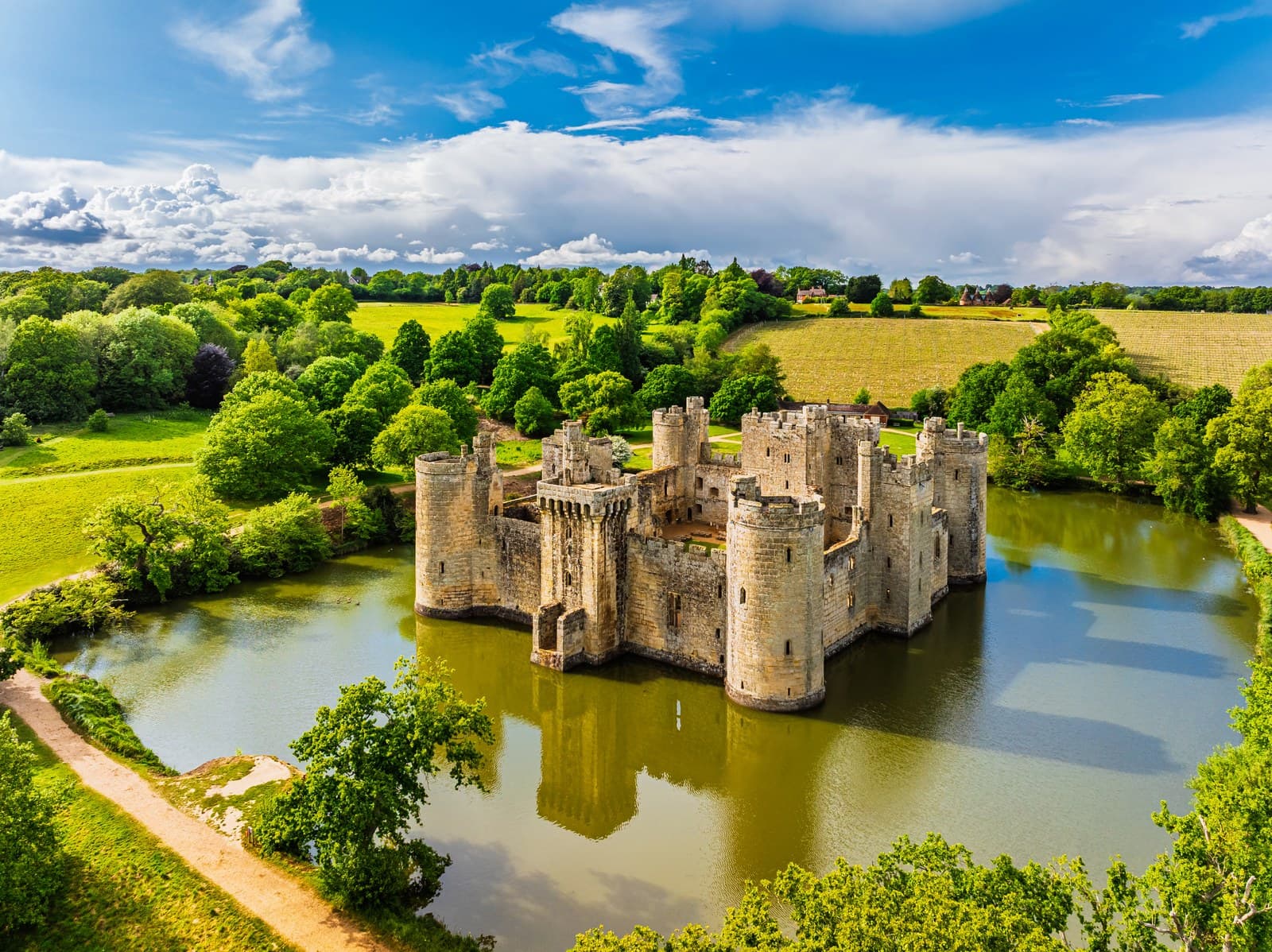
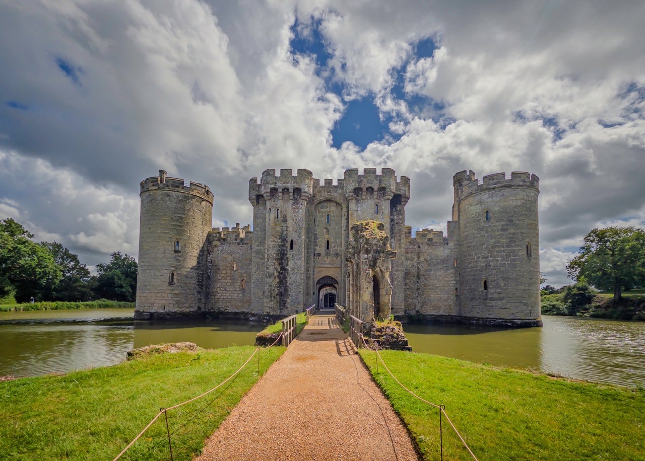
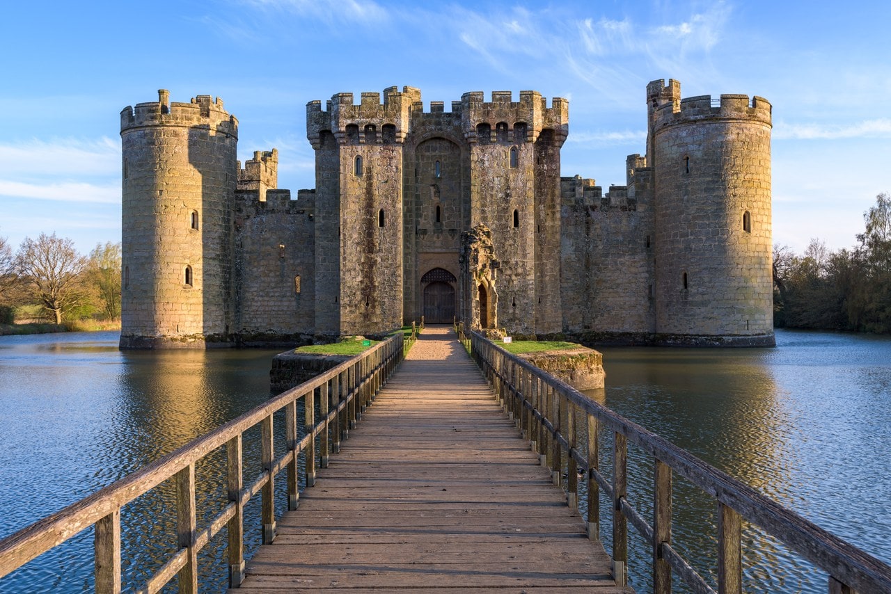
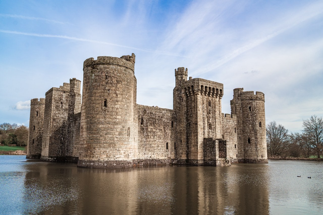
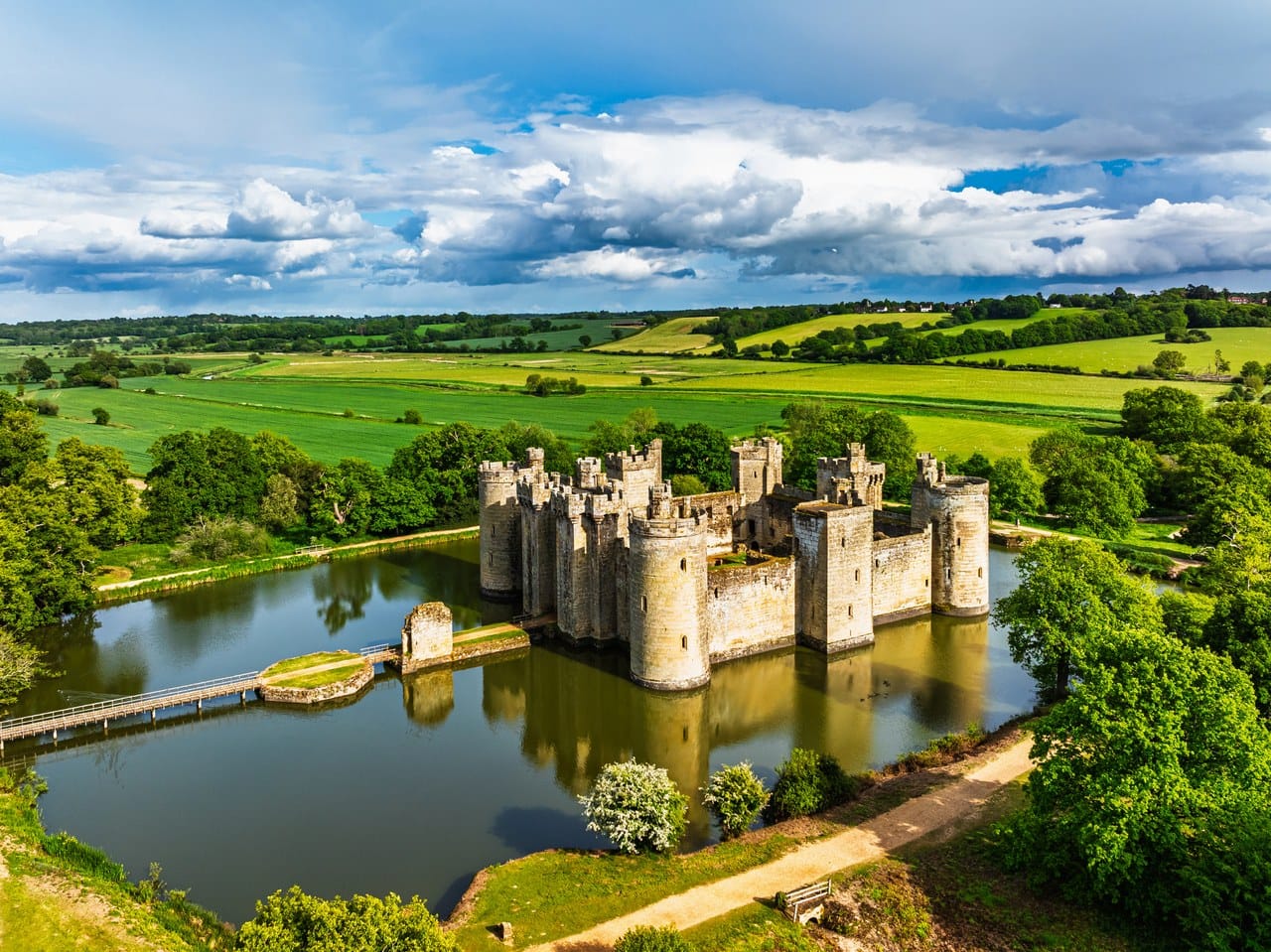
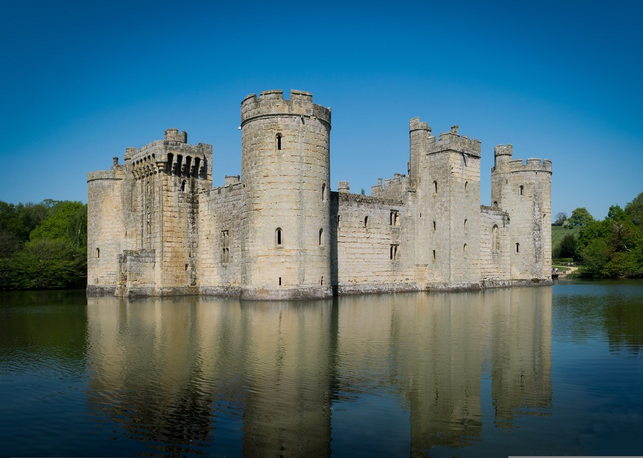
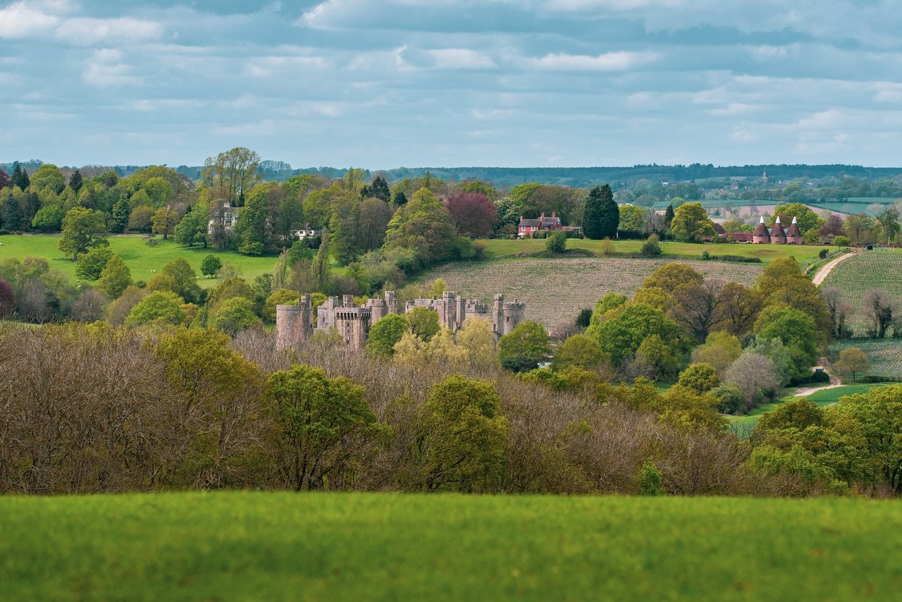
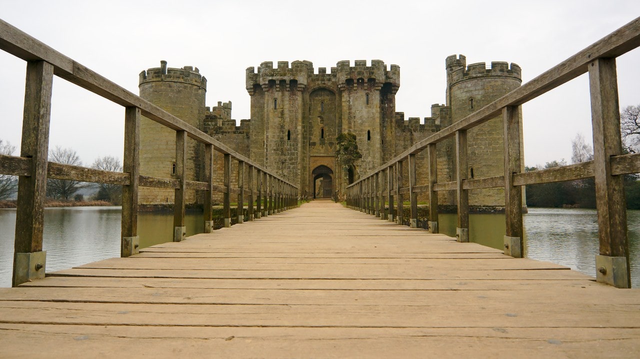
Bodiam Castle rises straight out of a broad sheet of still water in the Rother valley of East Sussex, and from the outside it looks finished. Four round towers stand at the corners of a compact stone square, a twin-towered gatehouse occupies the middle of the north wall, and the whole outline is doubled in the moat beneath it. Cross the bridge, walk through the gate passage, and the building stops: inside the curtain there is mown grass, a scatter of footings, and a few walls still carrying their window openings. Bodiam is a shell. The distance between what the outside promises and what the inside delivers is the first honest thing to say about it.
It is also a castle English scholars have spent forty years arguing about, and those two facts are the same fact. Since the 1980s historians and archaeologists have disagreed in print about what Sir Edward Dallingridge was doing here in the 1380s: fortifying a coast that French raiders had burned twice in living memory, or building himself a seat that looked as though he had. This guide does not settle that, because the people with the documents have not. What follows reports who argues what, and spends more of its length on what produces the argument than on the argument itself: the fabric that survives, the water around it, and the route a medieval visitor actually took to the door.
Quick Facts
| Location | Bodiam, near Robertsbridge, East Sussex, England |
|---|---|
| Built | Licensed 21 October 1385; probably complete by 1393 |
| Built for | Sir Edward Dallingridge (c.1346-1393), soldier of the French wars |
| Castle type | Quadrangular castle |
| Condition | Ruined interior within a near-complete curtain wall |
| Owner / managed by | National Trust, bequeathed by Lord Curzon on his death in 1925 |
| Heritage status | Scheduled monument (NHLE 1013554); Grade I listed building (NHLE 1044134); the pleasaunce separately scheduled (NHLE 1009013) |
| Nearest town & station | Robertsbridge, 5 miles, on the mainline; Bodiam station on the Kent & East Sussex Railway, a quarter of a mile, a seasonal heritage line not connected to the national network |
| Open to public | Yes, all year |
| Official website | nationaltrust.org.uk/visit/sussex/bodiam-castle |
History
Richard II granted Sir Edward Dallingridge a licence to crenellate his manor house at Bodiam on 21 October 1385, and the castle raised on that site was probably effectively complete by Dallingridge’s death in 1393. No building accounts survive to date any part of it. The first record of the finished castle is from 1395, and the National Trust’s own conservation plan puts the campaign at seven to ten years. Parliament had opened on 20 October 1385 with Dallingridge sitting for Sussex, and his licence was sealed the following day. Its date puts Bodiam late in the long arc of castle building in England, a licensed private castle of the 1380s.
The wording of the licence is the whole argument in miniature. Dallingridge was permitted to crenellate his manor of Bodiam “by the sea in the county of Sussex and to make a castle thereof in defence of the adjacent country against the king’s enemies.” Gatehouse Gazetteer, which catalogs these grants, notes that Bodiam’s is possibly the most quoted licence to crenellate “as it was one of the first published,” that its wording is most unusual in a licence of this kind, and that drawing general conclusions about licences from so exceptional an example “has to be done with exceptional care.”
Bodiam was not a bare field before the castle arrived. The 2016 conservation plan gives eight pages and a period of its own to what it calls a putative moated house on the same island. The plan finds that buildings inside the moat, and presumably the moat itself, came before the architecturally unified castle. Masonry from that earlier phase is still clasped inside the east side of the castle basement, about 9 by 5.7 meters internally and, the plan says, built of the same local stone as the castle. The plan hedges the reading four separate ways, calls better understanding of the phase a priority for research excavation, and says the earlier work “could well suggest an initial, more modest ambition”. Whatever else Bodiam is, it is not a castle conjured in one act on open ground.
Dallingridge, and how Bodiam came to him
Sir Edward Dallingridge was born around 1346, was knighted before November 1367, and spent roughly twenty years at war: in the Reims campaign of 1359-60 in the earl of Arundel’s company, with Lionel, duke of Clarence, on the journey to Milan of 1367-68, and across France from Calais to Bordeaux with John of Gaunt in 1373. In his deposition in Scrope v. Grosvenor, a court case over the right to bear a coat of arms, he gave the Reims campaign as his first military experience, and the historian Dan Spencer puts his age then at thirteen. He was reported in September 1380 to have been seriously wounded in action at Bourne, today’s Eastbourne. One popular story should be set aside. He is often placed among the companies of Sir Robert Knolles, and the History of Parliament records the opposite at exactly that moment: an arrest in the autumn of 1370 for failing to embark with Knolles’s expedition after taking an advance on his wages.
Bodiam did not arrive with his wedding. Dallingridge married Elizabeth Wardieu around November 1364, in a match his father had arranged. Her family’s manor at Bodiam came to her, and so to him, thirteen years later in 1377, when her father John Wardieu died and she inherited as his daughter and heir. Historic England’s scheduling records the manor as acquired by marriage by 1378, which is a latest-possible date rather than a mechanism. (The family name is also written Wardedieu and Wardeux; the operator’s current page and the History of Parliament both use Wardieu.)
He then set about making Bodiam a seat, selling off much of the Wardieu inheritance in the Midlands to consolidate his holdings in the south, moving his principal residence there, and obtaining a royal charter in 1383 for a weekly market and an annual fair. Between that charter and the licence his past caught up with him: a campaign of intimidation he had begun against John of Gaunt’s officials in 1381 came to trial in 1384, and a jury found against him, awarded damages of £1,080, and sent him to prison. He was out by January 1385, urgently needed to fortify Rye and Winchelsea against a renewed French threat. Ten months after that, he had his licence.
Dallingridge died before 30 August 1393 and was buried beside his wife at Robertsbridge Abbey. In March 1388 he had been commissioned to administer the oath of support to the Lords Appellant regime across Sussex, and fourteen months later he joined Richard II’s council. His last four years were spent there as its most prominent knight. He was Arundel’s leading Sussex retainer and an Appellant partisan, and not himself an Appellant lord.
1483: an order to besiege, and no recorded siege
Bodiam passed by marriage to the Lewknor family in 1470. In the autumn of 1483 Sir Thomas Lewknor, a Lancastrian, joined the Duke of Buckingham’s rebellion against Richard III. A commission went out to the king’s men in the county to “besiege the castle of Bodyham which the rebels have seized.” That instruction is the closest thing Bodiam has to a military record, and no account of what followed describes fighting. The conservation plan says that the castle appears to have been surrendered peacefully, that a Yeoman of the Crown named Nicholas Rigby was made constable in 1484, and that Lewknor’s attainder was reversed after Bosworth. Historic England’s two entries do not mention a siege at all, and the National Trust’s own history page says that a formal siege is not recorded and, in near-identical words to the plan, that the castle appears to have surrendered with little resistance. The one time the plan uses the word “siege” of 1483, it puts it in quotation marks.
An order to besiege Bodiam and no record of a siege: for a building this heavily fortified in appearance, that is the whole of its military history.
Ruin, and a story about how it happened
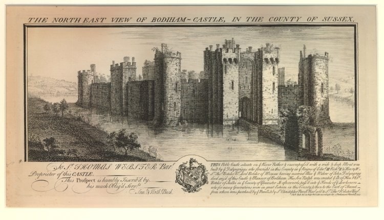
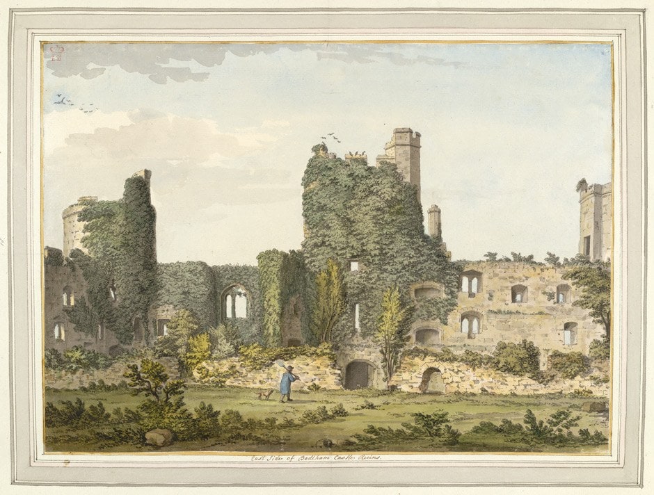
After the fifteenth century the documents thin out almost to nothing. Bodiam became a secondary seat for a family with better houses elsewhere, the estate split among three daughters in 1543. Sir Nicholas Tufton, later 1st Earl of Thanet, bought much of it, castle included, in 1623, and his son John acquired the remaining share between 1636 and 1639. In March 1645, by the conservation plan’s date, John sold the property to two ironmasters, Nathaniel Powell and Peter Farnden, for £6,000. Sir Thomas Webster of Battle Abbey bought it in 1723, and in 1829 it went to John “Mad Jack” Fuller of Rosehill.
Somewhere in that gap the inside of the castle was taken down, and nobody knows when. Both statutory entries blame the English Civil War. The Grade I listing 1044134, first listed in 1961, gives it eight words with no agent and no year: “It was partly dismantled during the Civil War.” The scheduled monument entry 1013554, whose text was amended in March 1995, says it twice and in more detail, dating the dismantling of the courtyard ranges to the 1640s and placing it around the purchase made by the Parliamentarian Nathaniel Powell in 1644. The conservation plan dates the conveyance 7 March 1645, with Farnden buying alongside Powell. Until 1752 the English year began on 25 March, so a date in early March can be written under either of two years.
The story behind those sentences is older than either of them, and it is the most interesting thing about Bodiam’s historiography. William Cotton put it into print in the 1830s, attributing the demolition to soldiers under Sir William Waller. Mark Antony Lower repeated it in 1857, in his history of Bodiam in the Sussex Archaeological Collections, then took it apart in the 1871 edition, on evidence a reader can still check: Waller does not appear to have been in East Sussex at all, Bodiam at the time belonged to a supporter of Parliament, and the castle “had been dismantled long before.” Lower also named the error underneath it: Cotton had assumed that Bodiam belonged during the Civil Wars to Sir Lewis Lewknor, the owner of Amberley. The conservation plan counts Lower among the story’s early proponents, and it is right to: the version of his history in its bibliography is the 1857 one, and the refutation is in the 1871 edition.
Lord Curzon is on both sides of the story. The National Trust’s conservation plan credits him with convincingly refuting the Waller narrative and suggesting that it may have arisen from a confusion between Bodiam and Amberley castles. Twenty-two pages later it records that he dredged iron cannonballs out of the moat and concluded that the archaeology supported his own contention that Waller’s men had slighted the castle after all. Both sentences are in the same document. The plan judges his finds “not definitive,” being relatively few, mostly commonplace and fairly evenly spread from the medieval period to the modern.
The statutory record has a short bibliography behind it. Entry 1013554’s runs to four items: Curzon’s own book of 1926, the RCHME survey of 1988, a National Trust guidebook of 1991, and a 1966 essay. Its evidence base stops in 1991, and the earliest item on it is the book by the man who restored the place.
Cubitt, Curzon and Weir
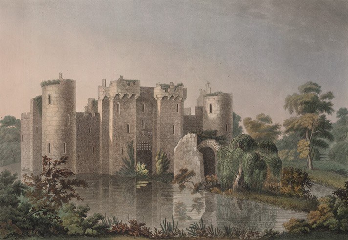
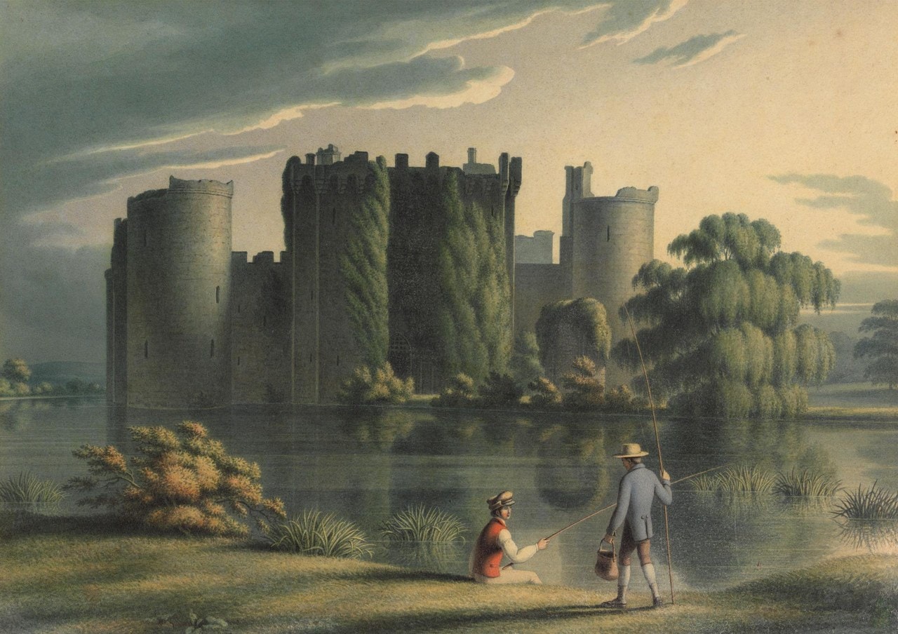
George Cubitt, MP for West Surrey, bought Bodiam in 1864 and put it through an extensive program of repair. He drained the moat, strengthened the foundations, filled decayed curtain walling with cement and concrete, and restored the whole upper part of the entrance gateway, the other towers and the curtain walls; the gateway he had found in a tottering condition, with most of the adjacent battlements missing. Worst of all was the south-west tower, whose outer wall had decayed in places to a single stone’s thickness. He reused stone from the site and also brought in new Wadhurst stone. When Cubitt was raised to the peerage in 1892, the castle went into the title itself: Letters Patent of 22 August 1892 created him Baron Ashcombe, of Dorking in the county of Surrey, and of Bodiam Castle in the county of Sussex.
George Nathaniel Curzon, the former Viceroy of India and later Marquess Curzon of Kedleston, bought the Bodiam estate in 1917 when it came on the market after Cubitt’s death, and kept the castle and fifty acres. (He is often said to have bought it in 1916; that is the year of a visit, after which he proposed to his future wife in Winchelsea church nearby.) His architect was William Weir, a leading member of the Society for the Protection of Ancient Buildings who had worked with him at Tattershall. Their approach was conservative by policy: historic fabric retained rather than renewed, new work deliberately distinguishable from old, wall heads capped in fine cement concrete under turf.
Almost everything they did was stabilization. Curzon drained and consolidated the moat again, and excavation found the footings of the two original timber bridges, demonstrating conclusively where they had stood. He capped the octagon and barbican platforms, repaired the battered footings of curtain and towers in concrete, and reinstated parapets on the south-west curtain and tower with stones recovered from the moat. He excavated the filled-in basements, brought the courtyard back to roughly its present level, and dug out the well. New stone came from a quarry at West Hoathly.
He got two things wrong that are still in circulation. He read the mill pond as a tiltyard, which is why it is still sometimes called one, and he put a wharf on the wrong side. He also tried, and failed, to drain the mill pond into a cricket pitch for the village, and the faint herringbone pattern in its floor is the drainage he laid for it in the 1920s.
The most creditable thing he did was something he did not do. Curzon had plans drawn up to restore Bodiam as a habitable residence, and then dropped them. He wrote that he had “desisted from what would have been an interesting architectural experiment, but might easily have degenerated into an archaeological crime.”
Curzon died on 20 March 1925 and left Bodiam to the National Trust by will, in a bequest that also included Tattershall Castle. The Trust made the core of the estate inalienable the following year, and the castle has been open to the public continuously since 1926. Weir was kept on and his repairs continued, with concrete roofs added to the east tower in 1932 and 1933 and the north-west tower in 1936, and a lead roof over the gatehouse in 1939. A century of Trust care is what 2026 marks, and the Trust is digging for it. “Bodiam 100” is a three-year archaeological project running up to the anniversary, and its 2025 season found a boundary ditch showing a tenement plot fronting a street west of the castle from at least the fourteenth century.
1940
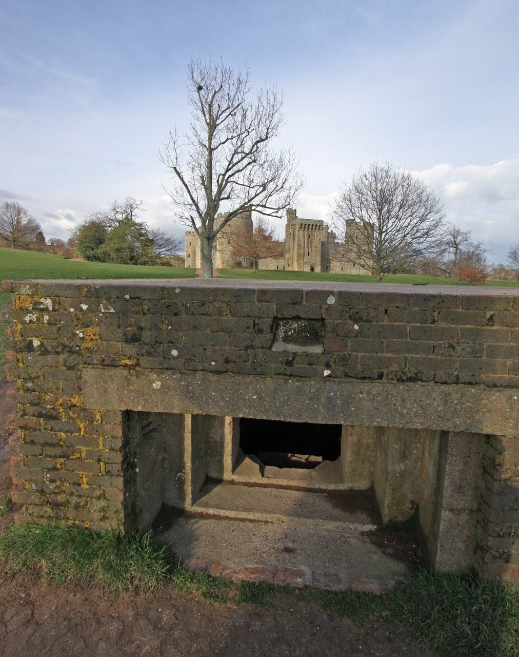
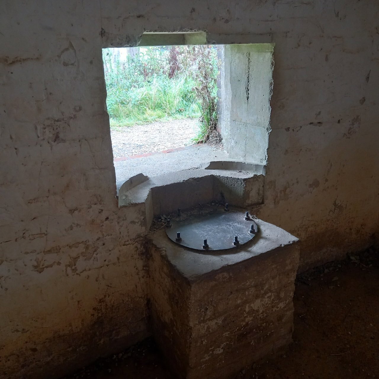
A hundred meters south of the moat, between the castle and the river, stands a pillbox built in 1940 after the Dunkirk evacuation to stop a German crossing of the Rother at Bodiam Bridge. It has two chambers, one for machine guns and one for an anti-tank gun, and would have been manned by ten men. Historic England describes it as brick-built with concrete foundations and lintels; the conservation plan adds that the south and west walls, which faced the likely line of attack, and the roof are concrete, with brick cladding that also served as the shuttering. Its angled plan follows War Office Directorate of Fortifications and Works design 28a, an unusual variation apparently developed for this site. It is scheduled as part of the same monument as the castle. The licence of 1385 spoke of defending the adjacent country against the king’s enemies; in 1940 somebody actually did it, from the same field.
Architecture
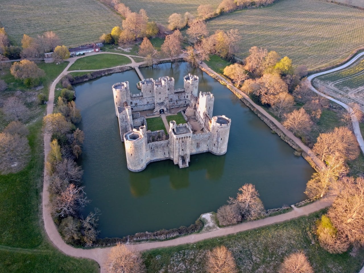
Bodiam is a quadrangular castle: a walled rectangle with a courtyard in the middle and accommodation built against the inside of the curtain. Historic England’s own class description defines the form as a strongly fortified residence built around a square or rectangular courtyard, with the outer walls forming the defensive line and towers on the corners and sometimes in intermediate positions as well.
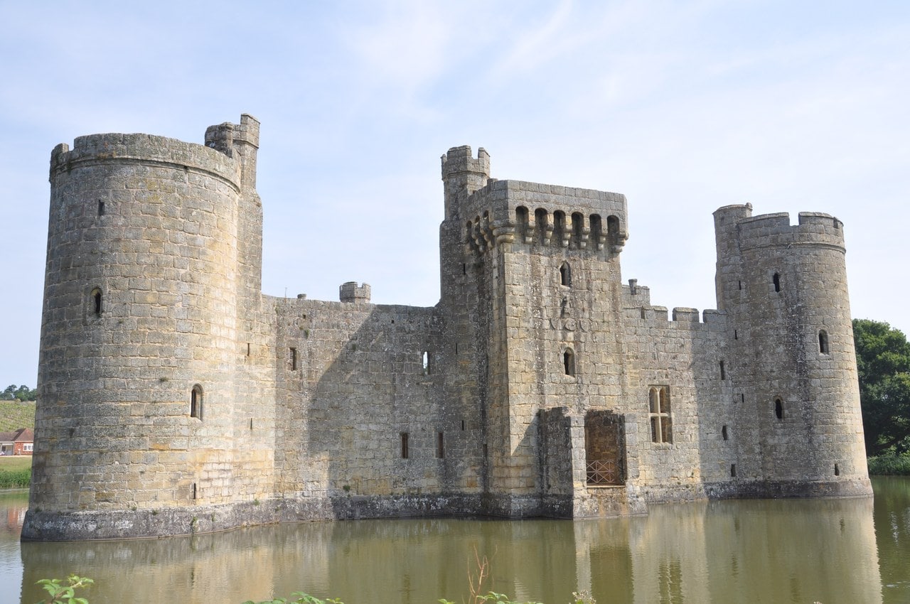
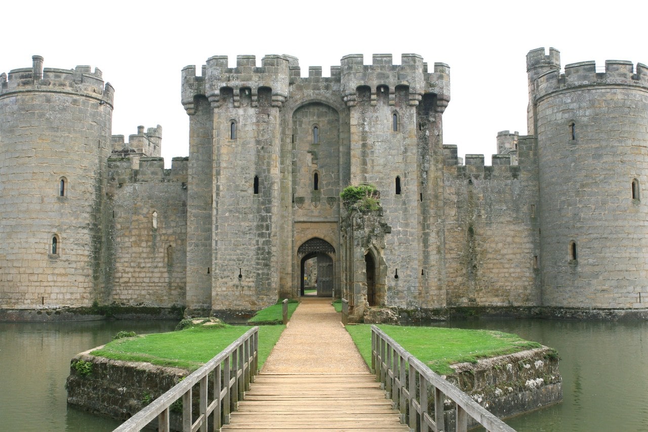
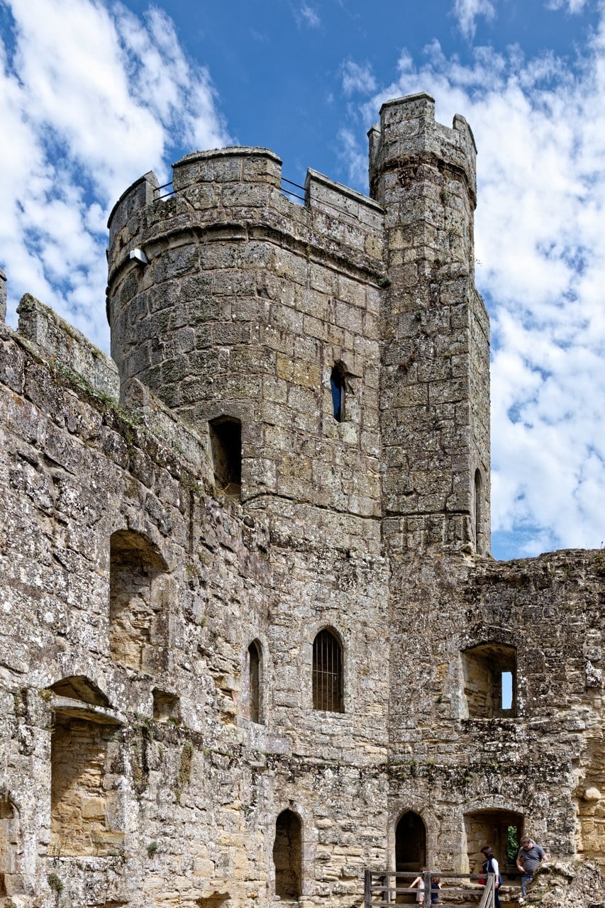
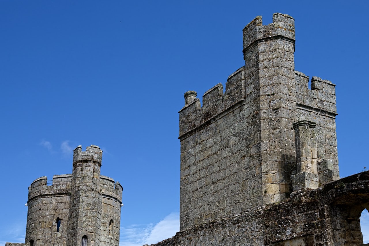
Four round towers stand at the corners, each of three stories, each containing a newel stair. A square tower stands at the center of the east, west and south walls. The listing treats all three together, while the scheduling counts the two on the east and west as intermediate towers and names the southern one separately as the postern tower, because that is the one with a gate in it. No intermediate tower stands on the north wall, where the gatehouse occupies the position instead, itself a pair of projecting rectangular towers with a recessed entrance passage between them. Round at the angles, square mid-wall. The conservation plan reads the consistent mason’s marks as one workshop working to a compressed building program, so on Bodiam’s walls the two shapes are contemporaries. The question of why a builder chose one plan shape over the other is a general one, and Bodiam answers it three times over.
Stone is where the sources part company. Both Historic England entries say the ashlar was quarried at Wadhurst, about fifteen kilometers to the north-west, the 1995 scheduling giving the distance and the 1961 listing only the place. Against that, the National Trust’s 2016 conservation plan says the castle is principally built of local stone from the Ashdown Beds, and that the quarry site is unknown. The plan notes that by 1730 stone was being dug locally in an open pit immediately north-west of the castle, which is still there, and the interior survey described below puts the likely source only a few hundred meters north, where the sandstone ridge comes close to the surface. Trust pages name the rock and never the quarry. Ashdown Beds sandstone is Wealden sandstone, so nobody disagrees about what the walls are made of. Where it came from, the two answers are roughly fiftyfold apart.
Numbers for the shell come from the conservation plan. Curtain walls stand 13.15 meters from the water of the moat to the top of the parapet copings, and are 2.2 meters thick at the bottom, where they rise on a shallow battered plinth. A battered wall is thinner higher up, and the plan gives no figure for the upper courses. The island those walls clasp is about 56 meters north to south by 52.1 east to west, and the round towers are about 8.7 meters in external diameter. Widely circulating figures of eighteen feet thick and fifty-nine feet high are supported by nothing reached for this guide and are wrong by a wide margin: 2.2 meters is about seven feet, and 13.15 meters about forty-three.
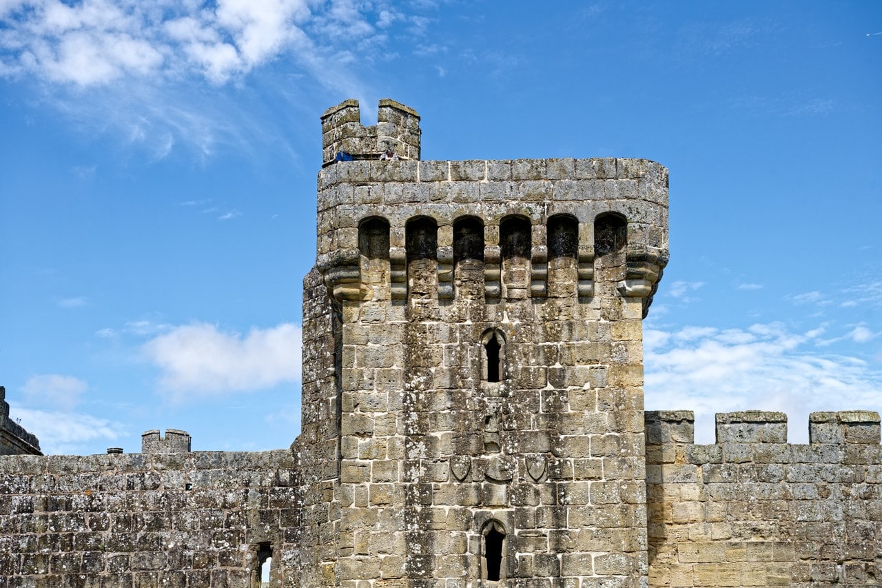
What that curtain carries at the top is more partial than a photograph suggests. It survives almost to its full height, but the curtain itself is crenellated only on the north face and on part of the south. Machicolation is documented on the gatehouse and the postern tower, but on neither the corner towers nor the curtain. Where the parapets do look complete, some may be Curzon’s reinstatement in stones dredged out of the moat.
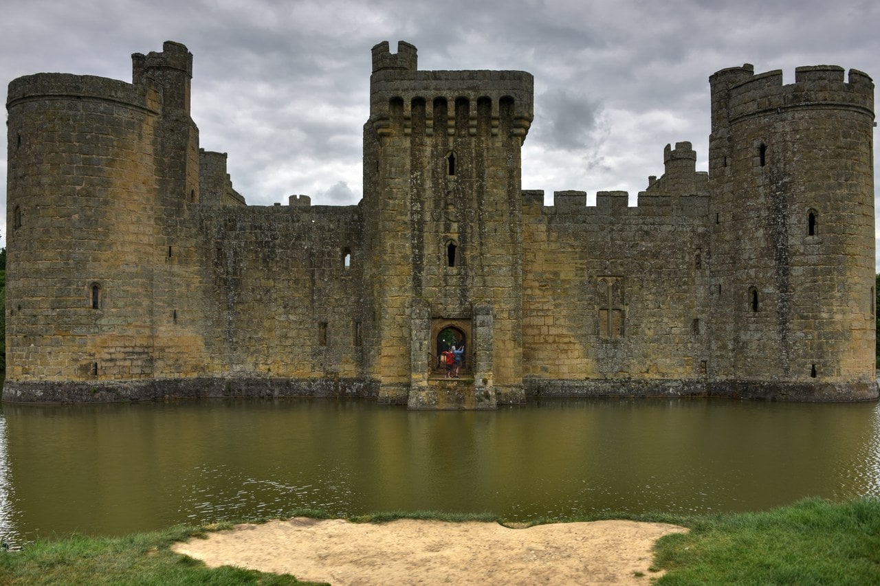
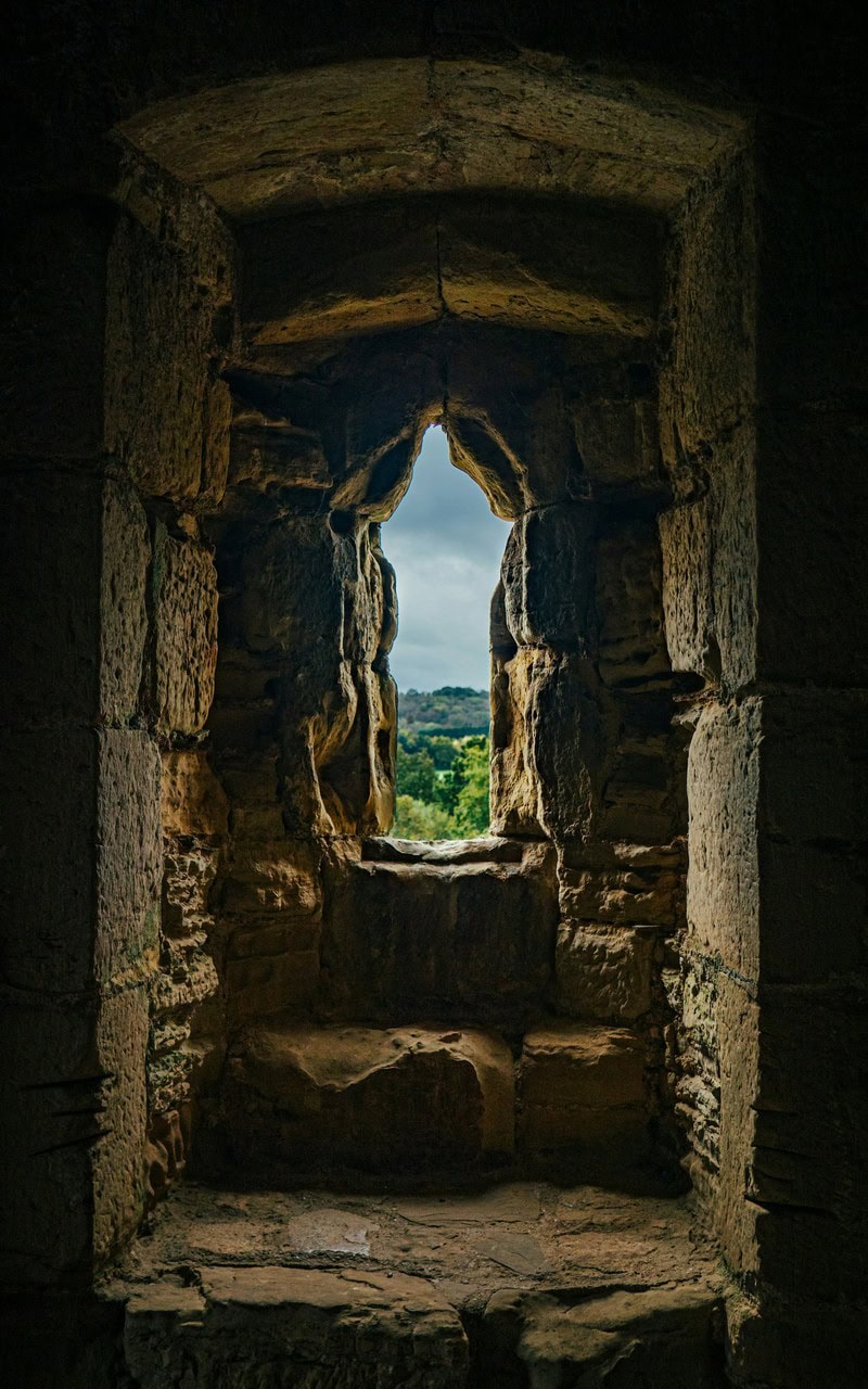
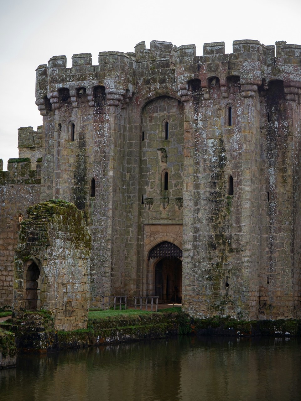
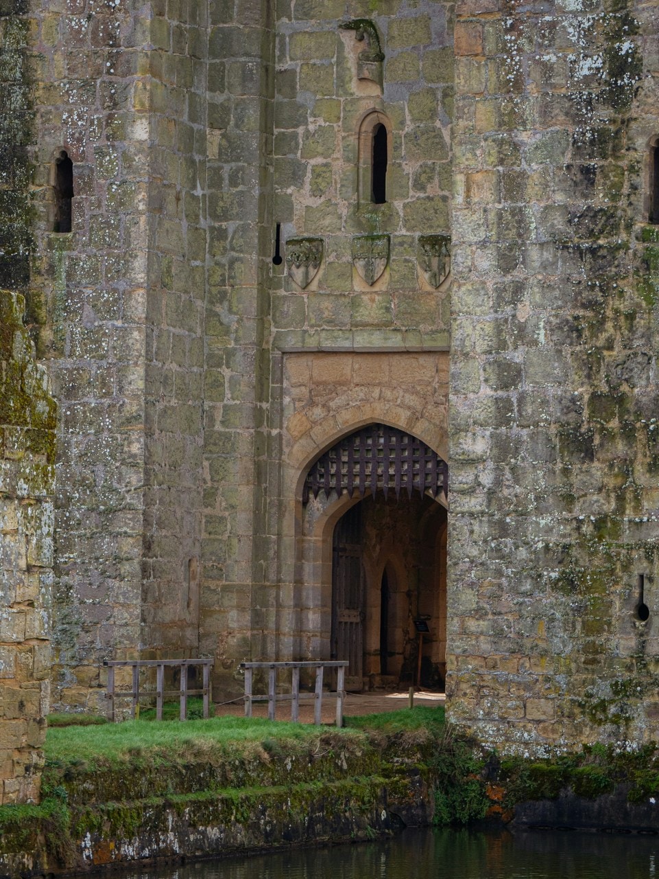
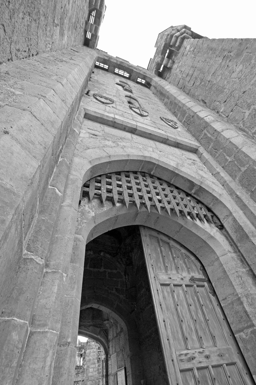
Gate front and gate passage carry the defensive vocabulary the whole argument turns on. Above the recessed entrance runs a corbelled, machicolated and crenellated parapet; simple lancet windows pierce the walls, and at ground level there are gunloops. Two pairs face north towards the bridge, of the standard inverted-keyhole type commonly used after about 1370; two of a dumb-bell pattern face each other across the front of the gateway; two more point diagonally north-west from the stair lobbies. Their combination of types, the conservation plan finds, is entirely consistent with the date of the building. It then argues their usefulness in both directions. The northward-facing loops, it says, seem singularly ill-aligned and too constrained within to be of serious use, while the two flanking the gate and the two aligned on the bridge from higher levels would provide good spots from which to aim a hand cannon. Charles Coulson is the source of the suggestion that their position makes them largely symbolic, and it is his argument rather than a finding.
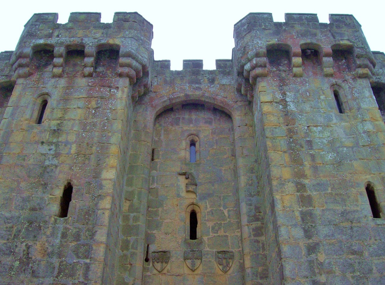
Over the entrance arch are three carved shields beneath a helm with Dallingridge’s unicorn crest, and they are read two ways. Both readings put his arms in the middle and his wife’s family’s beside them. For the third, the National Trust’s map and guide names the arms of his mother’s family, Radynden, while Mark Antony Lower in 1871 blazoned it as the arms of Bodiam, listing all three as the arms of the castle’s successive lords.
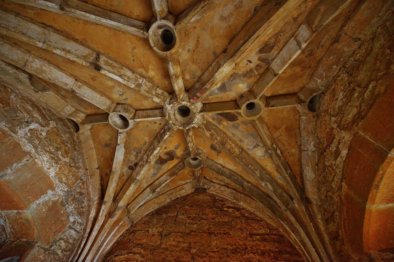
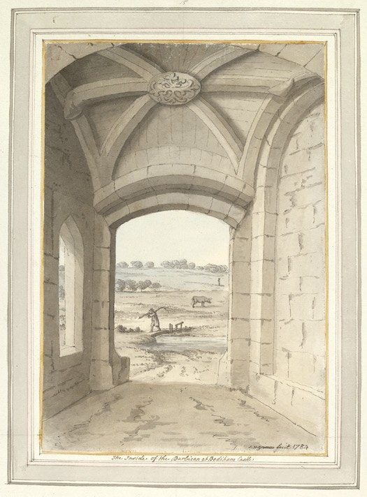
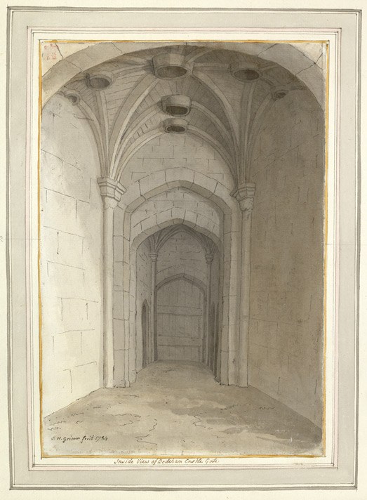
Both bays of the gate passage once carried ribbed vaults and the southern one survives, its bosses and half-bosses pierced, which is what murder holes are. Ring-bosses, the conservation plan calls them, and reads them as small and probably decorative, or at least symbolic of defensibility rather than militarily functional. Since the portcullis chamber above has a fireplace in it, the plan reasons, the openings were presumably reached, if at all, through hatches in the floor rather than standing permanently open. The plan calls the motif widespread in gatehouse passages of the late fourteenth century, first used in the Cradle Tower at the Tower of London between 1348 and 1355.
One joint here is medieval and easy to mistake for restoration: the gatehouse’s rear chamber was added to the front block during the building campaign, leaving a straight joint on both sides, a chamber above it reached by its own stair, and slit windows on the first-floor staircase that the addition concealed. Bodiam has joints of two kinds, medieval changes of mind and nineteenth- and twentieth-century repair, and they look very similar.
Inside the walls: what survives of the ranges
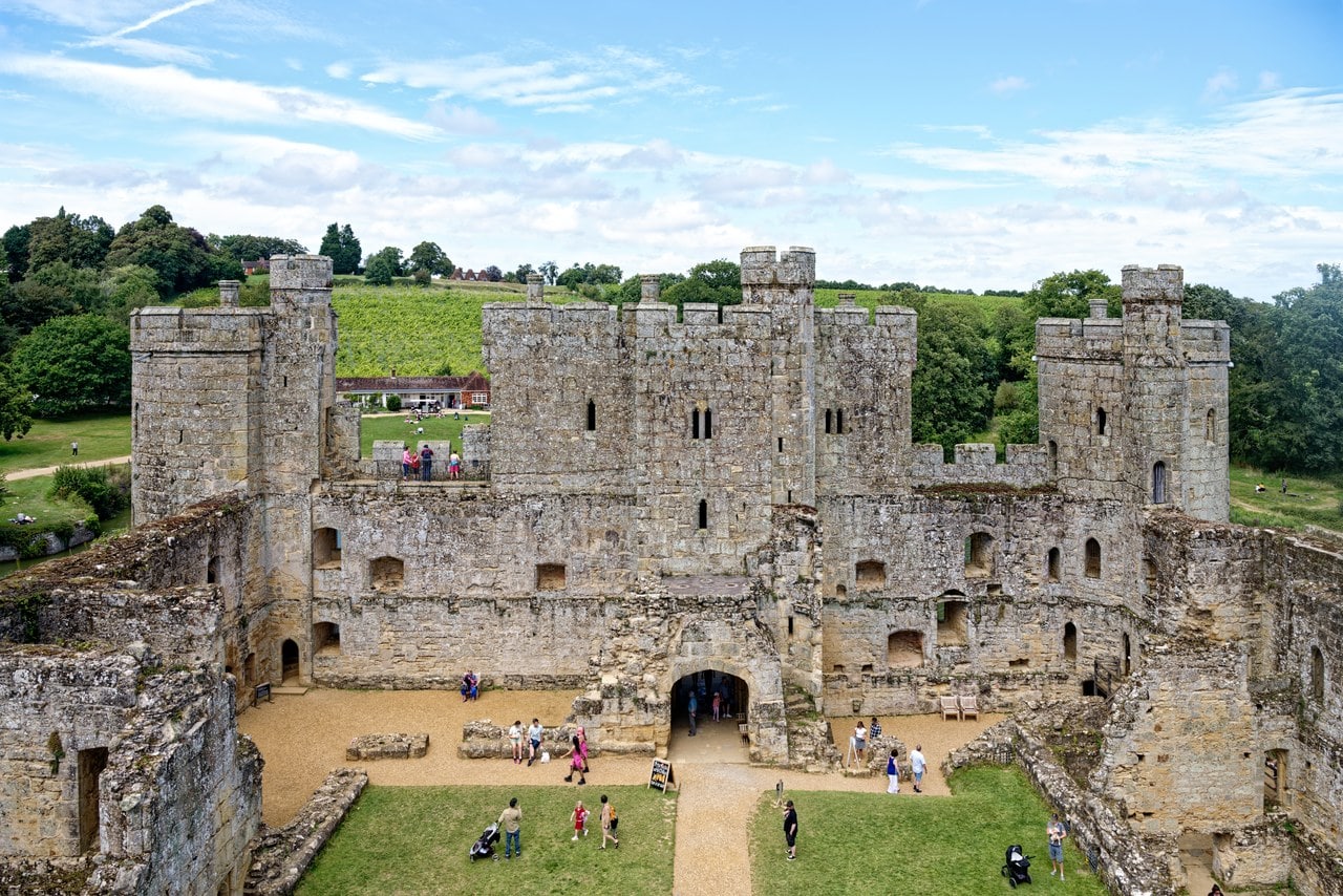
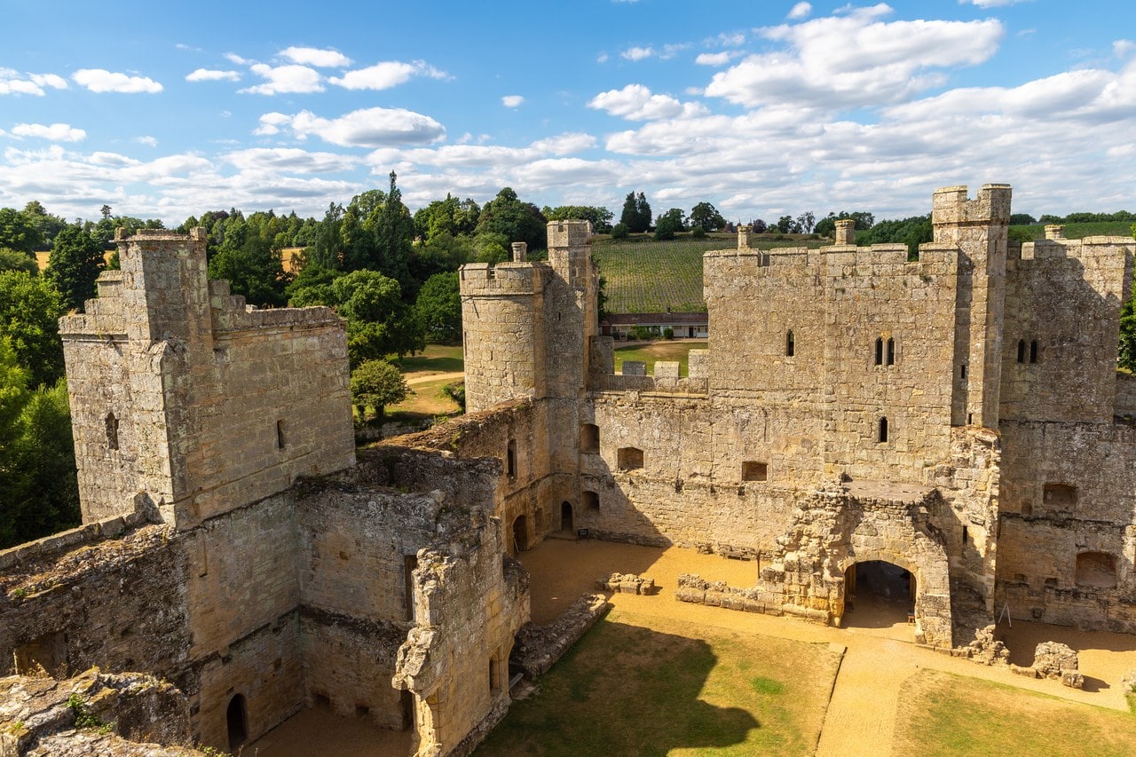
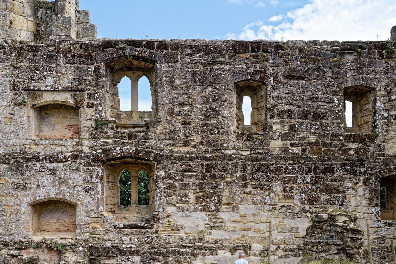
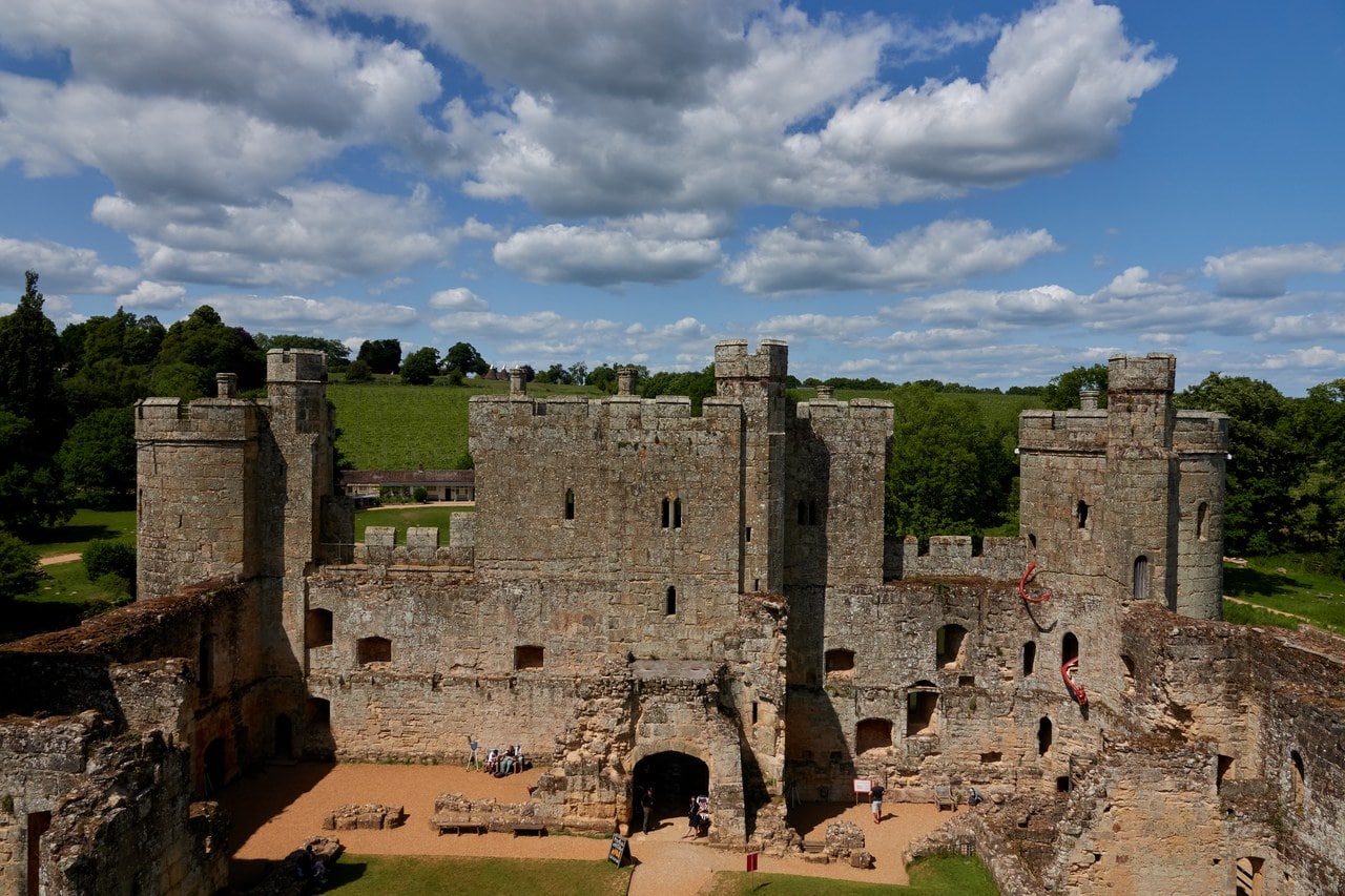
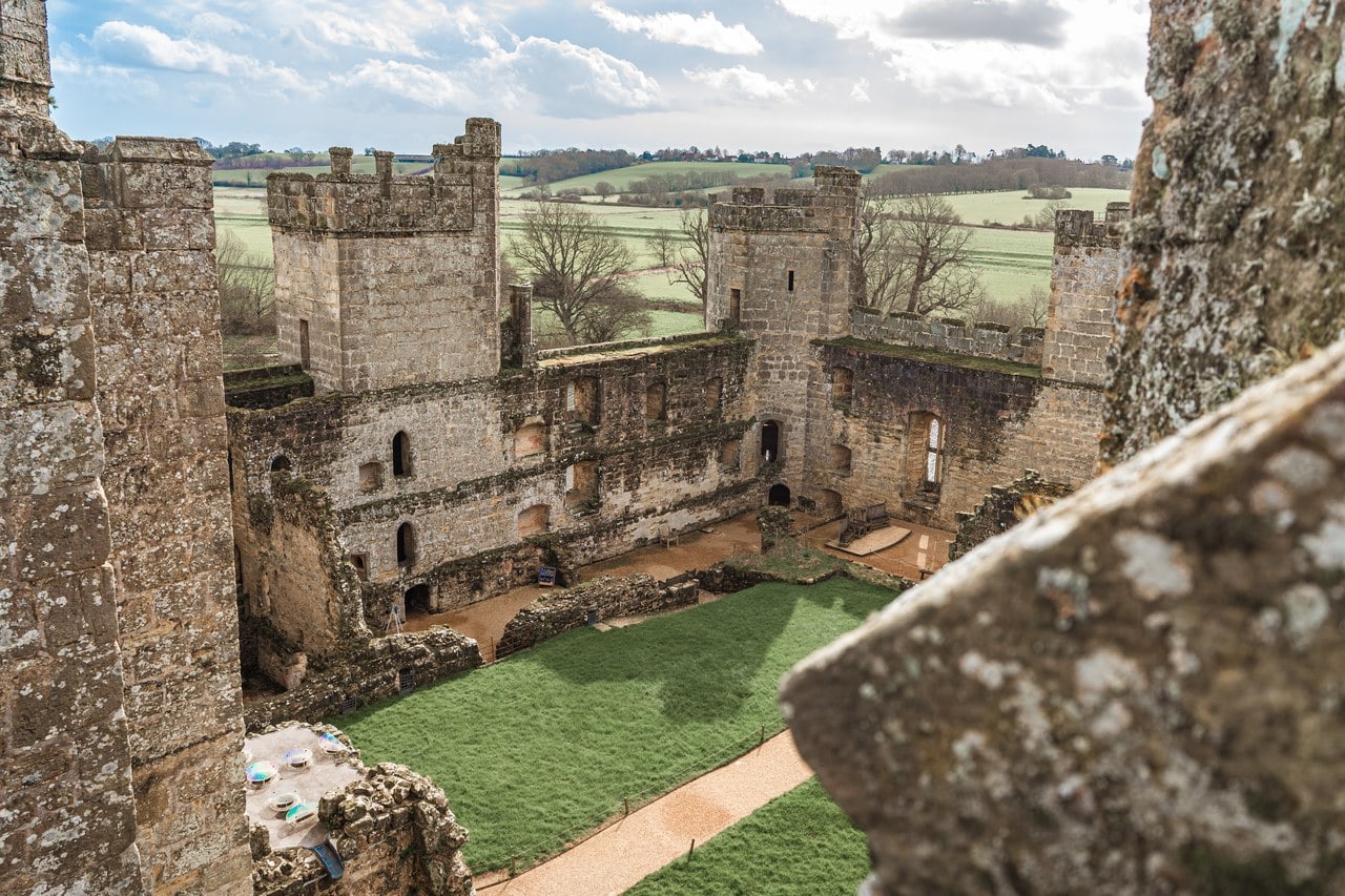
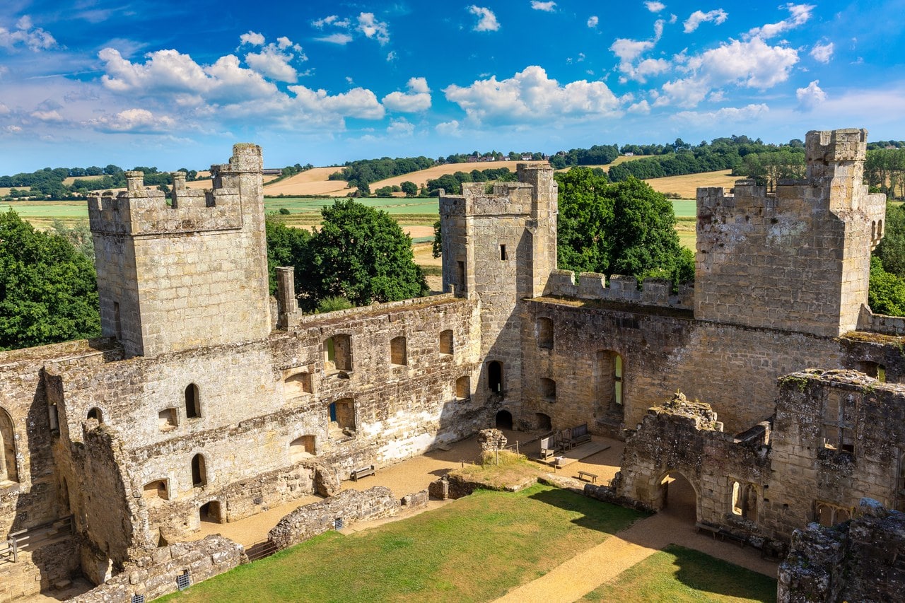
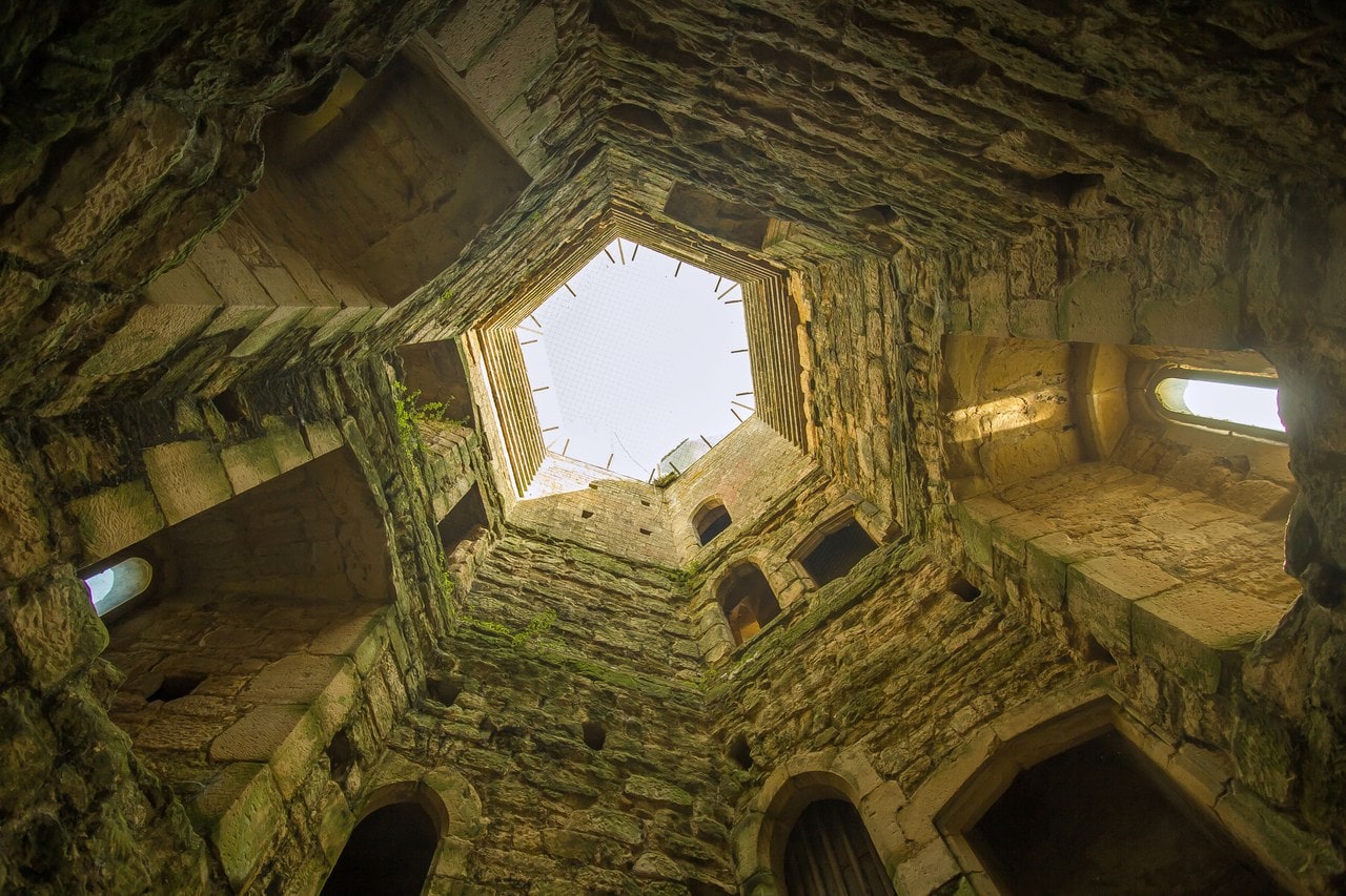
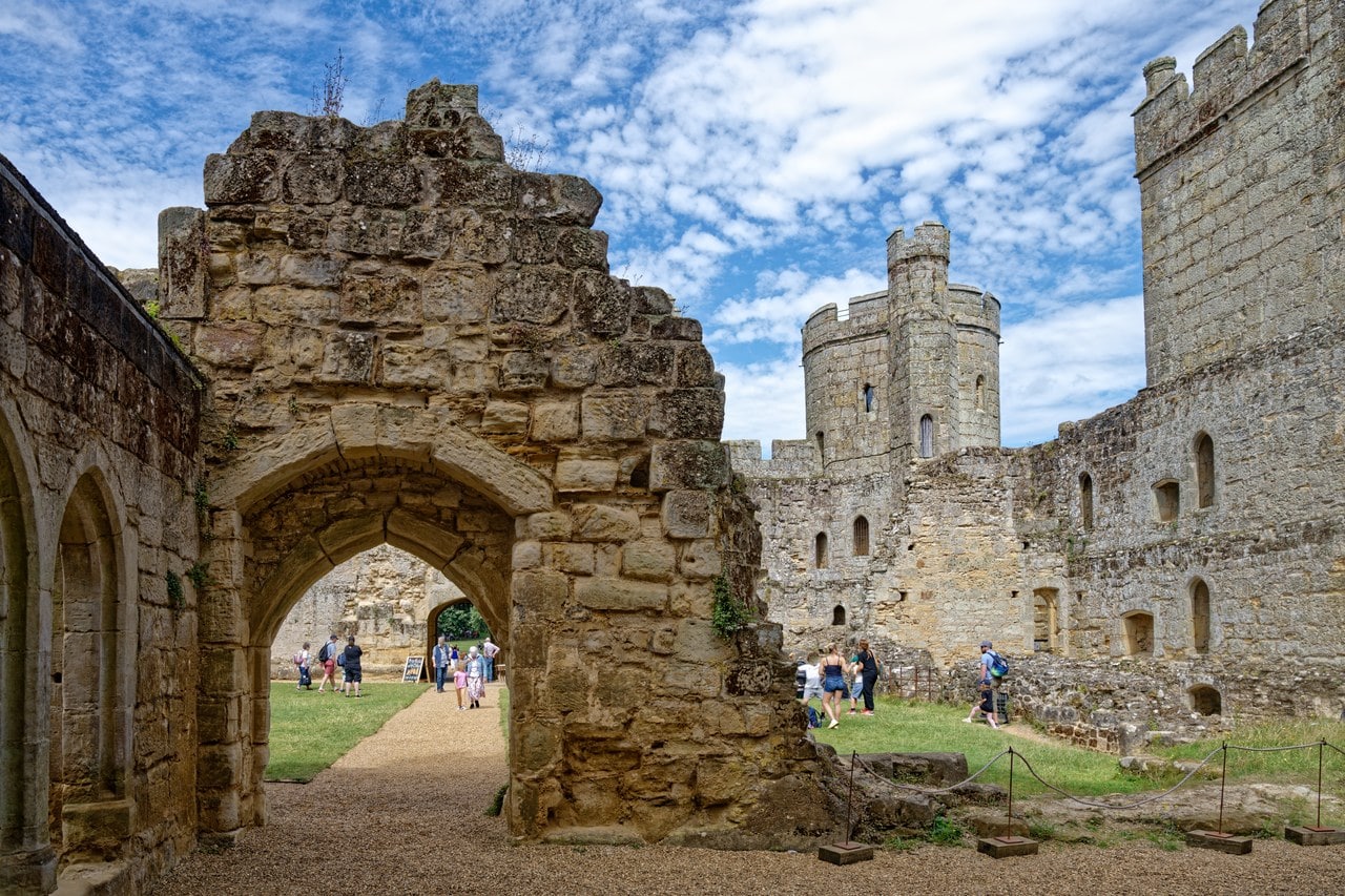
Bodiam’s outer walls stand nearly or completely to their full height, and above basement level almost nothing survives inside to show how the upper floors were divided. What a visitor walks into is a rectangle of turf enclosed by a complete curtain, with the kitchen, pantry and buttery walls on the west side of the south range and part of the west range still standing. The east range, Historic England records, held the principal living rooms as well as the chapel, and the Trust’s Lord and Lady’s Apartments, reached from the high end of the hall, were set across two floors. Most of the rest of the ranges a castle courtyard normally held is footings and buried foundations. A survey of the interior by Cooper, Copeland and Johnson, made between 2010 and 2012 with a reflectorless total station and published in 2017, puts it bluntly: the ruinous state of the internal walls hampers interpretation, and of the west range it says the inner walls are so ruinous as to make further comment difficult.
Set that against what the conservation plan says about the fabric overall, which is stronger than a visitor might expect: the surviving fabric of the castle is almost entirely primary, and what survives is largely unaltered since its original construction. Bodiam is ruined and it is not rebuilt. The survey adds a caution of its own: it is not always easy to tell Cubitt’s and Curzon’s repairs from the medieval fabric, because original stone was reused and later repointing has hidden the changes in mortar.
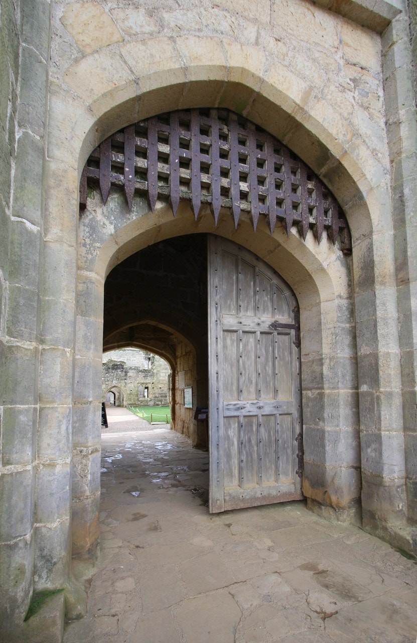
The outer portcullis partly survives in the gatehouse. It is oak, iron-clad in its lower part, with the usual iron spikes along its foot, and it was built into the arch as the stonework went up rather than fitted afterwards. Radiocarbon dating puts the growth of its timber between AD 1280 and 1410 at ninety-four percent probability. The conservation plan calls it one of a very small number of mostly fourteenth-century portcullis grilles to survive in Britain, with the one at Hever very similar in both form and date. Its top was crudely cut away at some later date while it stood raised. Historic England’s scheduling describes it as the medieval outer portcullis, made of iron-clad oak; the conservation plan supplies the qualifier that phrase leaves out.
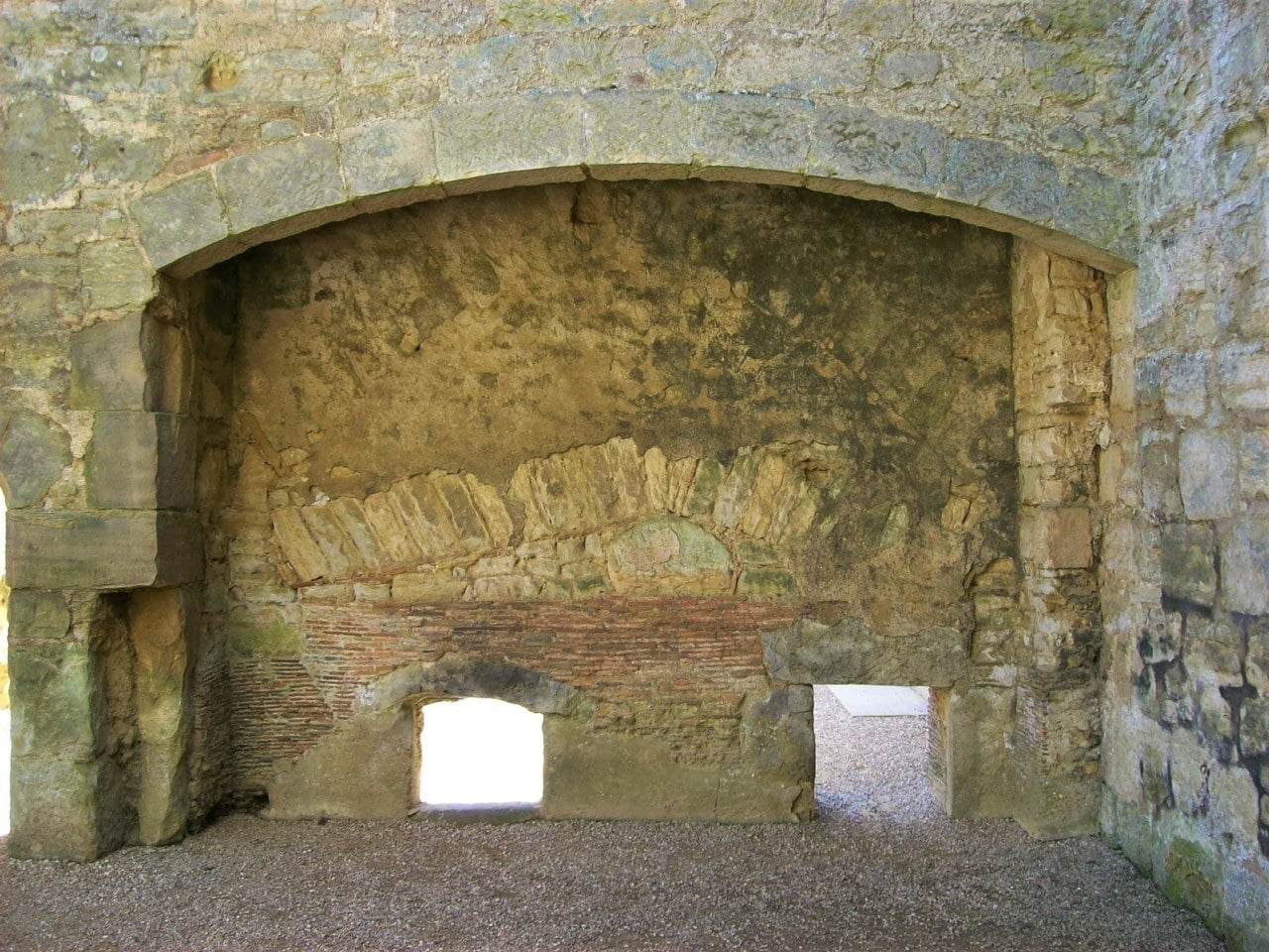
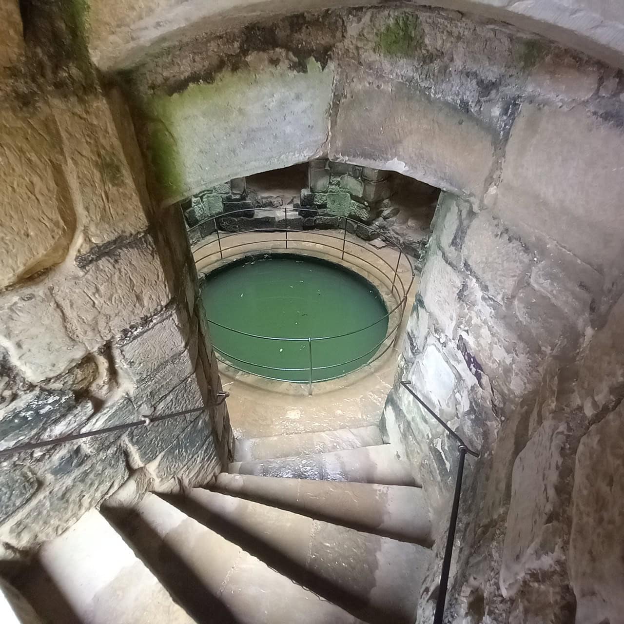
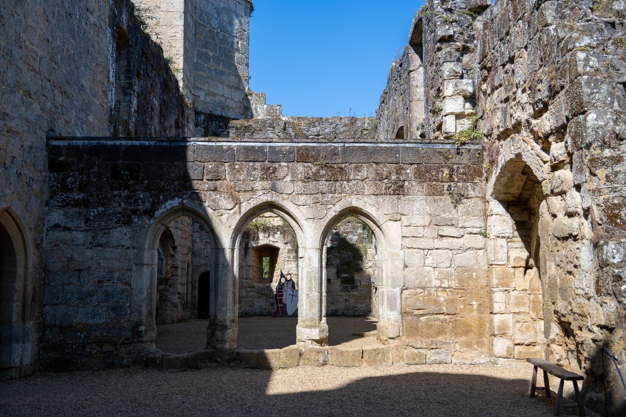
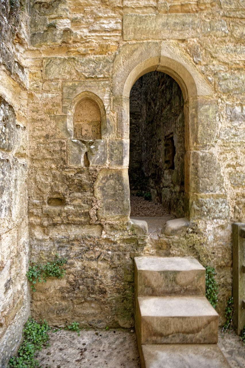
Several things are legible on the ground for anyone who knows to look. A large mullioned and transomed window with two pointed lights near the eastern end of the south curtain marks where the great hall was. Bodiam’s chapel survives as its east window, three plain pointed lights, partially restored in the nineteenth century, in a projecting bay on the north side of the central east tower. Three arches in the south range are the screens passage, with doors behind them to buttery, pantry and kitchen. In the basement of the south-west corner tower is the well, stone-lined and restored, about 2.75 meters across and 2.5 deep, still holding water. Heavy wear on the stair treads and knife-sharpening marks on the fireplaces are the kind of evidence that survives being dismantled.
On the southern part of the east curtain wall the building seasons are still readable in the stonework. The south-east tower had been carried up to the top of its ground-floor window, the wall beside it steps down to a lower level, and the last few courses of that season are in smaller stones. When work resumed the masons used larger stones, cut them to shape over the ones already in place, and made no attempt to continue a course. The same survey found the plan set to the cardinal points with an accuracy of 1.2 degrees, and the rectangle of the walls almost perfect.
Two smaller things repay a look. A leafy boss at the center of the corridor vault behind the gate is the only surviving piece of figurative sculpture in the whole building, and Cooper and colleagues, citing Coulson, note how plain the castle is otherwise. The scheduling says the north range is thought to have held stables, and the same survey doubts it: the doorways look too narrow, there are plinths for a suspended floor, and one room had a window seat.
One caution about what is under your feet. Historic England’s scheduling names, item by item, the things it excludes as modern. The list includes the wooden floors inserted into the second floors of the gatehouse, the north-west tower, the mid-western tower, the postern tower and the north-east corner tower. Climb a tower at Bodiam and the floor you stand on is very often not the medieval one. The gatehouse roof is modern as well: concrete cast in place in 1977, when the gatehouse interior was opened to visitors, above the lead-and-timber roof of 1939, which survives beneath it as a ceiling.
The Approach to Bodiam Castle, and What It Was For
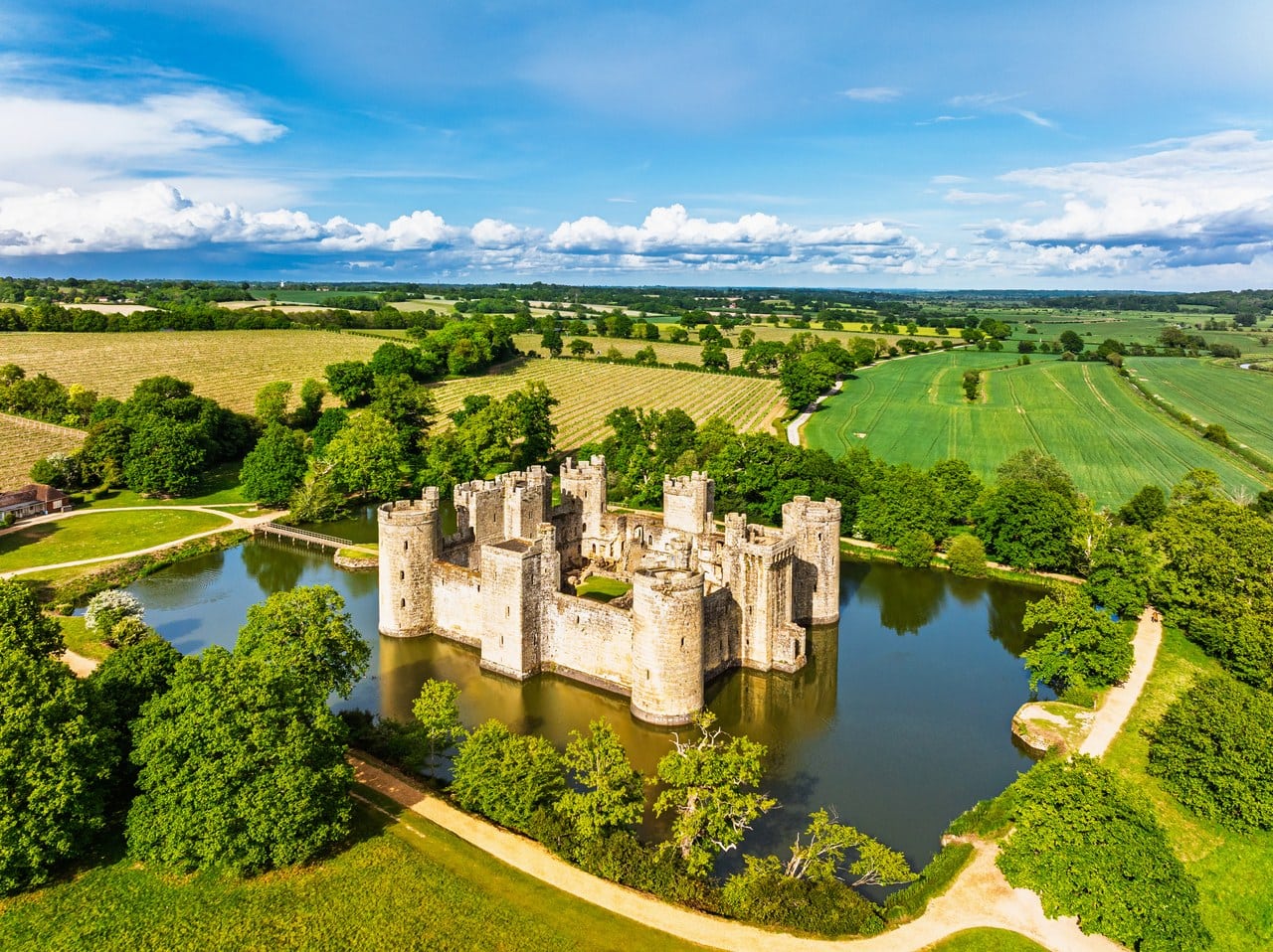
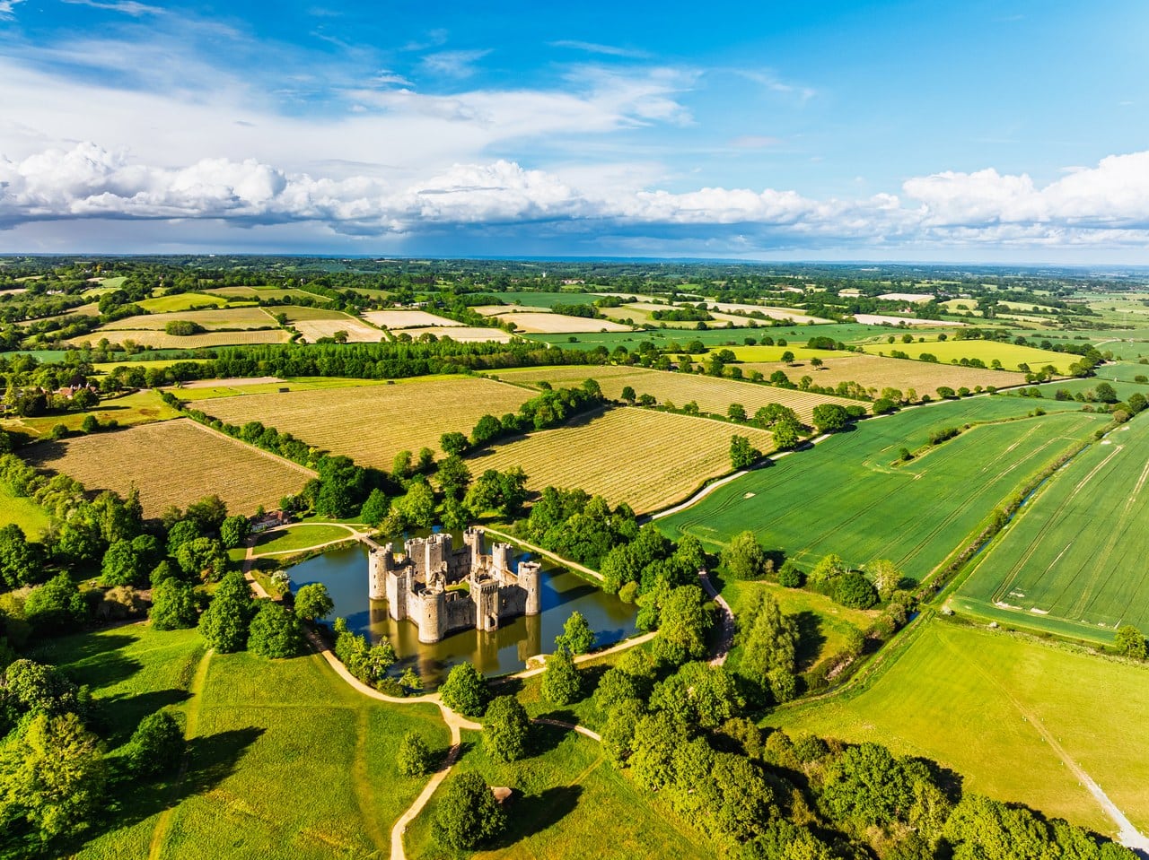
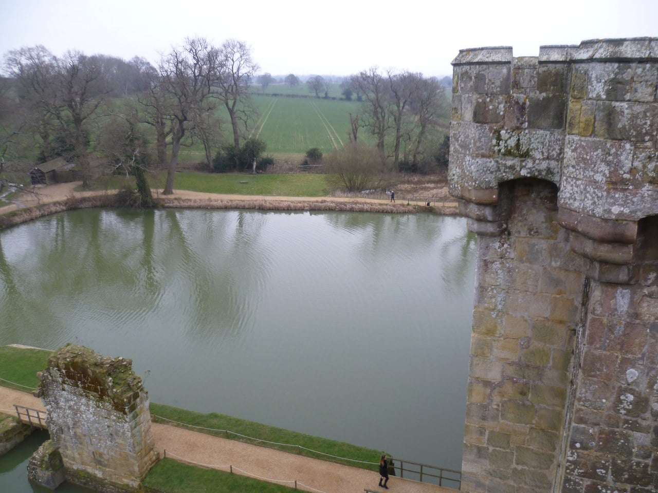
Water is what everyone photographs here, and it is also the part of Bodiam that has changed least and been misread most. Historic England records a sub-rectangular moat about 155 meters by 115 and around two meters deep, fed by natural springs rather than by the Rother, about 250 meters away. Wet conditions in that silt are part of why the site is protected. The general case for what a castle moat was actually for is argued elsewhere on this site. What is Bodiam’s own is the route that crossed the water, and that route is not the one visitors take now.
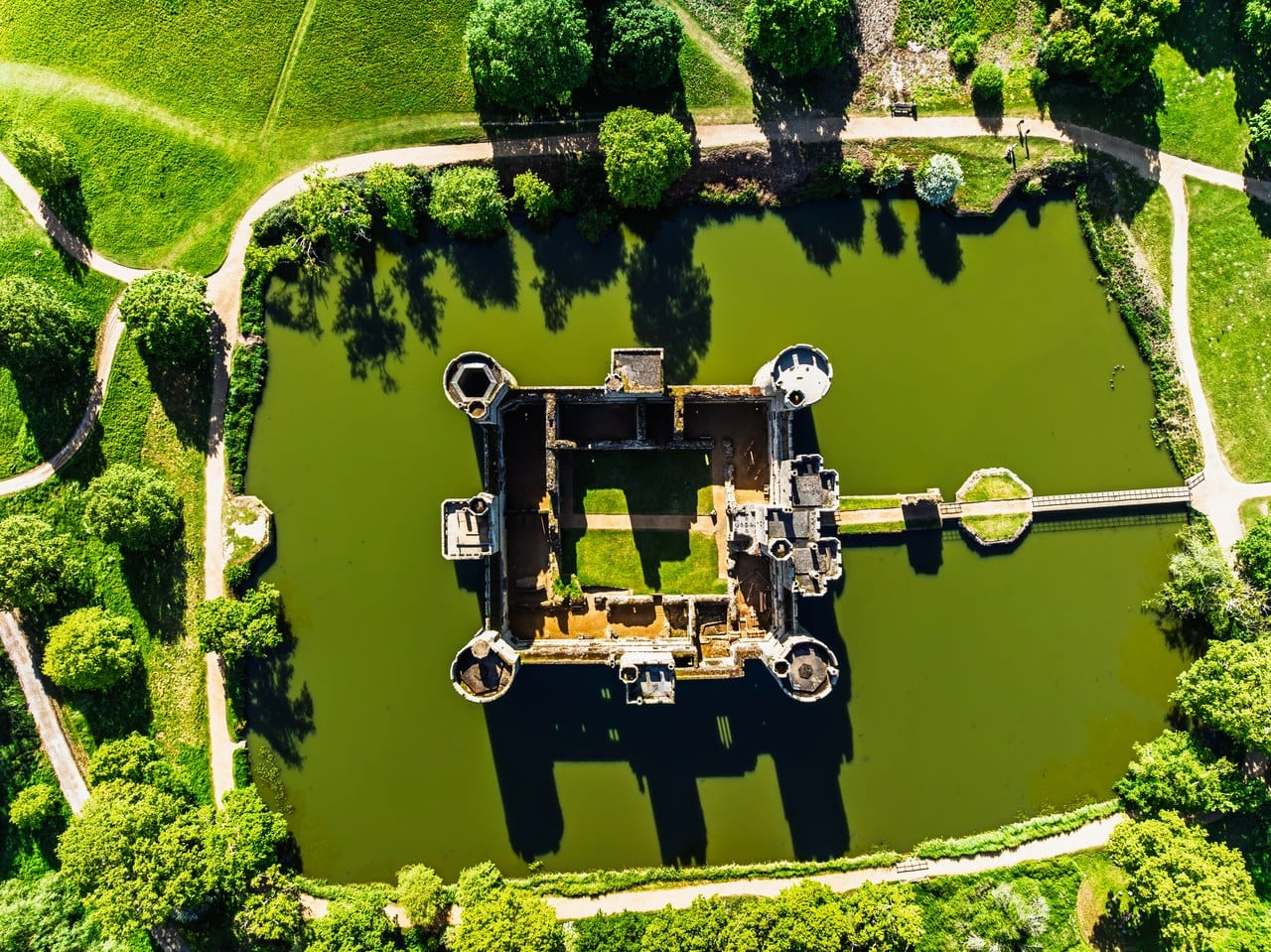
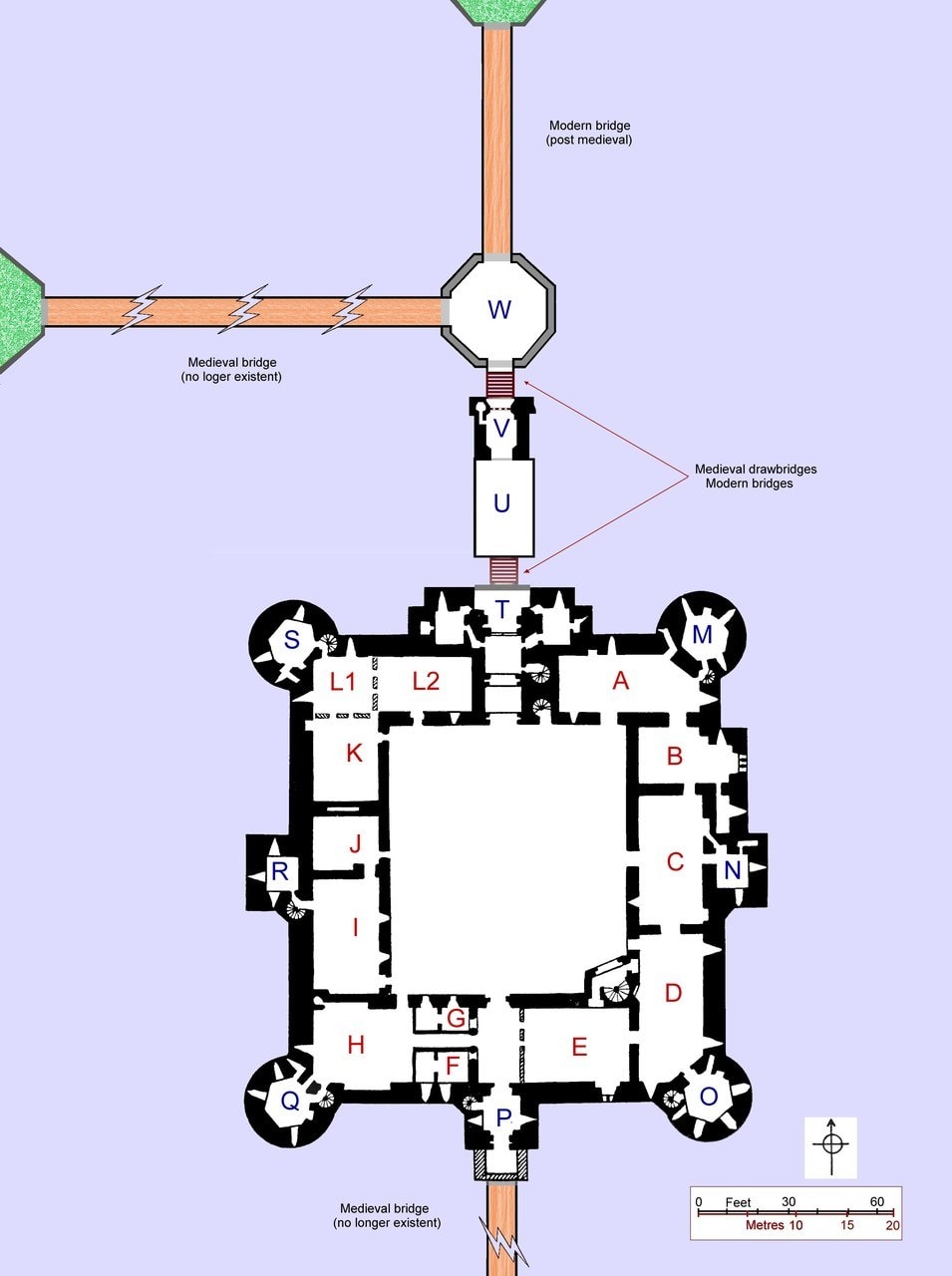
Projecting halfway into the broad northern arm is a stone causeway, which contains the remains of an outer barbican and ends in an octagonal plinth, a stone platform standing in the moat. Historic England says the plinth originally carried further defenses, without saying what they were. Excavations in 1919 and 1920, and again in 1970, found the foundations that carried the original main bridge, and they run from that octagonal plinth west to an abutment at the northern end of the outer edge of the moat. That abutment still stands. A further bridge, since dismantled, crossed the southern arm from a central abutment to reach the postern gate, and its footings were found too.
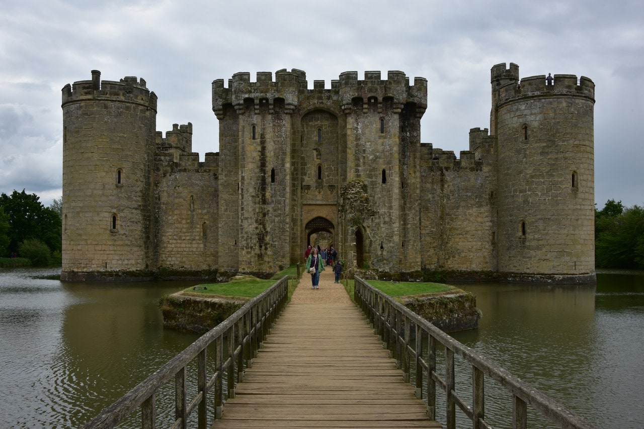
Read that carefully and the medieval arrival began quite differently from the modern one. A visitor crossed a long bridge from the west bank, turned through a right angle at the octagon, went along the causeway past the barbican, and only then faced the gate. Today’s approach comes straight down from the north across a bridge Historic England names in its list of modern features excluded from the scheduling, along with the wooden bridge onto the causeway. Only the first leg of your route differs from the one the castle was built for, but it takes the turn with it: arriving in line with the causeway, you never make the right angle at the octagon.
What that sequence was meant to do is where the evidence stops and interpretation starts. Documented are the causeway, the barbican remains, the plinth, the excavated foundations of the west bridge, the surviving west abutment and the footings of the south bridge. Not documented anywhere reached for this guide are the number of turns an arriving visitor made, whether the dog-leg was meant to be seen rather than to be defended, or what stood on the octagon. Reconstructions of a staged approach, such as the National Trust guidebook of 1991 with its “care taken to stage the views of the castle to visitors approaching from Bodiam Bridge,” are a reading of those elements rather than a record of them. Much the same applies to the gatehouse, its portcullis and its drawbridge as a working system: two drawbridges are recorded at Bodiam, neither survives, and Curzon dug out the pit for one.
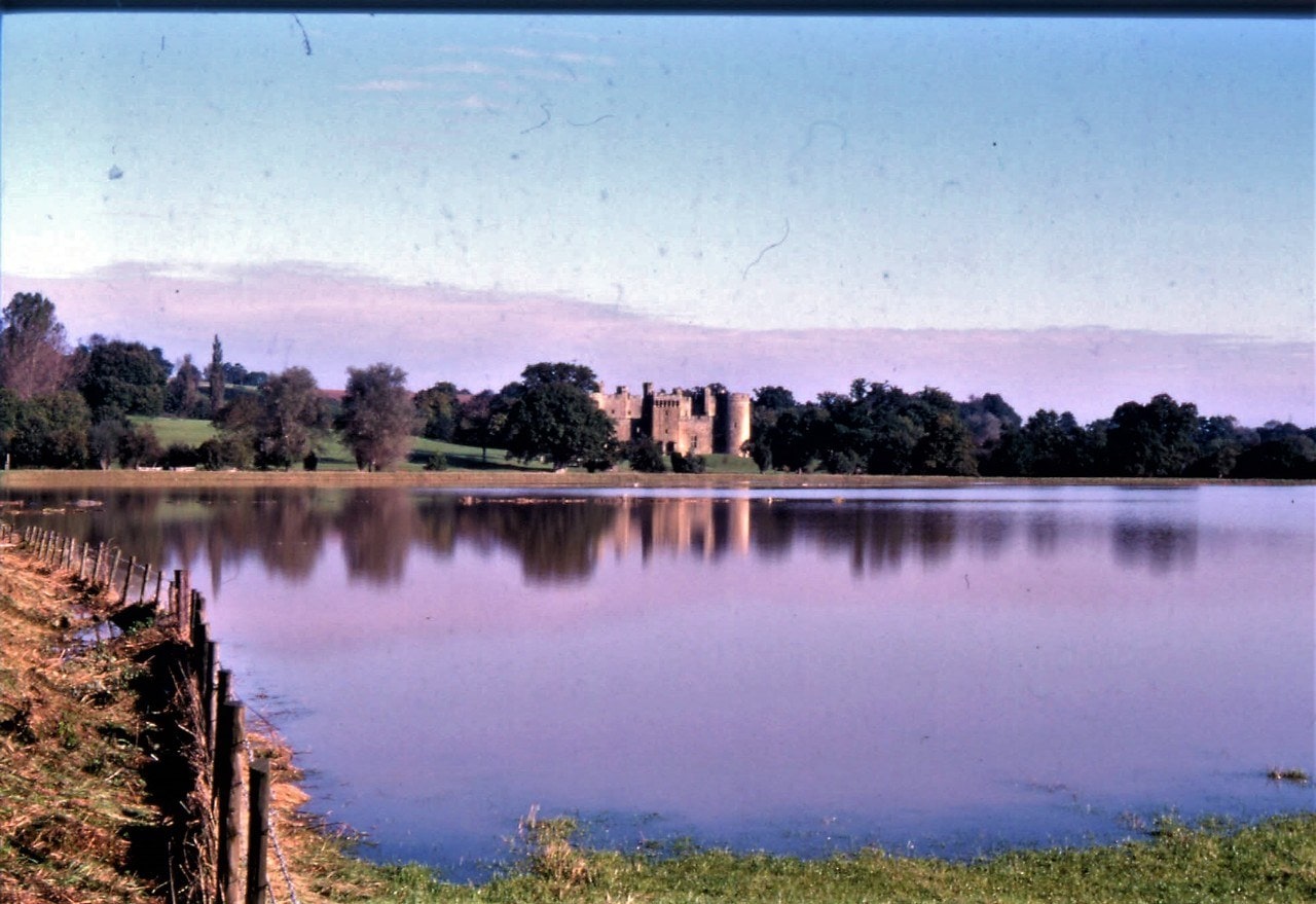
Around the moat, present state and postcard part company. Historic England describes the water-management features and ornamental earthworks around the castle as “designed to add to the defences and to provide an attractive, elaborate approach and landscaped setting for the castle,” which is both halves of the argument in one clause, written into the statutory record that protects the ground. Most of that system is dry now, altered by later drainage and dumping, so a visitor sees hollows rather than a chain of pools, though sluices on the south and east still take the moat’s overflow. To the south lies the disused mill pond, 160 meters long and about 65 wide, which once helped to power a fourteenth-century watermill that formed part of the castle complex.
Then there is the ridge 250 meters north, scheduled in its own right as a medieval pleasaunce, an ornamental garden and viewing platform, surviving as earthworks: a terraced rectangle about 66 meters by 15, standing 1.6 meters proud on its downhill side. Historic England’s stated reason for protecting it is that it represents part of “a carefully contrived and impressive setting from which Bodiam Castle could be displayed to important visitors.” The scope matters: that is the state explaining why it protects the ground, and it is said of the pleasaunce rather than of the castle. It is the same feature as the Gun Garden, a name it has carried since at least 1730 when it was an orchard, and the conservation plan makes that identification twice. That plan agrees the platform is ideally placed for looking at the castle, and notes that a viewer on it faces the north side of the moat square on, with a clear axis to the octagon. It then doubts the garden reading, preferring a terrace cut into the slope for a building and calling any interpretation provisional. The ridge stands in the private grounds of Court Lodge and there is no public route to it.
Mark Antony Lower, writing in 1857, read the same hillside the other way round. He recorded it as the Gun Garden and Gun-Battery Field, with “a tradition of the Castle having been once taken by an assault from that spot,” which he thought, if it meant anything, must refer to 1483. One slope, read in the nineteenth century through a siege tradition and in the twentieth as a place to stand and admire the view. Bodiam does this to people.
Fortress or Show Castle
Two things make Bodiam the standing example in the fortress-or-show-castle argument: it is almost unaltered, and it is almost undocumented. No building accounts, no household records of the campaign, one licence and a landscape. Everything else is read off the fabric, which is why the same walls have produced opposite conclusions from careful people.
Take the positions in the order they were published. A. Hamilton Thompson in 1912 gave the traditional military reading, which Spencer summarizes as Bodiam built to protect the coastal towns of Rye and New Winchelsea, “which were navigable from Bodiam via the river Rother.” D. J. Turner asked the modern question in the title of a 1986 paper, “Bodiam, Sussex: True Castle or Old Soldier’s Dream House?” Landscape survey reframed everything: RCHME fieldwork of 1988, published by Christopher Taylor, Paul Everson and Robert Wilson-North in 1990, read the water features as a designed setting rather than a defensive system. Charles Coulson’s Bodiam paper followed in 1992, arguing that the castle’s defenses are weak on their own terms, an easily drained moat, badly sited gunloops and thin walls, and that the military language is a studied exaggeration conveying what he called a message of power and deterrence.
Christopher Whittick in 1993 located Dallingridge’s dam and leat and showed the mill pond to be working infrastructure. Colin Platt answered the revisionists in 2007, insisting that Bodiam was meant to serve a military purpose. Creighton and Liddiard proposed in 2008 that the war-or-status framing is itself the problem.
Spencer’s 2014 study attacks Coulson’s premise rather than his conclusion, which is the sharpest move anyone has made. Coulson’s reading needs Dallingridge to be a newcomer compensating for a lack of pedigree. Spencer points out that by 1385 Dallingridge was a well-established member of a cohesive east Sussex gentry, substantially wealthy and tied to the resident magnate, and that he had represented Sussex in parliament on numerous occasions since 1379. Spencer also dates the decision to build much earlier than the 1384 lawsuit Coulson reads as its trigger, possibly to 1377. He concludes that Dallingridge wanted a visible symbol of his authority and also meant to capitalize on genuine fear of French invasion, which is two motives rather than a choice between them.
The builder is better documented than the building. The conservation plan dates the French raids that burned Rye and Winchelsea to 1377 and 1380. In July 1380 Dallingridge was appointed to survey the defenses of New Winchelsea, which Spencer says were still inadequate when the town was attacked at the end of that month, and a Close Roll entry of 17 September records that he, “being by the king and council commanded to abide upon the defence of the sea shore of Sussex against the king’s enemies, is grievously wounded at Bourne co. Sussex.” His licence, granted five years later, carries the same phrase, “against the king’s enemies,” in the published calendar. Spencer counts four commissions of array for him, in 1377, 1385, 1386 and 1392, and calls them all critical years for the safety of Sussex and England. None of that says what Bodiam was for. It says the man who obtained the licence had, in Spencer’s words, “extensive experience of combating French raiders whilst ensuring the defence of key coastal settlements.”
The most useful sentences in the whole literature belong to the conservation plan the National Trust commissioned from the Drury McPherson Partnership. It holds every reading of the mill pond open at once, saying there is no reason why the mill and pond, while having a primary functional purpose, could not also have had an aesthetic purpose in contributing to the castle’s setting, or indeed a military one in defending it. On the licence, the plan is franker still: framing the petition in terms of defense of the realm would have provided a suitably dutiful rationale, and to build a castle at one’s own expense was a significant gesture of loyalty; but it is hard not to see what Dallingridge actually built as primarily an enhancement of his own social and political status.
One reason the argument will not close is that the word in dispute has moved. Medieval usage of “castle” covered a fortress, a walled town, a military camp and something better described as a seigneurial great house; this site takes up where the line between a castle, a palace and a fortress is drawn on its own terms. So asking whether Bodiam is a real castle may be asking a question in a vocabulary that did not exist when it was built.
Visiting Bodiam Castle
List the 5 castles on this map
- Bodiam Castle — East Sussex, England
- Windsor Castle — Berkshire, England
- Dover Castle — Kent, England
- Framlingham Castle — Suffolk, England
- Kenilworth Castle — Warwickshire, England
Getting there
By car, leave the A21 at the southern end of Hurst Green and Bodiam is three miles east; the postcode is TN32 5UA and the turning is opposite The Duck Inn on the crossroads. Parking is free to National Trust members and charged per car for everyone else, taken through the JustPark app or by cash at the machine, with members checking in by scanning their card. Set the app up with payment details before you arrive, because phone signal is not guaranteed.
Two mainline stations serve Bodiam and neither has a bus to it: Robertsbridge at five miles, which has no taxi rank and needs one pre-booked, and Battle at ten miles, which has a rank. A third station does have a bus. Stagecoach service 349 runs from Hastings railway station to Hawkhurst and, the National Trust says, stops opposite the entrance to the castle car park. Stagecoach’s own timetable, valid from 12 April 2026, shows seven buses each way from Monday to Saturday, roughly two hours apart, and five on Sundays and public holidays; the ride from Hastings takes about forty minutes, and of the timetable’s two Bodiam stops, Bodiam Castle Inn is the nearer to the castle. On that timetable, at least one bus back to Hastings leaves after the castle has closed on every day of the week, which makes Bodiam a car-free day out from Hastings. From London, Robertsbridge, Battle and Hastings come in that order on Southeastern’s line to Hastings, so the car-free route stays on the train past the two nearer stations and doubles back by bus.
Bodiam has its own railway station a quarter of a mile away and it is not connected to the national network. Kent & East Sussex Railway runs a seasonal heritage service from Tenterden through Northiam to Bodiam on a published list of operating dates rather than a weekly pattern, so read the calendar before assuming a weekend train. Tenterden has no mainline station either, which makes the KESR something to do on a Bodiam day rather than a way of reaching one. Reinstatement of the line to Robertsbridge was approved by government in 2023 and work is underway, with no completion date published. Arriving by the railway earns a discount on admission, noted beneath the admission table. Cycle parking and a repair station are at visitor reception, and bicycles are not permitted inside the grounds.
Admission
| Ticket | Without Gift Aid | With Gift Aid |
|---|---|---|
| Standard season, from 1 March 2026 | ||
| Adult (18+) | £13.00 | £14.30 |
| Child (5-17) | £6.50 | £7.20 |
| Family (2 adults and up to 3 children) | £32.50 | £35.80 |
| Family (1 adult and up to 3 children) | £19.50 | £21.50 |
| Peak season, 23 July to 2 September 2026 | ||
| Adult (18+) | £15.00 | £16.50 |
| Child (5-17) | £7.50 | £8.30 |
| Family (2 adults and up to 3 children) | £37.50 | £41.30 |
| Family (1 adult and up to 3 children) | £22.50 | £24.80 |
| Parking, per car, non-members | £5.00 | |
| Coach parking, un-booked, two hours | £50.00 | |
| Opening hours, 2026 | ||
| Castle, grounds, shop and tea-room, to 1 November | 10am to 5pm | |
| Castle, from 2 November | 10am to 3.30pm | |
| Grounds, shop and tea-room, from 2 November | 10am to 4pm | |
| Car park opens | 9.45am | |
| Last admission to the castle | 30 minutes before it closes | |
| Whole site closed | 24 and 25 December 2026 | |
Free entry for National Trust members, and free parking for members. Under-5s free. No advance booking is required. Visitors who travel to Bodiam on the Kent & East Sussex Railway get 10% off the listed admission prices. The With Gift Aid price is meant for eligible UK taxpayers and includes a voluntary donation of 10 per cent or more, on which the Trust can reclaim tax; the choice is entirely yours, and if you do not pay UK tax the Without Gift Aid price is the one to pay. A non-member family of four arriving by car in the standard season pays the family price plus the parking charge. Read 2026-09-23; check the operator’s page before traveling.
How long you need
Allow an hour and a half to two hours for the castle, the moat circuit and the towers, and half a day if you add the tea-room, the grounds and the riverside walk. That is our estimate, not the operator’s: the National Trust publishes no duration figure for Bodiam. What matters more is the last-admission cut-off, which falls before the castle closes, so a late-afternoon arrival in winter buys you the grounds and not the interior; the times are in the Admission table.
For a route that follows the evidence, use the one on the Trust’s own map and guide, which circles the outside of the castle. From the ticket office the path passes the rectangular lawn that was the castle’s mill pond, which the Trust says still often floods in winter and in whose floor Historic England records a slight herringbone drainage pattern, the drains Curzon laid; then the 1940 pillbox; then the south front, with the postern tower at its center and the great hall’s big window near its eastern end. On the west bank, stones on the bank mark the site of the original bridge, and the map puts you on the spot. Walk round to the modern bridge, stop on the octagonal platform and look back west to those stones, then pass the barbican remains to the gate: gunloops at its foot, the portcullis in its groove, and the surviving vault of the passage overhead, its bosses pierced. Inside, find the three arches of the screens passage, the kitchen hearths, the steps down to the well in the south-west tower and the chapel’s east window, and look for the break between two building seasons at the southern end of the east curtain, beside the south-east tower. Finish at the top of a tower, remembering that areas may close when the bats are most active. The Gun Garden ridge to the north is private land and not part of the route.
For food and facilities: the Wharf Tea-room by the car park overlooks the River Rother and serves light lunches, the Castle View Café opposite the castle entrance opens seasonally for drinks and snacks, and you are welcome to picnic in the grounds. Toilets, accessible toilets and baby changing are by the car park, with seasonal mobile toilets opposite the castle, and there is a shop by the car park and a second-hand bookshop by the water. The moat and the river have steep banks and deep water, which is worth knowing with small children.
Best time to visit
Parts of the castle can close for the bats. Bodiam holds a nationally significant bat maternity roost, and the operator says some areas may be closed at times of year when the bats are most active, such as when pups are born and are learning to fly; it does not publish which months those are. One seasonal change matters for timing: in winter the castle closes earlier than the grounds.
Crowds have one honest indicator and it is a price. The National Trust prices a summer peak band (the dates are in the Admission table), which is the operator making a statement about demand at its own site, although it publishes no sentence saying those weeks are the busiest.
At Christmas the Trust dresses the castle, with trees in the tower rooms and Father Christmas’s sleigh in the courtyard, and it runs family events and activity trails through the year. Before planning a visit around Christmas, check the Admission table, which lists the days the castle is closed.
Dress for it: this is a mainly outdoor site with an open-air interior, and there is almost nowhere inside the castle to shelter from rain.
Photography
Drones are prohibited, and not as a request. National Trust byelaws, constituted by Acts of Parliament, forbid an unauthorized person from operating an airborne vehicle over Trust property, and the Trust states separately that all aerial activity above its sites is prohibited without specific permission. Bodiam is exactly where that will tempt people, and the answer is no. The aerial views in this guide are licensed stock photographs; professional filming or photography at a Trust site goes through its Filming and Locations Office under a signed contract.
Flash and tripods are not permitted indoors, and the Trust asks visitors to check with staff or volunteers before using a camera inside at all. Where “indoors” falls in a roofless castle is unclear, so ask on the day rather than guessing. More generally, the Trust’s photography policy welcomes pictures taken for private, non-commercial use at most of its places, and draws the line precisely: they must not be used to earn money, promote a business or be given to photo libraries or agencies.
Light at Bodiam follows from the way the building is set out. Its entrance front faces north, so the gatehouse elevation everyone photographs takes direct sun only early and late in the day, only in the summer half of the year, and never while the castle is open. The south front, with the postern, is in sun through the visiting day; the east front has the morning, and the west front turns into the light only once the sun has passed due south, around 1pm in summer and noon in winter. Inside, the Trust notes that the Lord and Lady’s Apartments had east-facing windows that captured the morning light. There is also a historical reason to walk around to the far bank, since the original approach came from the west.
Accessibility
Level access reaches the castle courtyard and no further. From the ticket office it is 440 meters to the head of the bridge and 70 more to the gatehouse, on a gravel path with a slight incline and benches along the way, according to the Trust’s access statement. Towers are climbed by steep spiral staircases, with up to 56 steps to the top. The postern’s, the operator says, have narrow treads and a steep rise, and are not suitable for those of limited mobility or with small children. Beyond the approach there are slopes and undulating ground, and the Trust’s own machine-readable data declares the site not level.
Five accessible spaces sit in the main car park near the tea-room and shop, with an accessible toilet beside them, and one manual wheelchair is available at visitor reception. A buggy runs between reception and the castle, and the caveat matters as much as the service: it is volunteer-run and may not always be in operation. Induction loops are fitted at reception, the tea-room and the shop, and Braille guides and large-print floorplans and guidebooks are available on request. Only assistance dogs are admitted to the castle and the shop, while dogs on short leads are welcome in the grounds, the Wharf Tea-room and the Castle View Café.
Bodiam has no accommodation of its own and the village is very small. Battle, ten road miles south-west, makes the natural base: it is on the Hastings mainline and, unlike the nearer Robertsbridge, has a taxi rank, and Battle Abbey and the 1066 battlefield make it a two-day base rather than a one-night stop. Accommodation in Battle on Booking.com runs from pubs with rooms to the town’s hotels. Without a car, Hastings, where the 349 starts, is the base with a bus to the castle.
Some links on this page are affiliate links, which means StoneKeep Atlas may earn a small commission, at no extra cost to you, if you book through them.
More Views of Bodiam Castle
Common Questions
Why is Bodiam Castle famous?
Because it looks complete and is not, and because scholars have spent forty years disagreeing about what it was for. Its outer walls, four round corner towers and gatehouse stand close to full height in a wide moat, which makes it instantly recognizable; inside, the ranges are largely gone. That gap between the silhouette and the substance is what the argument feeds on, and no side of it has closed.
Who was Edward Dallingridge?
Sir Edward Dallingridge (c.1346-1393) was a Sussex knight and soldier of the French wars who obtained the licence to crenellate Bodiam from Richard II in October 1385. He served under the earl of Arundel, Lionel of Clarence and John of Gaunt, sat for Sussex in ten parliaments, and spent his last four years as the most prominent knight on Richard II’s council. He was buried beside his wife at Robertsbridge Abbey.
Was Bodiam Castle ever attacked?
No attack on Bodiam is recorded. In 1483, after its owner joined Buckingham’s rebellion, a commission went out, in the conservation plan’s words, to “the king’s men in the county” to “besiege the castle of Bodyham which the rebels have seized,” and the castle appears to have been handed over peacefully. Mark Antony Lower printed a Patent Roll commission of 8 November 1483 to levy men in Kent and Sussex to retake it, and concluded in 1857 that the castle was surrendered, probably without any formal siege.
Can you go inside Bodiam Castle, and what is left in there?
Yes, the castle interior is open and it is a shell. Visitors cross the bridge, pass under the portcullis and come out into a grass courtyard; the towers are climbed by steep spiral staircases. Standing remains include the kitchen, pantry and buttery walls, the screens-passage arches, the chapel’s east window and the great hall’s window in the curtain. Above basement level almost nothing survives to show how the floors were divided.
How did Bodiam Castle come to the National Trust?
Lord Curzon bought the Bodiam estate in 1917, kept the castle and fifty acres, and had it repaired by the architect William Weir on conservative principles. He also had plans drawn for turning it back into a house and abandoned them, calling the idea a possible archaeological crime. On his death in March 1925 he left Bodiam to the Trust by will, together with Tattershall Castle.
Is Bodiam Castle English Heritage or National Trust?
Bodiam is a National Trust property, so entry is free to Trust members and English Heritage membership does not admit you. Historic England is a third body and a different kind of thing: it does not run the castle, and the National Heritage List it publishes records Bodiam as a scheduled monument and as a Grade I listed building, and the pleasaunce on the ridge to the north as a separate scheduled monument.
Beyond Bodiam Castle
Framlingham Castle is the closest English parallel to Bodiam on this site: another curtain wall with its towers standing around a courtyard whose ranges have gone, and a good test of how differently two shells can read. Against Bodiam, a castle probably built within a decade, Dover Castle is one hill adapted from the Roman period to the twentieth century, and Windsor Castle is the opposite case again, never abandoned and still lived in. John of Gaunt, whose officials Dallingridge set out to intimidate, rebuilt Kenilworth Castle in Warwickshire from the early 1370s into what English Heritage calls a palace. For the wider questions this guide only touches, our guides to how castle moats worked, to whether a building is a castle, palace or fortress, and to the history of castles take them up properly. Our country guide to castles in England reads Bodiam as the far end of a line that begins with a working royal palace, and sets out the regions, operators and memberships behind a visit.
Conclusion
Bodiam rewards a slow walk more than a quick look, because almost everything interesting about it is a matter of where you stand. From the north bank it is a complete castle. From the courtyard it is a ruin, most of its buildings surviving mainly as footings. From the octagonal platform in the moat it is an approach, the point where the route the castle was built for turned through a right angle and today’s comes straight on. All three readings are of the same building, all three are honestly come by, and the argument that has run since the 1980s is in large part about which of them to privilege. Every visitor crosses the octagon on the way in. Stop there, look back west to where the medieval bridge came in, and you are standing inside the argument.
Principal Sources
- Cooper, Catriona, Penny Copeland and Matthew Johnson. “Bodiam Castle: A New Survey of the Interior.” In Lived Experience in the Later Middle Ages: Studies of Bodiam and Other Elite Landscapes in South-Eastern England, ed. Matthew Johnson. Oxford: The Highfield Press, 2017, 25-50. sites.northwestern.edu
- Coulson, Charles. “Some Analysis of the Castle of Bodiam, East Sussex.” In Medieval Knighthood IV, ed. C. Harper-Bill and R. Harvey. Woodbridge: Boydell, 1992, 51-107.
- Creighton, Oliver, and Robert Liddiard. “Fighting Yesterday’s Battle: Beyond War or Status in Castle Studies.” Medieval Archaeology 52 (2008), 161-69. doi.org/10.1179/174581708×335477
- Drury, Paul, and Michael Copeman / Drury McPherson Partnership. Bodiam Castle, Robertsbridge, East Sussex: Conservation Management Plan for the National Trust. Part 1: Understanding and Significance. June 2016. sites.northwestern.edu
- Gatehouse Gazetteer. “Licence to crenellate for Bodiam Castle, 1385 Oct 21.” gatehouse-gazetteer.info
- Historic England. National Heritage List for England, entry 1009013: “A medieval pleasaunce 30m south east of Court Lodge: part of the landscaped setting of Bodiam Castle.” Scheduled monument. historicengland.org.uk
- Historic England. National Heritage List for England, entry 1013554: “A quadrangular castle and its landscaped setting, an associated millpond, medieval crofts and cultivation earthworks, and a World War II pillbox at Bodiam.” Scheduled monument, amended 1 March 1995. historicengland.org.uk
- Historic England. National Heritage List for England, entry 1044134: “Bodiam Castle.” Listed building, Grade I, 3 August 1961. historicengland.org.uk
- Kent & East Sussex Railway. “Robertsbridge Extension update.” kesr.org.uk
- Lower, Mark Antony. “Bodiam and Its Lords.” Sussex Archaeological Collections 9 (1857), 275-302. archive.org
- Lower, Mark Antony. Bodiam and Its Lords. New edition. London: John Russell Smith, 1871; first printed in Sussex Archaeological Collections 9 (1857), 275-302. archive.org
- National Trust. “Archaeology at Bodiam Castle.” nationaltrust.org.uk
- National Trust. “Bodiam Castle” (property page: visiting, access, facilities). nationaltrust.org.uk
- National Trust. “Bodiam Castle and Grounds Access Statement.” National Trust PDF
- National Trust. “Bodiam Castle map and guide.” 2021. National Trust PDF
- National Trust. “Flying drones at our places.” nationaltrust.org.uk
- National Trust. “History of Bodiam Castle.” nationaltrust.org.uk
- National Trust. “Photography and filming at the places we care for.” nationaltrust.org.uk
- Platt, Colin. “Revisionism in Castle Studies: A Caution.” Medieval Archaeology 51 (2007), 83-102. doi.org/10.1179/174581707×224679
- Spencer, Dan. “Edward Dallingridge: Builder of Bodiam Castle.” Ex Historia 6 (2014), 81-98. sites.exeter.ac.uk
- Stagecoach South East. Service 349 timetable, Hastings to Hawkhurst, from 12 April 2026. Stagecoach timetable PDF
- Taylor, Christopher, Paul Everson and Robert Wilson-North. “Bodiam Castle, Sussex.” Medieval Archaeology 34 (1990), 155-57.
- Thackray, David, with RCHME. “The Setting,” chapter seven of Bodiam Castle. National Trust, 1991; republished by Historic England as research report 7598. historicengland.org.uk
- The London Gazette, issue 26328, p. 5383, 23 September 1892 (the barony of Ashcombe). thegazette.co.uk
- Turner, D. J. “Bodiam, Sussex: True Castle or Old Soldier’s Dream House?” In England in the Fourteenth Century: Proceedings of the 1985 Harlaxton Symposium (1986), 267-77.
- Whittick, Christopher. “Dallingridge’s Bay and Bodiam Castle Millpond: Elements of a Medieval Landscape.” Sussex Archaeological Collections 131 (1993), 119-23.
- Woodger, L. S. “Dallingridge, Sir Edward (c.1346-1393).” In The History of Parliament: The House of Commons 1386-1421, ed. J. S. Roskell, L. Clark and C. Rawcliffe. Woodbridge, 1993, vol. 2, 738-42. historyofparliamentonline.org
Image credits. Hero, Bodiam Castle in its moat, from the air: Photo: Maciej Olszewski / Adobe Stock; The north front from the causeway: Photo: Andrew / Adobe Stock; Three shields on the gatehouse front: Photo: Len Williams, CC BY-SA 2.0; The Bucks’ engraving of 1737: Nathaniel Buck, Samuel Buck, public domain; Grimm’s east side of Bodiam, 1784: Samuel Hieronymus Grimm, public domain; Francis Jukes’s aquatint of 1799: Francis Jukes, public domain; Henry Jackson Morton’s watercolor of Bodiam: Henry Jackson Morton, CC0; The 1940 pillbox below the castle: Photo: Brian Snelson, CC BY 2.0; A square mid-wall tower between two round drums: Photo: Jonathan Smit via Pixabay; The south front and the postern tower: Photo: August Schwerdfeger, CC BY 4.0; Murder holes in the gate-passage vault: Photo: HARTLEPOOLMARINA2014, CC BY-SA 4.0; The courtyard inside the curtain today: Photo: Tilman2007, CC BY-SA 4.0; Courtyard and towers seen from a tower top: Photo: Sergii Figurnyi / Adobe Stock; Two-light windows in the inner face of the curtain: Photo: Tilman2007, CC BY-SA 4.0; The portcullis raised in its groove: Photo: Brian Snelson from Hockley, Essex, England, CC BY 2.0; The kitchen hearth: Photo: Poliphilo, CC0; The well in the south-west tower: Photo: Alansplodge, CC BY-SA 4.0; The three arches of the screens passage: Photo: Joseph Creamer / Adobe Stock; An embrasure and its small pointed opening: Photo: Greg Willson via Unsplash; The causeway and octagonal platform from directly overhead: Photo: Maciej Olszewski / Adobe Stock; Ground plan of Bodiam with its outworks: After the Royal Archaeological Institute, 1905; outworks and key added by PBS, public domain; Grimm’s interior of the barbican, 1784: Samuel Hieronymus Grimm, public domain; Grimm’s gate passage, 1784: Samuel Hieronymus Grimm, public domain; The north gatehouse at close range: Photo: Katelyn G via Unsplash; The modern timber bridge from the north bank: Photo: Roberto / Adobe Stock; An oblique aerial view of the moat: Photo: Maciej Olszewski / Adobe Stock; The Rother in flood below the castle, October 2000: Photo: Patrick Roper, CC BY-SA 2.0; Visitors on the bridge to the north gatehouse: Photo: August Schwerdfeger, CC BY 4.0; The courtyard and gatehouse from high on the south side: Photo: Ramil / Adobe Stock; Bodiam Castle across the moat from the south-west: Photo: Tom Richards / Adobe Stock; The courtyard past a weathered merlon, from a tower top: Photo: Tom Richards / Adobe Stock; Two floors of openings in the range walls: Photo: Sergii Figurnyi / Adobe Stock; Moat and castle in open farmland, from the air: Photo: Maciej Olszewski / Adobe Stock; The moat as a bright rectangle in the valley pasture: Photo: Maciej Olszewski / Adobe Stock; An aerial of the castle and moat on a spring evening: Photo: Roberto / Adobe Stock; Looking up inside a roofless tower: Photo: diego_torres via Pixabay; The gatehouse arch and its raised portcullis: Photo: Katelyn G via Unsplash; The north front squarely on, with the footbridge: Photo: shutterbug26 via Pixabay; Reflection in the still moat: Photo: timbigger via Pixabay; The Rother valley setting, seen from the fields above: Photo: Gixerkid, CC BY-SA 4.0. Source: Bodiam castle in spring, Wikimedia Commons; The moat from the top of the north-west tower: Photo: Marathon, CC BY-SA 2.0. Source: Bodiam Castle moat from the North-western Tower - geograph.org.uk - 4388624, Wikimedia Commons; A round corner tower and its crenellated parapet: Photo: Tilman2007, CC BY-SA 4.0. Source: Bodiam Castle Northeast Tower 1044134 20230814 0315, Wikimedia Commons; A square mid-wall tower with a corner drum beyond: Photo: Tilman2007, CC BY-SA 4.0. Source: Bodiam Castle, East Tower Rother 1044134 20230814 0288, Wikimedia Commons; The postern tower from the south: Photo: Tilman2007, CC BY-SA 4.0. Source: Bodiam Castle, Postern Tower form the South Rother 1044134 20230814 0264, Wikimedia Commons; The gate front and its shields from directly below: Photo: Brian Snelson from Hockley, Essex, England, CC BY 2.0. Source: Bodiam Castle portcullis and machicolations (3334929707), Wikimedia Commons; The bridge deck over the moat: Photo: Gervasio Varela, CC BY 2.0. Source: Bodiam Castle - Flickr - Gervasio Varela, Wikimedia Commons; A pointed doorway in the courtyard range: Photo: Tilman2007, CC BY-SA 4.0. Source: Bodiam Castle, Eastern Part Rother 1044134 20230814 0306, Wikimedia Commons; A doorway and stair in the south-west corner: Photo: Tilman2007, CC BY-SA 4.0. Source: Bodiam Castle Southwestern Corner 1044134 20230814 0310, Wikimedia Commons; Inside the 1940 pillbox: Photo: Alansplodge, CC BY-SA 4.0. Source: Bodiam Castle pillbox interior 01, Wikimedia Commons. Freely licensed images are resized to fit; otherwise unaltered.