
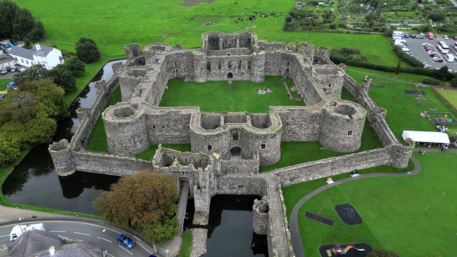
Beaumaris Castle
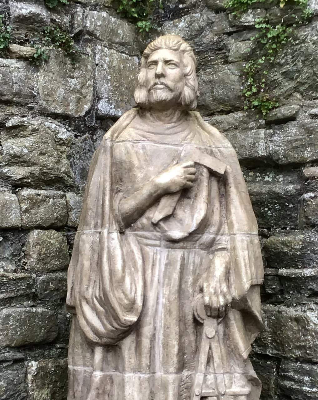
Beaumaris Castle, Castell Biwmares, was begun for King Edward I in 1295 on flat marshland beside the Menai Strait, the last royal castle he began in Wales, and it was never finished. What sets Beaumaris apart is the gap between its plan and its height. It stands at the northern end of the town of Beaumaris on the Isle of Anglesey and, by the measure of Cadw’s World Heritage Site management plan, approximately 150 m from the sea. Master James of St George, master of the king’s works in Wales, directed the work and, Cadw’s listing record says, was probably the castle’s master mason.
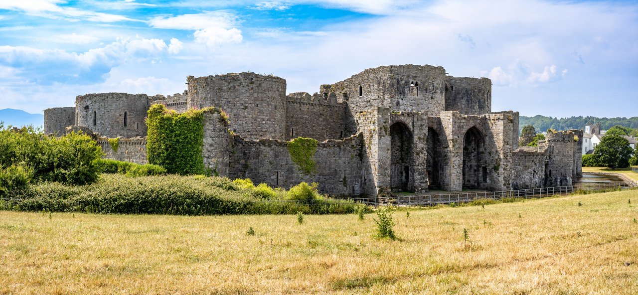
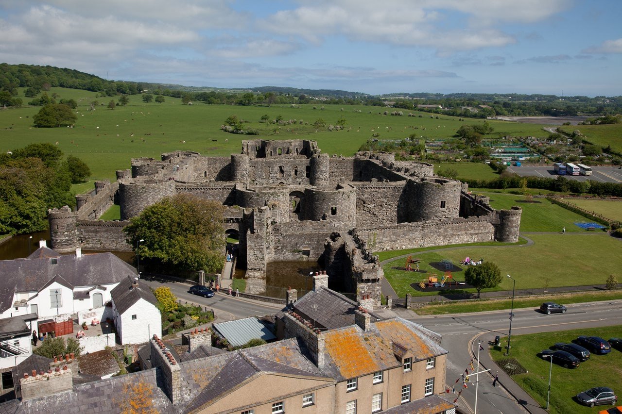
All four of its rings were built: a moat, an outer curtain, a ring of open ground and a square inner curtain with six great towers and two gatehouses. The upper stages were not. Its outer walls stand at their full height, but the inner towers and both gatehouses stop where the masons left them when work ceased, about 1330, and the turrets meant to crown them were never begun. Cadw’s place page calls it “famous as the greatest castle never built.” Read on the ground, ring by ring, Beaumaris is a design complete in outline and stopped in mid-rise.

Quick Facts
| Location | Beaumaris, Isle of Anglesey, Wales, on the Menai Strait |
|---|---|
| Built | Begun 1295; work stopped about 1330, unfinished |
| Built for | King Edward I |
| Architectural style | Edwardian military architecture, late 13th to early 14th century |
| Castle type | Concentric (“walls within walls”) |
| Condition | Unfinished, largely roofless: outer curtain at full height; inner towers and gatehouses at the height reached when work stopped; moat wet on the north, west and part of the south, reinstated after 1925 |
| Owner / managed by | In state guardianship since 1925; cared for by Cadw on behalf of the Welsh Ministers |
| Designations | Scheduled monument AN001; Grade I listed building |
| UNESCO status | Part of the Castles and Town Walls of King Edward in Gwynedd World Heritage Site, inscribed in 1986 |
| Town & station | Beaumaris; Bangor (Gwynedd) station, about 15 km (9 miles) by Cadw’s figure |
| Open to public | Yes, all year |
| Official website | Cadw: Beaumaris Castle |
History
Llanfaes and Its People
Before the castle there was Llanfaes. In the early thirteenth century, Cadw writes, a town of that name grew up in the southeast corner of Anglesey under the patronage of Llywelyn the Great, whose royal palace, or llys, was nearby and who founded there the first of just three Franciscan friaries in Wales. By the 1280s it was a busy port trading with other towns in Britain and on the Continent. Cadw’s World Heritage Site management plan calls it “reputedly the most prosperous and populous borough in native Wales.” It lay just a mile from the spot Edward chose for his new town and castle, a site picked, the management plan says, to control the trade route operated by the Llanfaes ferry.
Llanfaes had to make way. As soon as Edward’s troops arrived in 1295, according to Cadw, they started to demolish it, and many of its residents were forcibly resettled in a second new town at Newborough, 13 miles (20 km) away on the other side of the island. A record cited in Arnold Taylor’s chapter of The History of the King’s Works speaks of the tenants and inhabitants “having transferred to Newborough and Beaumaris.” Cadw quotes the townspeople’s petition to the king: “They cannot buy or sell as they used to and ships are not allowed to land in the town’s harbour. Their houses have been carried off to Beaumaris and nothing is left.” By Edward’s death in 1307, Cadw says, only a windmill, a parish church and the town’s friary were still standing.
In place of Llanfaes rose an English borough beside the castle. Beaumaris received its first royal charter in 1296, and by 1305 it contained 132 burgages, or properties, which Cadw says made it the biggest borough in north Wales. Coflein, the Royal Commission’s record, notes that the castle’s constable acted as its mayor.
Begun in 1295
In 1294 another serious rising broke out in north Wales, led by Madog ap Llywelyn, who took the title prince of Wales. The History of the King’s Works records that Conwy, whose defenses were by then complete, held out, but that the Welsh stormed Caernarfon and did serious damage to the half-built castle. Llanfaes itself, the management plan adds, was severely damaged in the revolt.
Work at Beaumaris began in April 1295. The History of the King’s Works says Edward began the castle “in order to control Anglesey and the Menai Strait,” and Arnold Taylor’s Cadw guidebook to Harlech calls it a response to the revolt. Cadw’s scheduling record places it at the end of a sequence: it was the last royal stronghold to be built by the king in Wales, and it “completed the chain of fortifications with which he had begun to enclose Gwynedd in 1277.” That chain was Edward I’s castle-building program in Wales, and Beaumaris was its final link.
Money was spent freely at first. Some £6,000 went on the work between April and September 1295, the management plan records, a third of it on the carriage of materials alone.
The Report to the Exchequer, 1296
How fast the castle rose in its first year is known from a report of early 1296. Dated at Conway on 27 February 1296, it was written by Master James of St George and the clerk Walter of Winchester to the Treasurer and Barons of the Exchequer, and The History of the King’s Works prints it in a free English translation.
It was written in answer to an inquiry, and much of it was about money. The writers explained that the work had needed, and would go on needing, 400 masons, both cutters and layers, and 2,000 lesser workmen, with 100 carts, 60 wagons and 30 boats bringing stone and sea-coal, as well as 200 quarrymen, 30 smiths, and carpenters for the joists, floorboards and other jobs. Those numbers were a statement of what the building required, not a count of men on the payroll. If the king wanted the work finished as quickly as it should be and on the scale on which it had begun, they wrote, they could not make do with less than £250 a week throughout the season. When the letter was written, they added, they were short of £500 for both workmen and garrison.
They also reported progress. Some of the walls already stood about 28 feet high, and 20 feet even at their lowest, and they had begun “ten of the outer and four of the inner towers,” the inner four being the pairs flanking the two gatehouse passages. Their warning about the Welsh was blunt: “as you well know, Welshmen are Welshmen, and you need to understand them properly; if, which God forbid, there is war with France and Scotland, we shall need to watch them all the more closely (font a duter de tant le plus).” And they made a promise about the sea: “at high tide a 40-ton vessel will be able to come fully laden right up to the castle gateway; so much have we been able to do in spite of all the Welshmen …” It was a forecast, written in the future tense, not a record of ships arriving.
By October 1300 the cost stood at nearly £11,400, all of it, so far as the documents allow The History of the King’s Works to judge, spent on the works of the castle.
Halted, Resumed and Left Unfinished
That pace did not last. The main campaign stopped in 1298, when Edward’s attention turned to Scotland and Master James went north to new work there; The History of the King’s Works thinks small-scale work may have gone on for two or three years more.
Building resumed after 1306. Cadw’s listing record dates the northernmost facet of the west side and most of the north side of the outer curtain to after 1306 “and a break in the building programme,” and Cadw’s ground plan marks the barbican and the Llanfaes Gate as begun in or after 1306. Master James was back at Beaumaris in 1307, the management plan records, and was succeeded before 1309 by Master Nicholas de Derneford, by which time James had died. The years 1321 and 1322 brought an emergency, which The History of the King’s Works places amid the Marcher lords’ hostility to the Despensers’ ambitions in south Wales. When the emergency was over, work soon began again and went on slowly through the rest of Edward II’s reign, in the 1320s.
It dwindled through that decade. Cadw says building work “had petered out by the 1320s,” and by about 1330 it had stopped, with the castle unfinished; Cadw’s scheduling record puts the end at 1330. By that year, The History of the King’s Works reckons, “if our allowances and calculations are approximately right, Beaumaris’s building can have cost little less than £14,400: about the same, that is to say, as the cost of the whole of the castle and town walls at Conway.”
What was left short can still be read on the ground. Cadw’s place page says the south gatehouse and the six great towers in the inner ward never reached their intended height, and the management plan adds that their turrets were never begun. The Llanfaes Gate, in Cadw’s words, “was barely started before being abandoned.” Five separate accommodation suites were planned, Cadw’s listing record notes, and in the event they were not built. Even so, The History of the King’s Works judges that the castle “was never, in fact, finished in accordance with the original design, but its walls and moats were complete, and it was capable of being garrisoned and defended despite the lack of its crowning turrets.”
The Glyndŵr Siege, Decay and the Civil War
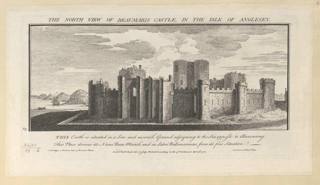
Beaumaris was not kept in good repair. A survey in 1343, the management plan records, found several areas “dilapidated and ruinous,” including chambers, towers and roofs, while Cadw’s listing record reads the same survey as showing that little of the fabric has been lost in the centuries since. In 1389, with tension mounting in Wales, the chamberlain ordered 20 men to be placed in the castle “because of enemies at sea.”
Unfinished as it was, Cadw’s scheduling record observes, the castle was “sufficiently complete to be garrisoned and besieged during the revolt of Owain Glyn Dŵr (about 1400-10).” It was besieged in 1403, at the height of the Glyndŵr revolt, and the management plan says it was not recaptured until 1405. Coflein’s record goes further, saying that rebels associated with Owain Glyndŵr “captured Beaumaris and held it for two years” from 1403. After these disorders, Coflein records, the town was walled. Beaumaris in 1403 is one of the rows in our ledger of how medieval castles fell.
Decline followed. By 1539 the castle was reported to be in a ruinous state, and by 1609, according to Cadw’s scheduling record, it was utterly decayed. In the Civil War it was held for the king. Thomas Bulkeley, created Viscount Bulkeley in 1644, is said to have spent £3,000 on repairs to it, and he held it with his son, Colonel Richard Bulkeley. Parliament’s eventual victory led in 1646 to the castle’s surrender to Major-General Thomas Mytton. It was held again in the second Civil War, and the Dictionary of Welsh Biography dates its recapture to 2 October 1648, after which Mytton reduced Anglesey to subjection.
By about 1660, the scheduling record says, some partial dismantling seems to have taken place, and the management plan reports contemporary accounts of a program of dismantling “thought to have involved the removal of the courtyard buildings.” Over the following centuries, the management plan adds, the castle was robbed for building stone, as the appearance of the early nineteenth-century Beaumaris gaol indicates.
The Bulkeleys of Baron Hill and State Guardianship
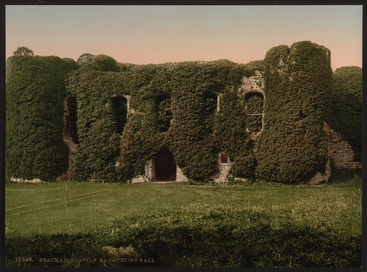
In 1807 the Bulkeleys of Baron Hill bought the castle from the Crown. In 1822 it passed to the last Viscount Bulkeley’s nephew, Richard, later Sir Richard Bulkeley Williams-Bulkeley, who opened the castle grounds to the public, and in 1832 Princess Victoria attended a Royal Eisteddfod held in the inner ward. By the nineteenth century the moat had silted up, and Coflein records that the walls were largely overgrown with vines.
State care began in 1925, when the castle was placed in guardianship. The Commissioners of Works then carried out what the management plan calls “a large-scale conservation programme,” which included stripping back vegetation, digging out the moat and repairing stonework; the ivy that had cloaked much of the castle was also removed. Cadw, on behalf of the Welsh Ministers, now cares for the monument.
Architecture
Reading the Plan, Ring by Ring
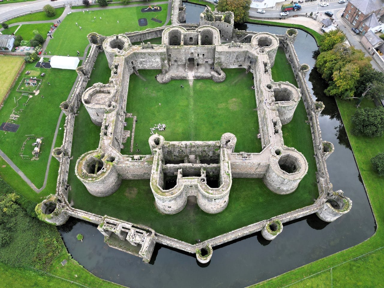
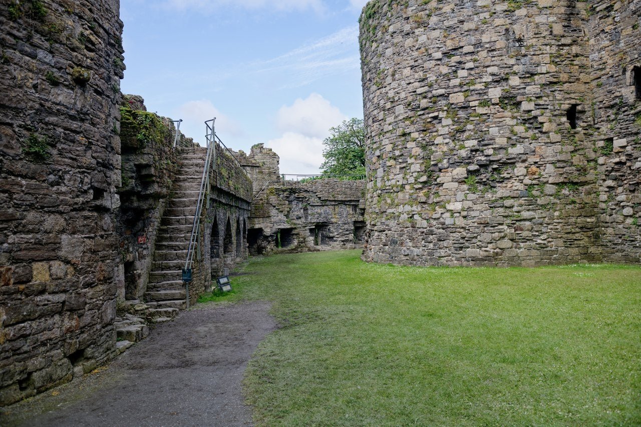
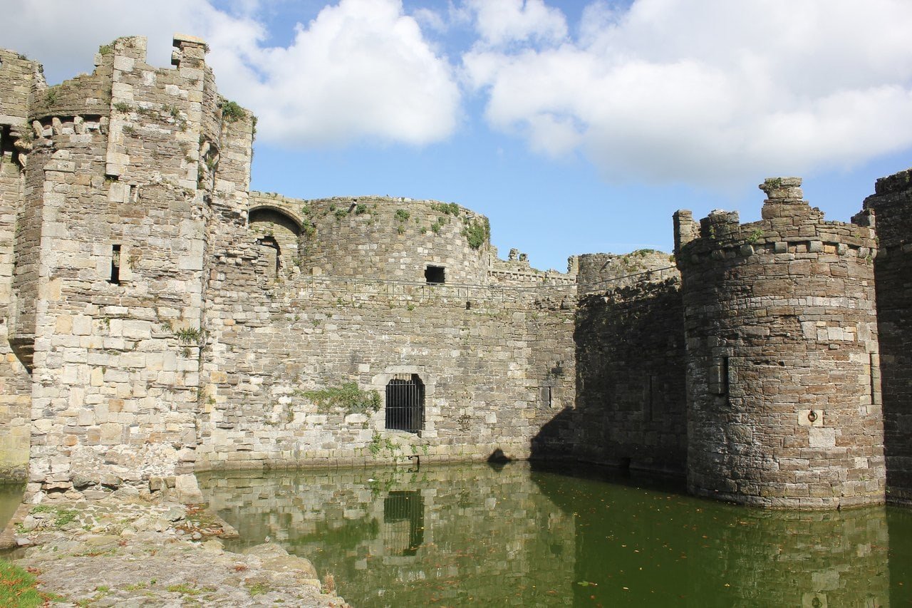
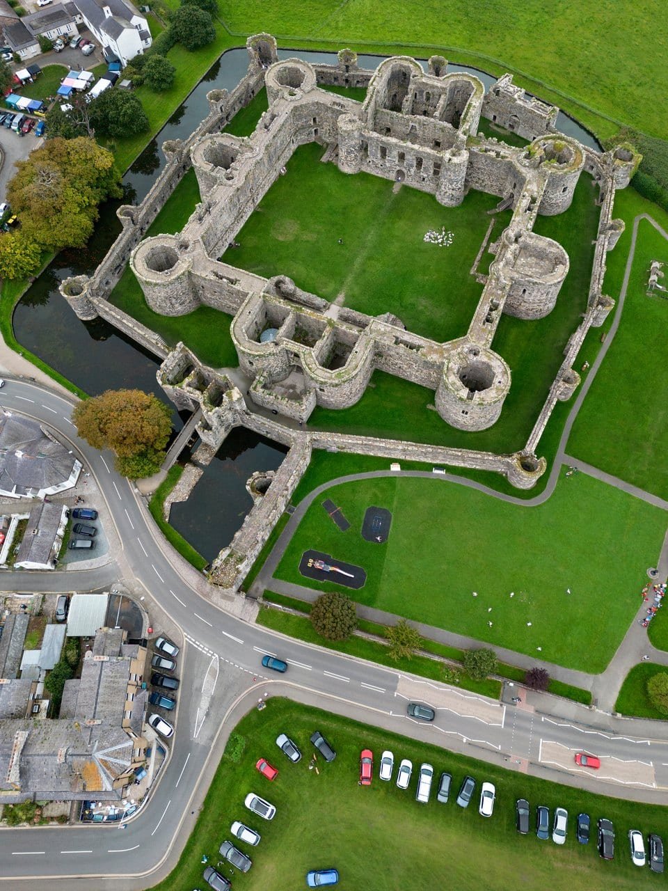
Beaumaris was laid out on open ground. Cadw’s scheduling record says that “the plan of the castle took full advantage of the flat site, unfettered by the natural constraints that shaped Conwy and Caernarfon Castles,” and its place page makes the same point in the language of design: “Here Edward and his architect James of St George took full advantage of a blank canvas …” On that canvas they drew a concentric plan. In the scheduling record’s phrase, the castle was built on the principle of walls within walls, with four rings of defense, and Cadw’s listing record names all four: the moat, the outer curtain wall, the outer ward and the inner curtain wall. Two of the rings are walls. Between them runs the outer ward, a narrow band of open ground, and inside the inner curtain lies the inner ward. Of the two walls, the inner curtain is the higher, Cadw’s listing record notes, and the management plan credits the different heights of the inner and outer defenses, combined with the placing of the arrow loops, with providing “strong fields of fire.”
Seen from above, the rings read as nested shapes. At the center is the square inner ward, with round towers at its corners, a D-shaped tower midway along its east and west sides, and twin-towered gatehouses to north and south. Around it runs the outer curtain, nearly square in plan but broken into shallow facets that turn it into an octagon. Cadw’s management plan credits the empty site, “unencumbered by rising ground or existing settlements,” with allowing Master James “to create the concentric plan with a degree of symmetry not achieved at Caernarfon, Conwy or even Harlech.” Cadw’s place page goes further and calls the result “a fortress of immense size and near-perfect symmetry.”
The Outer Curtain and Its Towers
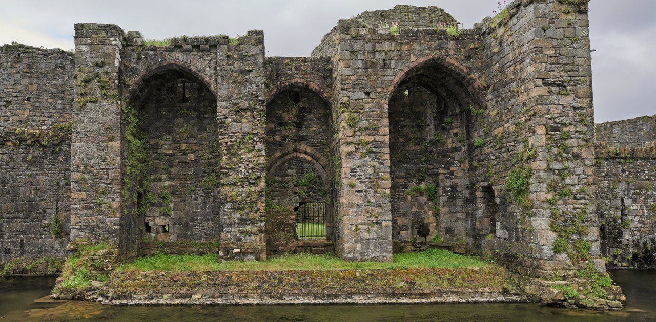
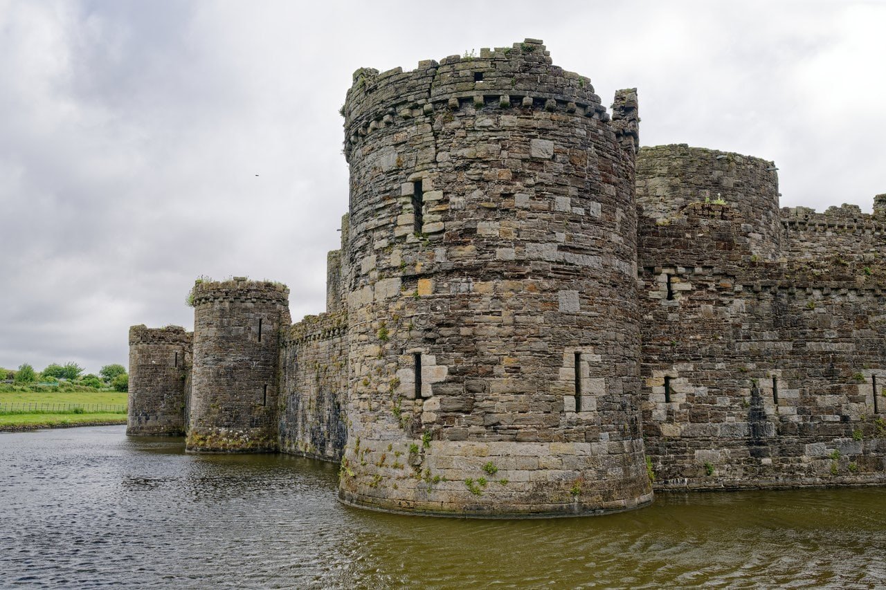
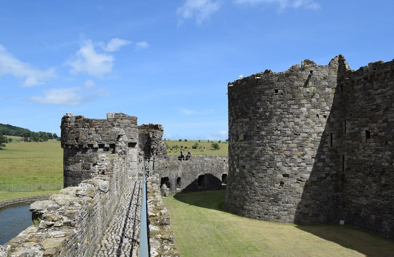
The outer curtain wall is the ring that reached its intended height: in the words of Cadw’s scheduling record, “the walls of the outer ward remain at their full height.” A count on Cadw’s ground plan gives it twelve towers and two gates. The towers are round, and Cadw’s listing record notes that every one of them has a corbelled parapet; the record describes machicolations only at the Gate Next the Sea and on the dock wall, not on the curtain towers. According to Cadw’s place page, “the outer walls alone bristled with 300 arrow loops.” Like the rest of the castle, the curtain is built mainly of coursed local limestone, with local sandstone, the listing record says, used for the dressings and moldings.
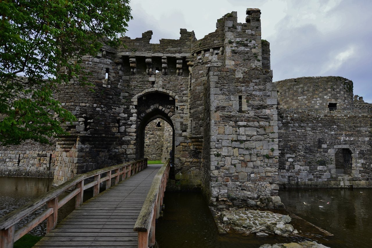
Its two gates do not line up with the gatehouses behind them. On Cadw’s ground plan the Gate Next the Sea, on the south, sits to the west of the South Gatehouse’s line, and the Llanfaes Gate, on the north, sits to the east of the North Gatehouse’s. Most of the north side was a late addition, built after 1306 and a break in the building program, and its gate was never finished. Cadw’s listing record says the Llanfaes Gate “was unfinished in the medieval period and has survived much as it was left,” and that the north walls of its proposed towers, the walls facing the moat, were never built. Later arches, it adds, were built across the surviving walls of those towers at high level so that a wall walk could pass.
The Inner Ward and Its Unfinished Towers
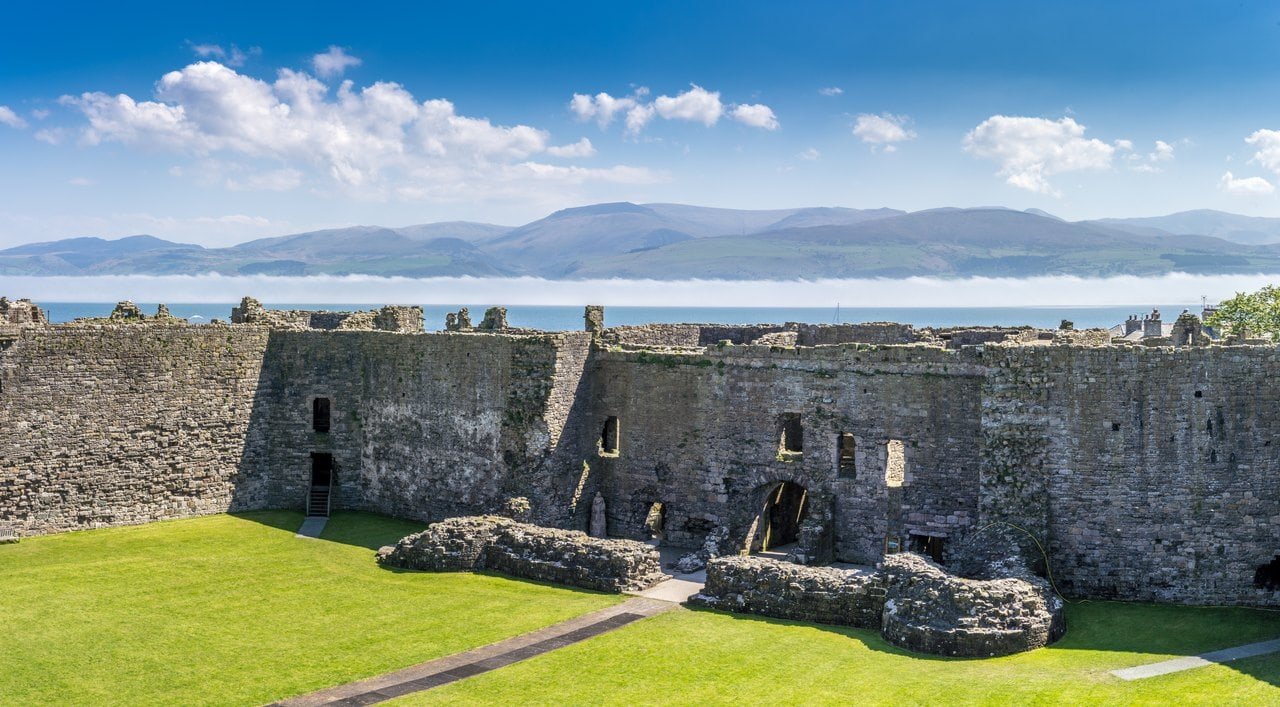
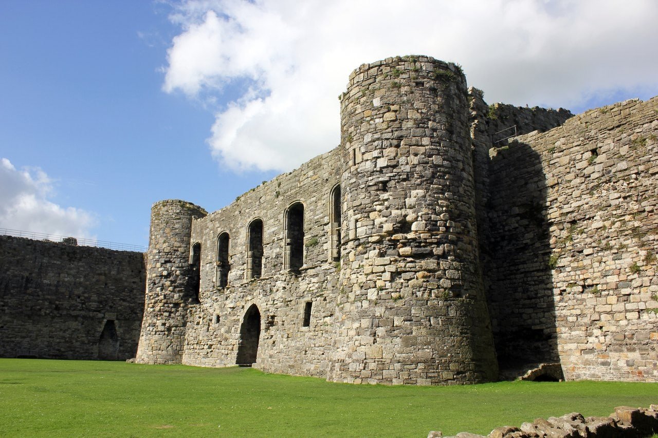
Inside the inner curtain the building stops short. Six great towers stand around the inner ward: four round towers at the corners and two D-shaped towers in the middle of the east and west walls, which Cadw’s ground plan names the Chapel Tower and the Middle Tower. Cadw says none of the six reached its intended height. The scheduling record puts it in terms of what a visitor sees today: the two gatehouses and the walls of the inner ward “remain at the extent and height reached before construction ceased in 1330.” The turrets that were to rise above the tower tops were never begun. Coflein sums up the effect in a single sentence: “The intended residential ranges were not begun and the towers and gates of the inner ward lack their upper storeys, giving the castle a low and unassuming aspect.”
The ward itself is now lawn. Some buildings did once stand there: its domestic buildings have been removed, the scheduling record says, though traces of buildings remain, and Cadw’s ground plan marks the likely sites of a hall and chamber and, with question marks, of a kitchen and stables.
The North and South Gatehouses
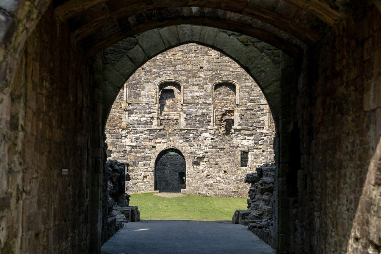
Each inner gatehouse was planned as a double-depth block astride a gate passage, and the pair now show the same design at two different stages. The North Gatehouse passage is the complete one. Cadw’s listing record traces it from the outer end: a doorway with double draw-bar sockets, a portcullis slot, the springers of former arches between murder slots (murder-holes, in the more familiar term), loops in each wall, another portcullis slot, a pointed doorway with double draw-bar sockets, doorways to rooms on either side, and a third portcullis slot.
The South Gatehouse passage was designed in the same way and never finished. Its outer doorway has double draw-bar sockets, followed by a portcullis slot, four segmental arches between murder slots, loops in each wall, then another portcullis slot and a doorway whose position is marked by double draw-bar sockets. Beyond that point, the listing record says, the passage walls were not completed, though near the end are the position of another doorway and the base of a third portcullis slot.
In height, the difference is greater. Only the outer half of the South Gatehouse was carried above ground-floor level. Its inner half survives as the footings of guard rooms, each with fireplaces, and of two round stair turrets, one of which keeps the base of a newel stair. In front of the gate stands a barbican, rectangular in plan, which the listing record describes as added.
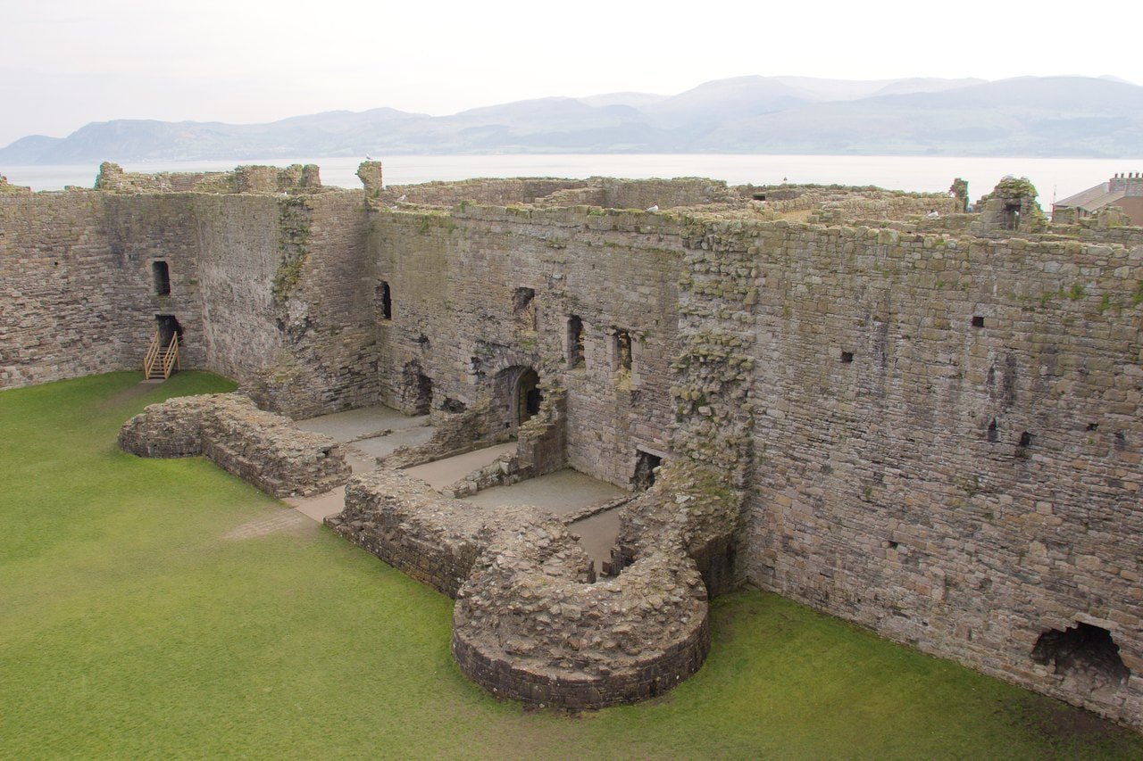
The North Gatehouse rose higher. On its north face it stands three storeys tall, and Cadw’s listing record calls it the principal accommodation block. Facing the inner ward, its middle storey has five bays: a doorway at one end and four windows that lit a first-floor hall. On the north face, the upper storey keeps a two-light window with cusped lights and the remains of a transom. There the work stopped. The History of the King’s Works describes the upper-floor suite of the North Gatehouse as “barely started.”
The Gate Next the Sea and the Dock
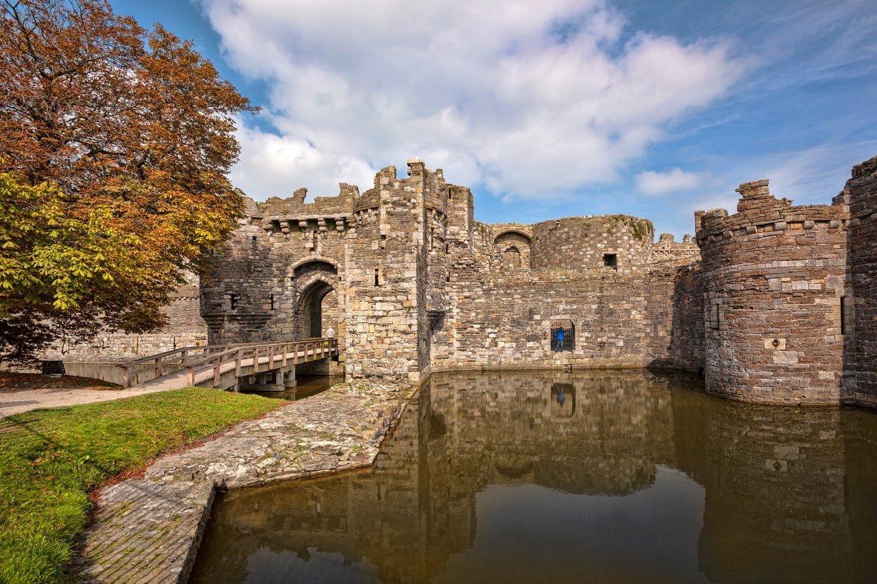
The southern gate of the outer curtain, which Cadw’s listing record calls the Gate Next the Sea and its ground plan the Gate Beside the Sea, has a central gateway under a tall segmental arch, with slots in the soffit for the drawbridge chains, a loop above, and machicolations on the parapet. Its passage is arched, with two murder slots, a loop to either side and, at the end, a former doorway whose draw-bar slots survive.
Beside the gate is the dock, where the curtain wall has a doorway for unloading provisions. The dock wall projects at right angles beyond it, with a corbelled parapet, a round tower midway, and at its far end a corbelled shooting platform, perhaps for a trebuchet, with machicolations on its end wall. Coflein records this bastion as Gunners Walk.
Cadw’s scheduling record describes the original design as “a wide water-filled moat with a dock that enabled the castle to be supplied directly from the sea.” That was the setting for the report’s forecast of 1296 that a laden 40-ton vessel would reach the castle gateway at high tide. Today, the record says, “there is a dock on the south where the moat now ends,” and the castle dock is no longer connected to the sea. How the dock was entered in the Middle Ages is uncertain: the management plan says that “the means of entry into the castle dock at Beaumaris is not clear.”
The Chapel Tower
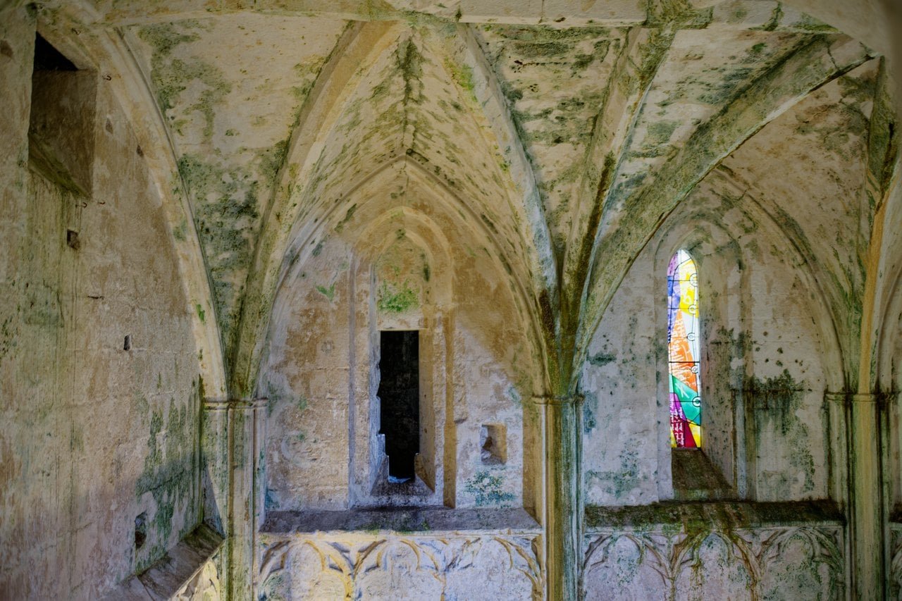
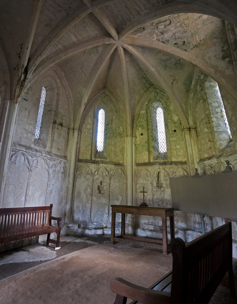
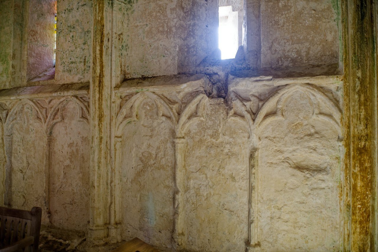
The castle chapel at Beaumaris keeps its stone vault. It fills the middle storey of the Chapel Tower, midway along the east wall of the inner ward, where five pointed windows light it. The entrance is through double cusped doorways that form part of a blind arcade of cusped arches with trefoiled spandrels, three to each of the chapel’s two bays. At the east end is a polygonal apse, and the rib vault springs from polygonal wall shafts. In the western bay, small windows were built into blind windows, which allowed proceedings to be viewed from small chambers inside the wall on the north and south sides, reached from the mural passage and provided with benches. Cadw’s listing record, which describes all of this, singles out the chapel and the North Gatehouse as the parts of the castle given the most architectural refinement.
Wall Passages and Garderobes
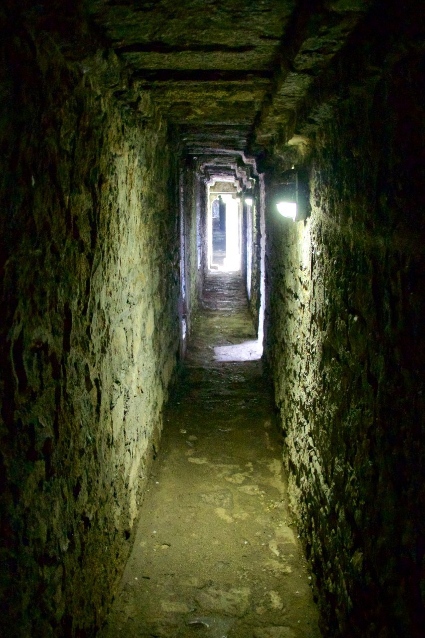
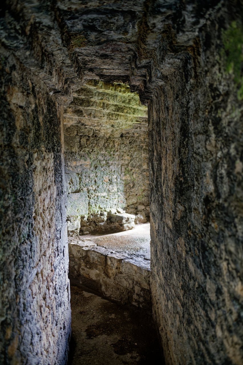
The walls are hollow in places. Each section of the inner curtain wall, Cadw’s listing record says, contains a central latrine shaft, with mural passages at first-floor level incorporating back-to-back garderobes. Its wall walk has its own back-to-back latrines, reached down stone steps.
The Moat Today
A moat once surrounded the whole castle. According to Cadw’s scheduling record, it “still exists on the north, west and half the south sides,” and the eastern part of the moat has been filled in; Cadw’s ground plan marks the “Site of Moat” along the full length of the east side. Silted up by the nineteenth century, the moat was dug out again after 1925, under state guardianship, and Cadw’s listing record describes it as reinstated. On the south it ends at the dock, which no longer reaches the sea.
Visiting Beaumaris Castle
List the 7 castles on this map
- Beaumaris Castle — Isle of Anglesey, Wales
- Conwy Castle — Conwy County Borough, Wales
- Caernarfon Castle — Gwynedd, Wales
- Caerphilly Castle — Caerphilly County Borough, Wales
- Dolbadarn Castle — Gwynedd, Wales
- Dolwyddelan Castle — Conwy County Borough, Wales
- Harlech Castle — Gwynedd, Wales
Opening hours and admission prices are in the Admission table below.
Getting there
The castle lies on the southeastern coast of Anglesey, at the northern end of the town of Beaumaris, across the Menai Strait from the mainland. Cadw gives Bangor, on the line between Crewe and Holyhead, as the rail station for the castle, 15 km (9 miles) away by its figure, and National Rail lists Bangor as step-free category A, with step-free access to all platforms. From Bangor, Arriva Cymru’s route 58 and its 58L and 58P variants run to Beaumaris by way of Menai Bridge, and the route can be joined a short walk from the station. Check current times with Traveline Cymru. Cadw names Bangor as the rail station for Caernarfon and Dolbadarn too, and our guide to the castles of Wales sets out the rail routes to Bangor from London and Manchester.
By road, Cadw lists the A545 from Menai Bridge and the A5 from Bangor, and it places National Cycle Network Route 5 at 5 km (3 miles) away. Cadw points drivers to the town car park opposite the castle, which it says gives the more direct route into the castle, and asks them to be mindful of two-way traffic there. Its access guide counts two pay car parks within a few minutes’ walk, about 200 m from the castle entrance, both with accessible parking spaces, plus two dedicated accessible parking spaces on the road beside the monument.
Admission
| Item | Detail |
|---|---|
| Prices for | 1 September 2026 – 31 March 2027 (read 17 October 2026; the next band is not yet published) |
| Adult | £10.40 |
| Senior (65+) | £9.30 |
| Junior (5-17), or student (student photo ID required) | £7.20 |
| Family, 2 adults and up to 3 children | £33.30 (at these prices, cheaper than adult and junior tickets only with two or more paying children) |
| Family, 1 adult and up to 3 children | £22.90 (at these prices, cheaper than adult and junior tickets only with two or more paying children) |
| Under 5 | Free |
| Disabled visitor and companion | Free |
| Cadw members | Free |
| Cadw £1 ticket | £1, for those on Universal Credit and other named benefits |
| Online ticket prices | 5% discount, non-refundable |
| Blue Light Card holders, HM Armed Forces and veterans | 10% off individual admission (not available online) |
| Explorer Pass | 3-day pass £28.00 (one adult), £42.00 (two adults), £67.20 (family); 7-day pass £42.00, £63.00, £78.50 (Cadw retail prices from 1 April 2026; family = 2 adults and up to 3 children or grandchildren under 18). Also sold and accepted at Caernarfon, Conwy, Harlech and Caerphilly, among other Cadw sites |
| Opening hours | Cadw’s English page: 1 March-30 June 9.30am-5pm; 1 July-31 August 9.30am-6pm; 1 September-31 October 9.30am-5pm; 1 November-28 February 10am-4pm. Cadw’s Welsh-language page gives 10am openings in every season; both pages have the castle open by 10am all year |
| Last admission | 30 minutes before closing |
| Closed | 24, 25 and 26 December and 1 January |
Checked against Cadw on 17 October 2026; confirm before traveling.
Suggested route
Start on the south side, at the Gate Next the Sea and the walled dock beside it, then walk into the outer ward, the narrow band of grass between the two curtains, where one ring of the plan can be seen standing inside the other. Go on into the inner ward. There the low footings of the South Gatehouse’s inner half and the five openings of the North Gatehouse’s hall front face each other across the lawn, and the stopped tops of the six towers show how far the work got. From the ward, short, narrow staircases lead up into the corridors within the walls and to the chapel in the Chapel Tower on the east side. Finish on the wall walks, which are reached by several external stone steps; Cadw asks visitors to use the handrails provided. For children, Cadw’s family guide to its castles describes a “Castle Quest” around the grounds, a hunt for masons’ marks and for interactive installations, and lists period costume to dress up in and a soft-play giant jigsaw of the castle to build.
Best time to visit
The castle is open all year. It stays open later in July and August and keeps shorter hours from November to February, and it closes for a few days at Christmas and on New Year’s Day; the times are in the table. In extreme weather Cadw may close its monuments at short notice. Birds nest and roost on the wall walks in season, Cadw notes, often in areas off the visitor route.
Photography
Personal photography is welcome. Cadw’s filming page tells anyone taking photos “for your own, personal use with just a camera and no additional equipment or dressing” to go ahead, and invites them to share their images with Cadw on social media; taking photos for commercial use is prohibited without Cadw’s permission. Under Cadw’s drone policy, operators adhering to the UK Drone Code may fly over Cadw monuments, but Cadw does not currently allow recreational drones to take off or land on its property. The same policy asks that any such imagery of the scheduled monuments in Cadw’s care be kept for personal use wherever possible and not published on third-party platforms, and that Cadw be informed, or given the opportunity to purchase the content, if any is to be shared publicly or used to generate income or publicity.
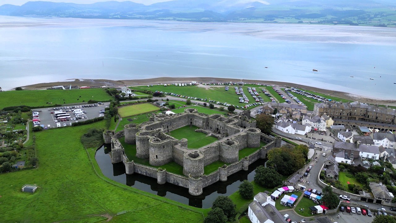
The view of the castle is shaped by its unfinished state. Cadw’s management plan observes that “because the walls and towers were not raised to their intended maximum height, the castle makes the greatest impression from distant viewpoints that are low on the coast or on the water.” Closer in, the plan names views from Baron Hill, from the streets of the historic town, particularly Castle Street, and from The Green on the seafront as important.
Accessibility
Entry is through the visitor center, which has automatic doors from the sidewalk and into the monument and a low-profile admission desk. Cadw notes a short steep resin ramp on the exit of the visitor center and a gravel path, then a brief walk past the wet moat over a short wooden bridge. Inside, every area is grassed apart from the gravel route from the outer ward to the inner ward. The corridors within the walls are reached by short, narrow staircases of around 10 to 15 steps, with some internal steps beyond, and the wall walks have no step-free route. Cadw’s access guide lists no parking for prams and scooters, and its place page says signs mark the key areas of risk around the site, among them deep water, falls from height, and steep and uneven steps.
A portable induction loop is available, and the castle offers no audio tour or large-print guide. There are no toilets on site, but free public toilets with accessible and baby-changing facilities are a flat, even walk of 50 m from the visitor center. There is no café; the site has picnic tables and a gift shop selling guidebooks, and Cadw’s place page lists an exhibition within the monument.
For a guided day out on the island, see tours of Anglesey and the North Wales coast on GetYourGuide, and for a night nearby, places to stay near the castle on Booking.com.
Some links on this page are affiliate links, which means StoneKeep Atlas may earn a small commission, at no extra cost to you, if you book through them.
More Views of Beaumaris Castle
Common Questions
What does a walk around Beaumaris Castle involve?
Mostly grass and open ground, with the climbing left to you. Much of the castle can be seen from ground level, Cadw’s access guide says, as you cross the outer ward between the two curtains and then the inner ward within them. The passages and the wall walks are another matter, as the same guide warns: “Whilst the towers at Beaumaris Castle are shorter than at other sites, there is still a considerable number of steps should you wish to experience the wall walks.”
What can you see at Beaumaris Castle?
On the ground, the plan itself: two walled rings with a band of open ground between them, gate passages still cut with their portcullis slots, towers halted at the height the builders reached, and a vaulted chapel. From the walls, the view opens out. Cadw’s World Heritage Site management plan notes landward views of Baron Hill, and says that “the most magnificent views are in an arc of more than 180 degrees from Puffin Island to the Menai Strait, taking in the Great Orme and Snowdonia.”
Do you have to pay to get into Beaumaris Castle?
Yes. Beaumaris is a ticketed Cadw site: the prices are in the Admission table above, and Cadw members enter free. Cadw extends free entry, upon renewal of membership, to members of English Heritage, Historic Scotland and Manx Heritage, and the reverse applies to Cadw members at their sites. The castle also accepts Cadw’s Explorer Pass, whose 3-day version can be used in any 7-day period and whose 7-day version in any 14 days.
Can you take dogs into Beaumaris Castle?
Yes, on the ground floor. Cadw’s page for the castle welcomes dogs on short leads “to access ground floor levels of the site,” and its access guide says that dogs must be kept on leads at all times and that non-assistance dogs must remain on the ground floor only. The access guide also lists a dog bowl among the castle’s facilities.
Why was Beaumaris Castle never finished?
Cadw’s place page gives two reasons: “But lack of money and trouble brewing in Scotland meant building work had petered out by the 1320s.” By about 1330 the work had stopped. What completion would have cost was at least reckoned. An undated estimate recorded in The History of the King’s Works put the Chapel Tower at £128 to finish and the two rear towers of the North Gatehouse at £100, but there was “no proposal or estimate for completing the other five main towers …”
Who owns Beaumaris Castle now?
Cadw looks after it, not the National Trust. The castle has been in the guardianship of the state since 1925, and Cadw cares for it on behalf of the Welsh Ministers. Guardianship is not the same as ownership. Cadw’s 2018 World Heritage management plan describes the castle and Baron Hill as having both been part of the Bulkeley estate for nearly 200 years, but it does not say plainly who owns the castle today.
What does the name Beaumaris mean?
It comes from the French for a beautiful marsh. Cadw’s World Heritage Site management plan says the castle was built on flat land described in contemporary documents as Bellum Marsicum in Latin and Beaumarreis in French, “the beautiful marsh,” and Cadw’s scheduling record glosses the name as the “fair marsh,” on level marshy ground not far from the water’s edge.
Beyond Beaumaris Castle
Conwy Castle, begun in 1283 on a narrow rock at the corner of its walled town, shows what Edward I’s builders made of a site that shaped the plan, the kind of constraint Cadw’s scheduling record says Beaumaris was free of. Caernarfon Castle, begun the same year as a fortress, a royal residence and a seat of government, was also never completed as planned, and the damage the Welsh did there in 1294 came in the rising that preceded Beaumaris. Harlech Castle, begun in 1283 on a rock above Tremadog Bay, held out through that rising: cut off by land, it was kept supplied by sea from Ireland. Caerphilly Castle in south Wales, begun in 1268 by the Marcher lord Gilbert de Clare, sets a concentric plan inside artificial lakes held back by dams. Dolwyddelan Castle above the Lledr valley and Dolbadarn Castle at the foot of the Llanberis Pass were castles of the princes of Gwynedd, the land Edward’s chain of fortifications was built to enclose. Closer at hand, Cadw also cares for two sites at Penmon, each a little over 3 miles from the castle by its figure: Penmon Dovecote, and the site it names Penmon Priory, Cross and St Seiriol’s Well. Our guide to castles in Wales reads Beaumaris beside the castles of the Marcher lords and the princes, and plans a trip that takes in both the north and the south.
Conclusion
Work on Beaumaris Castle began in April 1295, was halted and resumed, and left a whole plan with an unfinished elevation. The moat, reinstated after 1925, holds water on the north, the west and part of the south, the outer curtain stands at its full height with its twelve towers, and the two gatehouses show one design at two stages, one passage complete and the other stopped short. Inside, the six great towers end where the work ended, about 1330, without the turrets meant to crown them, while the chapel keeps its vault. Because those towers never reached their intended height, Cadw’s management plan says, the castle makes “the greatest impression” from far off, low on the coast or on the water.
Principal Sources
- Brown, R. Allen, and H. M. Colvin. “The King’s Works 1272-1485.” In H. M. Colvin, ed., The History of the King’s Works, vol. I: The Middle Ages. London: HMSO, 1963. archive.org
- Cadw. “10 Top Castles for Kids.” cadw.gov.wales
- Cadw. “Beaumaris Castle.” Place page. cadw.gov.wales
- Cadw. “Beaumaris Castle Access Guide.” cadw.gov.wales
- Cadw. “Ground Plan: Beaumaris Castle.” cadw.gov.wales
- Cadw. “Cadw Drone Policy.” cadw.gov.wales
- Cadw. “Castell Biwmares.” Welsh-language place page. cadw.llyw.cymru
- Cadw. Castles and Town Walls of King Edward in Gwynedd World Heritage Site Management Plan 2018-2028. Cardiff: Cadw, 2018 (PDF). cadw.gov.wales
- Cadw. “Explorer Pass 3 & 7 day.” cadw.gov.wales
- Cadw. “Filming and Photography.” cadw.gov.wales
- Cadw. “Free Access Schemes.” cadw.gov.wales
- Cadw. Listed Building 5574, Beaumaris Castle. Full Report. cadwpublic-api.azurewebsites.net
- Cadw. “More about Beaumaris Castle.” cadw.gov.wales
- Cadw. Scheduled Monument AN001, Beaumaris Castle. Full Report. cadwpublic-api.azurewebsites.net
- Coflein (RCAHMW). “Castell Biwmares; Beaumaris Castle, Beaumaris.” NPRN 95769. coflein.gov.uk
- Coflein (RCAHMW). “Gunners Walk, Beaumaris Castle.” NPRN 302767. coflein.gov.uk
- Dictionary of Welsh Biography. “Bulkeley family, Anglesey, etc.” biography.wales
- Dictionary of Welsh Biography. “Mytton, Thomas.” biography.wales
- National Rail. “Bangor (Gwynedd).” Station page. nationalrail.co.uk
- Taylor, Arnold. “The King’s Works in Wales 1277-1330.” In H. M. Colvin, ed., The History of the King’s Works, vol. I: The Middle Ages. London: HMSO, 1963. archive.org
- Taylor, Arnold. Caernarfon Castle and Town Walls. 6th ed. Cardiff: Cadw, 2004.
- Taylor, Arnold. Harlech Castle. 4th ed. Cardiff: Cadw, 2002.
- Traveline Cymru. “Timetables.” traveline.cymru
- UNESCO World Heritage Centre. “Castles and Town Walls of King Edward in Gwynedd.” whc.unesco.org
Image credits. Hero, the castle and its moat from the air: Photo: Llywelyn2000, CC BY-SA 4.0. Source: Castell Beaumaris Castle, Ynys Mon (Anglesey), Wales 44, Wikimedia Commons; an outer-curtain tower and the inner curtain behind it: Photo: Tilman2007, CC BY-SA 4.0; Samuel and Nathaniel Buck’s North View, 1742: Engraving: Samuel and Nathaniel Buck, public domain, via the British Library; the Photochrom print of about 1890-1900: Print: Photochrom Print Collection, public domain, via the Library of Congress; the plan from almost directly above: Photo: Llywelyn2000, CC BY-SA 4.0; the Llanfaes Gate: Photo: Tilman2007, CC BY-SA 4.0; the outer ward between the curtains: Photo: Tilman2007, CC BY-SA 4.0; the inner ward from above: Photo: Philip / Adobe Stock; the footings of the South Gatehouse: Photo: Mike Peel, CC BY-SA 4.0; the unfinished North Gatehouse: Photo: Jeff Buck, CC BY-SA 2.0; the Gate Next the Sea and its footbridge: Photo: HARTLEPOOLMARINA2014, CC BY-SA 3.0; the dock: Photo: Jeff Buck, CC BY-SA 2.0; the chapel in the Chapel Tower: Photo: Tilman2007, CC BY-SA 4.0; a mural passage: Photo: Mike Peel, CC BY-SA 4.0; an outer-curtain tower in the moat: Photo: Tilman2007, CC BY-SA 4.0; the castle, the town and the strait from the air: Photo: Llywelyn2000, CC BY-SA 4.0. Source: Castell Beaumaris Castle, Ynys Mon (Anglesey), Wales 34, Wikimedia Commons; the plan from above, portrait: Photo: mrallen / Adobe Stock; the castle from the open ground: Photo: estivillml / Adobe Stock; a gate reflected in the moat: Photo: Tomas Marek / Adobe Stock; through a gate passage: Photo: Alex / Adobe Stock; walking the walls: Photo: Bill Harrison, CC BY-SA 2.0. Source: Walking the walls (Beaumaris Castle) - geograph.org.uk - 7322426, Wikimedia Commons; a mural passage turning: Photo: Tilman2007, CC BY-SA 4.0. Source: 5574 Beaumaris Castle, North-East mural passage Beaumaris 20240530 0097 DxO, Wikimedia Commons; the chapel apse: Photo: Chris Gorringe, CC BY-SA 2.0. Source: Beaumaris Castle - The chapel inside the Chapel Tower - geograph.org.uk - 8164985, Wikimedia Commons; the chapel arcading: Photo: Tilman2007, CC BY-SA 4.0. Source: 5574 Beaumaris Castle, chapel Beaumaris 20240530 0110 DxO, Wikimedia Commons; the statue identified as Master James: Photo: AJ Marshall, CC BY-SA 4.0. Source: Master James statue at Beaumaris Castle, Wikimedia Commons; the castle above the town’s roofs: Photo: Gail Johnson / Adobe Stock. Freely licensed images are resized to fit; any other change, such as a crop, is named in the credit.