
Caerlaverock Castle
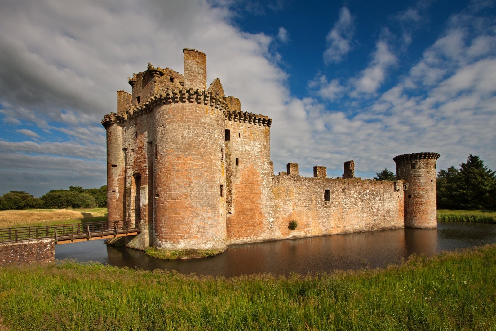
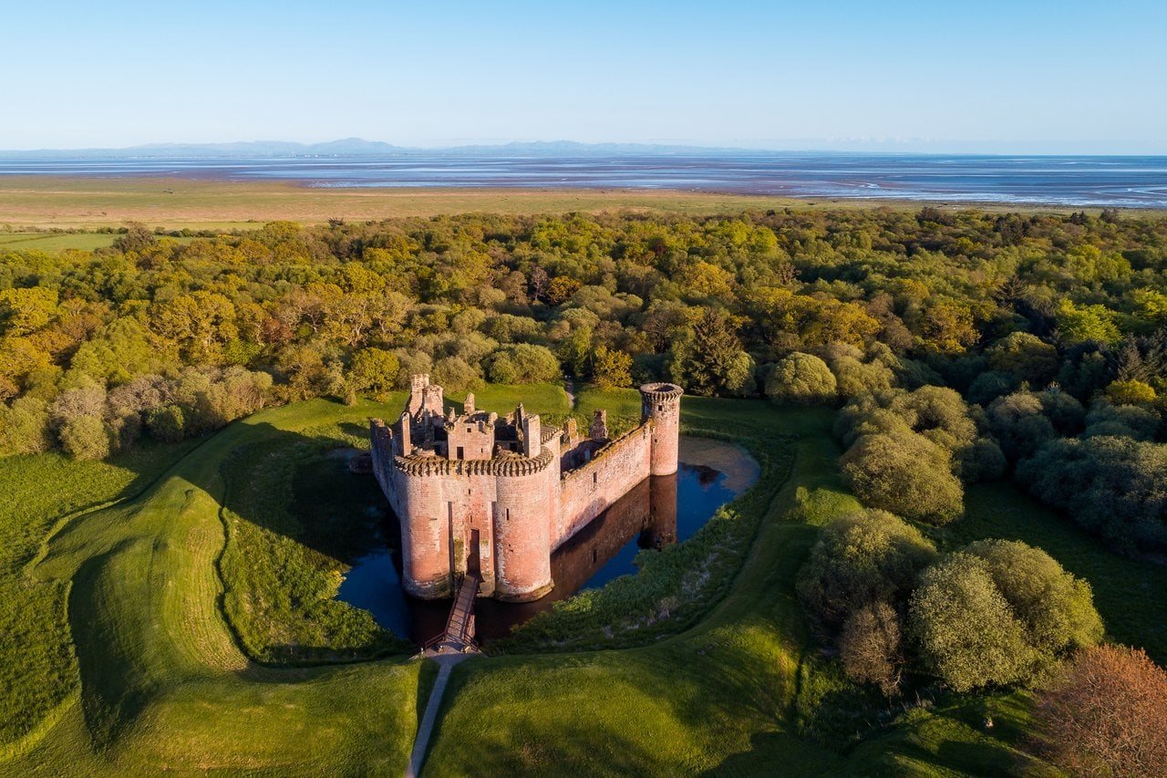
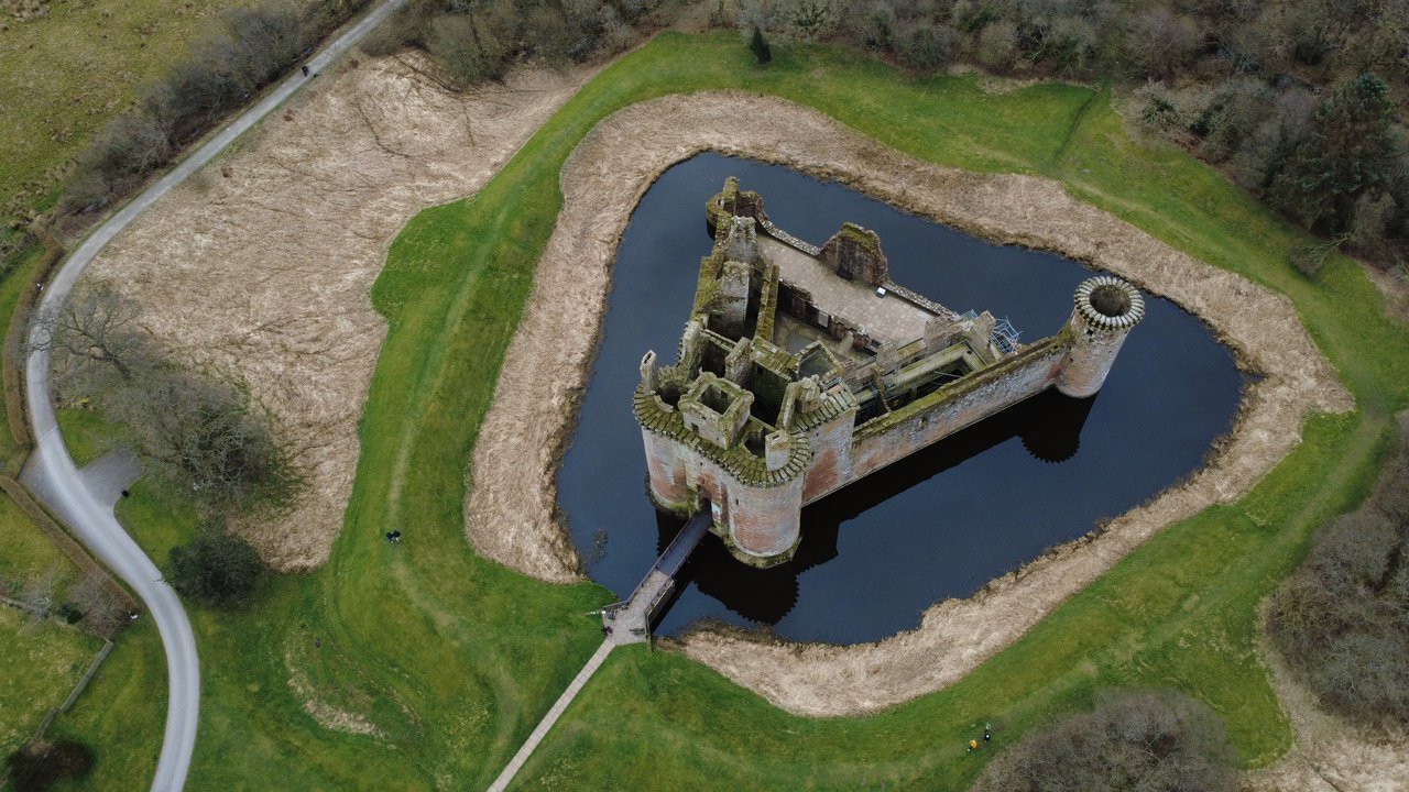
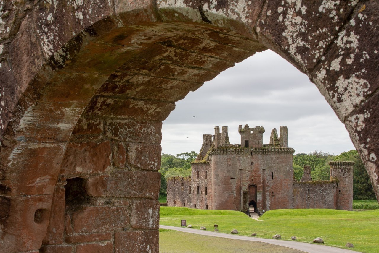
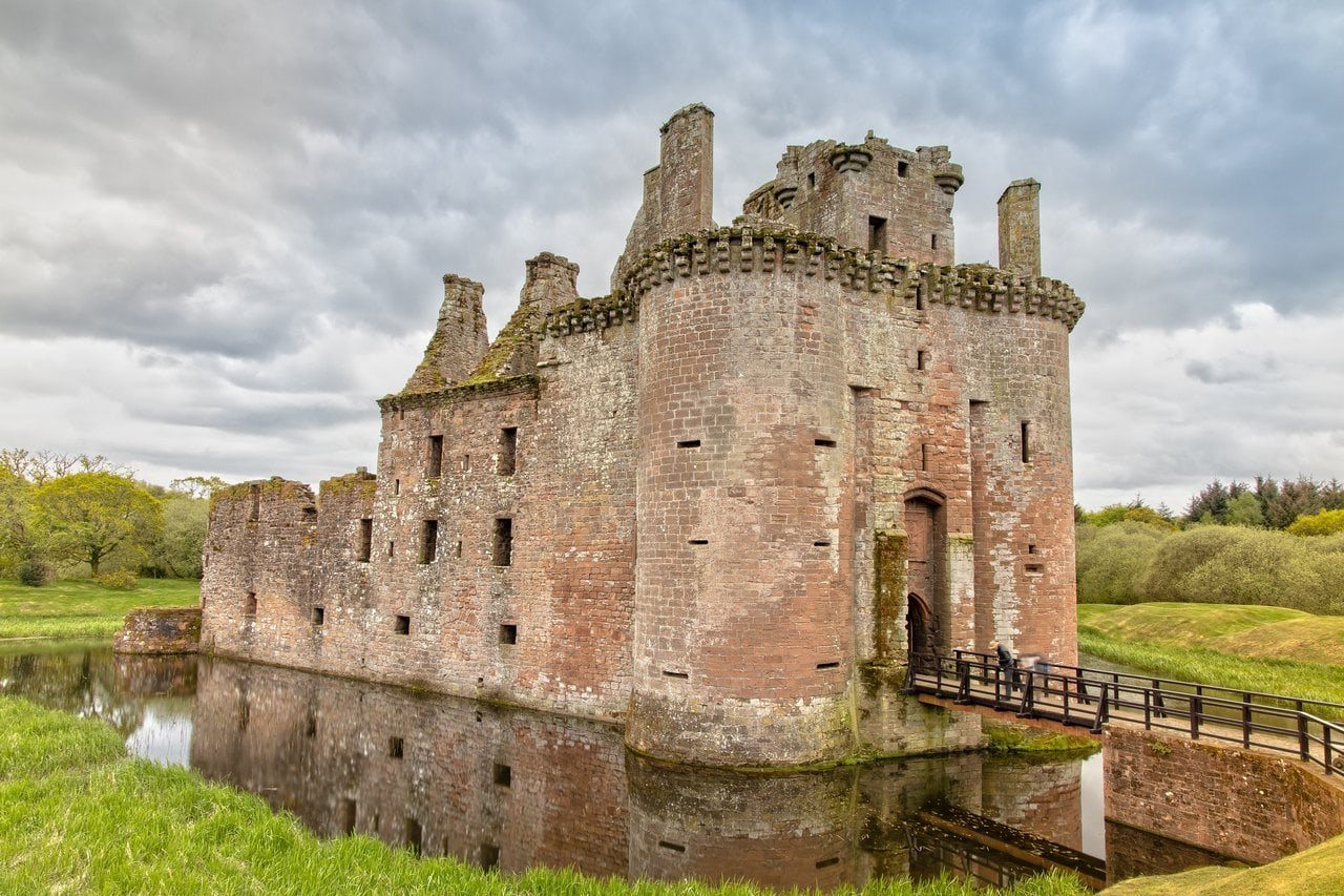
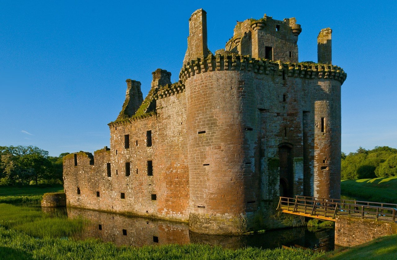
Caerlaverock Castle still stands inside its water-filled moat and still on the three-sided plan that a poem of Edward I’s siege of 1300 described as “formed like a shield”, near the Solway Firth, about 8 miles (13 km) south of Dumfries. Historic Environment Scotland calls its triangular shape unique among British castles, and the shape is where a visit begins: a gatehouse of two round towers at the northern point, curtain walls running back from it, and water all around.
Edward I besieged it in person in July 1300, and the poem, most likely by one of his heralds, describes the siege as well as the castle. Slighted and rebuilt more than once, the castle kept its original plan. In the 1630s the Earl of Nithsdale completed a Renaissance lodging inside its walls, and in 1640 an army of Covenanters, Charles I’s Presbyterian opponents, ended its life as a lordly residence. In one triangle of stone and water a visitor can still see those centuries: the twin-towered gatehouse, the round corner tower known as Murdoch’s Tower and the carved front of the Earl’s lodging. At the end of a short trail through the woods lie the foundations of an earlier castle.
Quick Facts
| Location | About 8 miles (13 km) south of Dumfries, near the Solway Firth, Dumfries and Galloway, Scotland |
|---|---|
| Built | Begun around 1277 (the tree-ring date of its first bridge); Nithsdale Lodging completed by 1634 |
| Built for | Probably the Maxwells |
| Architectural style | Medieval castle of enceinte (one defined by its ring of curtain wall and towers), with a Renaissance lodging of the 1630s |
| Castle type | Castle |
| Condition | Ruin; seen from outside, most of the castle stands to its wall-head except the south range |
| Owner / managed by | In the care of Historic Environment Scotland (guardianship) |
| Designations | Scheduled monument (SM90046) |
| Nearest town & station | Dumfries (about 8 miles / 13 km north, Historic Environment Scotland’s figure for the town) |
| Open to public | Yes, all year |
| Official website | Historic Environment Scotland: Caerlaverock Castle |
History
Caerlaverock was begun around 1277, the tree-ring date of its first bridge. It was probably built for the Maxwells. Historic Environment Scotland notes that there is no evidence for the family as lords of Caerlaverock before 1307, but thinks it likely that they were living here in the thirteenth century and that Herbert, son of John Maxwell, built the new castle. Its scheduling record calls Caerlaverock the stronghold of the Maxwells, wardens of the West March in the later Middle Ages. As for the name, it may mean either “fort of the lark” or “elm fort”.
Old Caerlaverock Castle
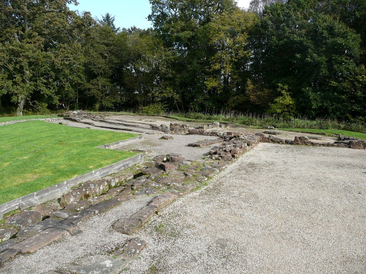
The first castle, which the same scheduling record says the Maxwells built, stood a couple of hundred meters to the south-east. It was built in the 1220s and abandoned about fifty years later, probably because its walls, set on silt and clay without proper foundations, were moving. A length of structural timber thought to come from its access bridge has been dated to about 1229. Its first hall was of timber. Over the next fifty years it was replaced by a three-bay stone hall on the same footprint, and the gap between the hall and the chamber block was filled in to make an L-shaped range. Towers were later added at its corners, possibly in an attempt to buttress its walls.
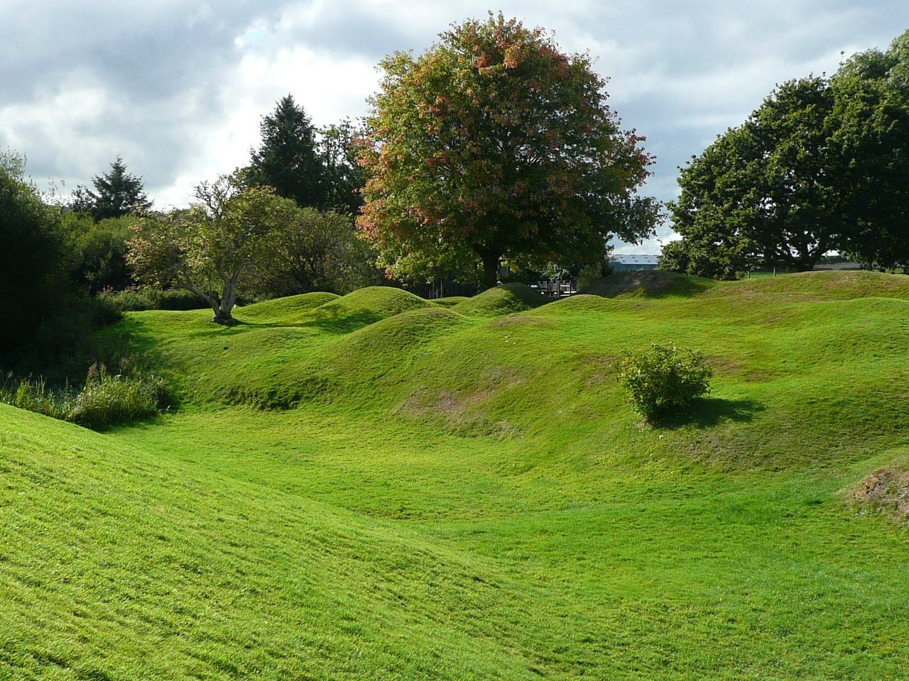
Historic Environment Scotland’s Statement of Significance puts the move this way: “Subsidence at the old castle, then hard by the salt marsh, may well have prompted the relocation.” An update of August 2021 to the same document says it was drafted before a research program begun in 2019, which includes work on how coastal storms in the medieval period affected the castle, and how far they prompted its rebuilding further inland. Today the old castle survives as stone foundations on a grassy mound inside a wide ditch, at the end of a short nature trail from the visitor center, with steps over its moat.
The Siege of 1300 and the Roll of Caerlaverock
After his victory over Wallace at Falkirk in 1298, Edward I granted Caerlaverock to Sir Robert de Clifford, but the grant had no effect. In 1299, Historic Environment Scotland’s timeline records, the castle’s garrison did great damage to English-held Lochmaben, and during that attack Caerlaverock’s own keeper, Sir Robert Cunynghame, was taken prisoner and executed. Edward I came the next summer and besieged the castle in person in July 1300; the garrison surrendered on the second day. The exact day of the siege is uncertain, though the king’s wardrobe accounts place him at Caerlaverock by 12 July.
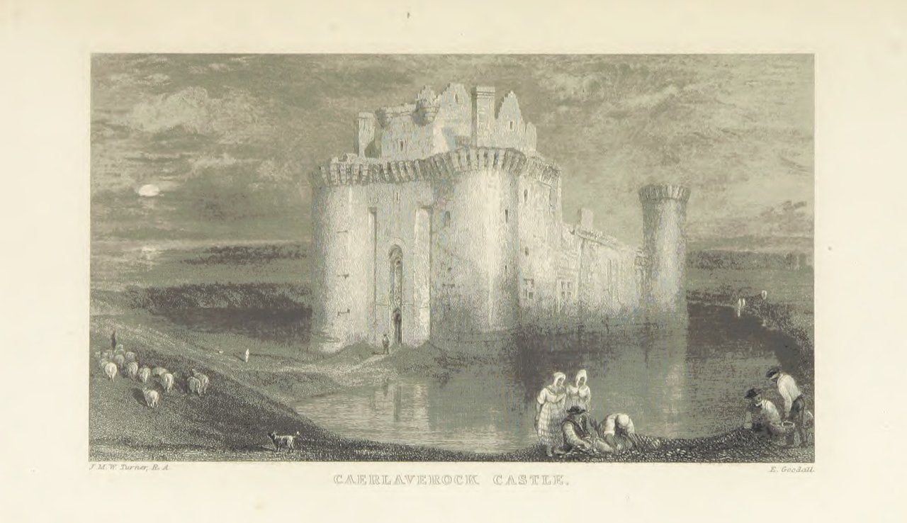
That siege survives in a contemporary poem, most likely by a herald in Edward’s army, known today as the Roll, or Siege, of Caerlaverock. It is a roll of arms in verse, which its 1864 editor Thomas Wright believed “the earliest roll of arms we possess”: it names the lords and knights bannerets who came to the siege and describes their arms, from the king’s “three leopards Of fine gold, set on red” to those of “Edward the king’s son”, the future Edward II, who led the fourth squadron. Its author counts the banners of Edward’s army rather than its men, and closes his roll-call of them: “With this last, named I have, without reckoning the doubles, Eighty-seven banners.” He describes the castle too. In Wright’s translation, “It was formed like a shield, For it had only three sides in circuit, With a tower at each angle; But one of them was a double one, So high, so long, and so large, That under it was the gate.” Harris Nicolas’s translation of 1828 adds: “It had good walls, and good ditches filled to the edge with water …”
The poet records Sir Adam de la Forde mining at the wall as well. In Nicolas’s version, “Adam de la Forde mined the walls as well as he could, for his stones flew in and out as thick as rain, by which many were disabled.” In the poem it is the stones of a Brother Robert’s engine, and the roof falling in, that break the defense; the garrison put out a pennon and asked for terms.
At this point the two medieval witnesses part company. The poet counts sixty men coming out, and says the king spared them and gave each a new robe. The Lanercost chronicle says instead that a number of those found in the castle were hanged, which Historic Environment Scotland thinks the more likely outcome. Edward entrusted the castle to Sir Robert de Clifford.
Slighted and Rebuilt, 1312 to the 1590s
Around 1312 Sir Eustace Maxwell, having joined Robert the Bruce, dismantled his own castle and was rewarded by a charter “for demolishing the castle of Caerlaverock”; how much was actually destroyed is unknown. Roger Kirkpatrick took it for the Scottish crown in the mid-1350s. A chronicler had him demolishing it to the ground, which Historic Environment Scotland calls “evidently another gross exaggeration”.
Sir Herbert Maxwell, knighted at James I’s coronation in 1424, became the first Lord Maxwell some years later. James V was at the castle in 1542, and Historic Environment Scotland’s timeline has him using it as his base before the battle of Solway Moss and retreating to it afterward. In the 1540s, during the Rough Wooing, it was surrendered to Henry VIII’s forces by negotiation and later recovered by the Scots. In 1570 an English force under the Earl of Sussex took the castle.
In 1593 Lord Maxwell was recorded fortifying the castle, perhaps for his feud with the Johnstones of Annandale rather than any national emergency, Historic Environment Scotland’s timeline suggests. That December the Johnstones defeated and killed him at Dryfe Sands, near Lockerbie, but the work went on under his son: the date 1595 is carved on the back of the gatehouse. Even so, O’Neil’s official guide reports that in 1607 an antiquary could describe Caerlaverock as “a weak house of the Barons of Maxwell”.
The Earls of Nithsdale and the Siege of 1640
Robert Maxwell’s elder brother was beheaded in Edinburgh in 1613 for murdering the laird of Johnstone. James VI restored Robert to the family’s estates and in 1620 created him 1st Earl of Nithsdale, and Robert built the Nithsdale Lodging inside the walls. Work began at some point after Charles I came to the throne in 1625, and a carved date of 1634 marks its completion. A description of 1640 called it “that dainty fabric off his new lodging”, in the spelling Historic Environment Scotland prints.
In 1640 the Earl held the castle for Charles I against a Covenanting army under Lieutenant-Colonel John Home for about thirteen weeks, and with the King’s permission agreed articles of surrender on 26 September. Covenanting artillery battered the castle through the siege, and after the surrender it was looted and, on the orders of the Committee of Estates, demolished in part. Historic Environment Scotland’s own accounts give the loss of the great south curtain to the guns in one place and to that deliberate slighting in another. Beyond the north outer ditch are the remains of a ravelin, a triangular gun defense, which Historic Environment Scotland suggests may be the Earl’s attempt to strengthen his castle further. If so, it adds, the attempt failed.
After 1640 the castle was no longer lived in as a lordly residence. The one later occupation on record is military: a Covenanting cavalry unit, the Earl of Lanark’s Horse, in 1644.
After 1640: Ruin and State Care
Abandoned, Caerlaverock drew artists and antiquaries instead. Historic Environment Scotland’s timeline records visits by Thomas Pennant in 1771, Captain Grose in 1789 and J. M. W. Turner in 1831, and all three made sketches. Turner had come to gather subjects for the publisher Robert Cadell’s illustrated edition of Walter Scott’s Poetical Works, and Caerlaverock became the frontispiece of one of its volumes. The 16th Duke of Norfolk placed the castle in state guardianship in the 1940s, and Historic Environment Scotland cares for it today. Excavations between 1955 and 1966 included a partial dig of the moat, where substantial remains of the drawbridges were found.
Architecture
In plan Caerlaverock is a castle of enceinte, the term for a castle defined by its enclosing ring of curtain wall and towers. Historic Environment Scotland counts it as “one of the best-preserved 13th-century curtain-walled castles in Britain …” The castle is built of red sandstone, and seen from outside, most of it still stands to its wall-head, apart from the south range.
The Triangle and Its Moat
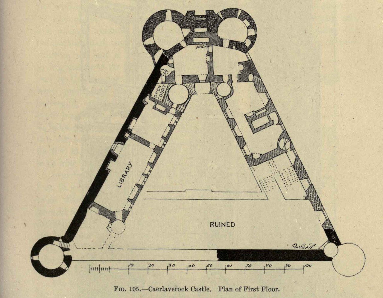
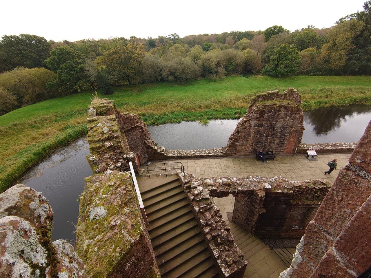
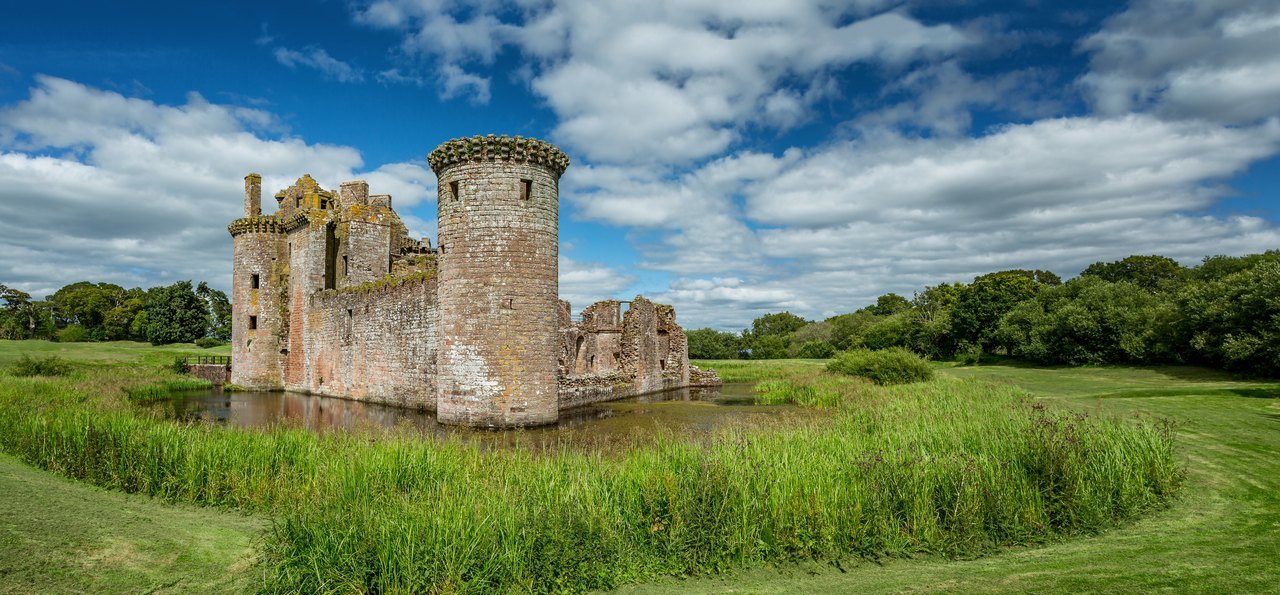
Caerlaverock is built to a triangular plan, with its gatehouse at the northern apex. Two curtain walls run back from the gatehouse to the two southern corners, and a third wall closed the triangle along the south. Historic Environment Scotland’s Statement of Significance sees a defensive logic in the north front: the way the flanking walls “recede rapidly and obliquely away” from the gatehouse “contrives to make this north front a bulwark against frontal attack.” It finds the closest resemblance, “perhaps”, in Edward I’s castles in North Wales, the plan being “similar to the inner ward of Rhuddlan Castle”, but because Rhuddlan was laid out in 1277, at the same time as Caerlaverock, it concludes that Caerlaverock “cannot be derivative of those castles.” The castle is still surrounded by its water-filled moat, crossed by a bridge to the gatehouse. On the north, beyond the moat, lie an outer ditch and bank; Historic Environment Scotland dates that outer ditch to the sixteenth century, with timbers from its bridge dated to between about 1559 and 1594.
Excavation found the remains of four successive timber bridges across the moat, the first dated by its timbers to about 1277. Tree-ring dates from the bridge timbers also record repairs in 1333 and a new bridge in 1371 with a lifting span that drew up into the forework between the gatehouse towers, a sign that the forework and the bridge were contemporary. A third bridge followed in the second quarter of the fifteenth century, and the Earl’s works of the 1630s added a smaller fixed bridge and causeway at the front entrance.
The Twin-Towered Gatehouse
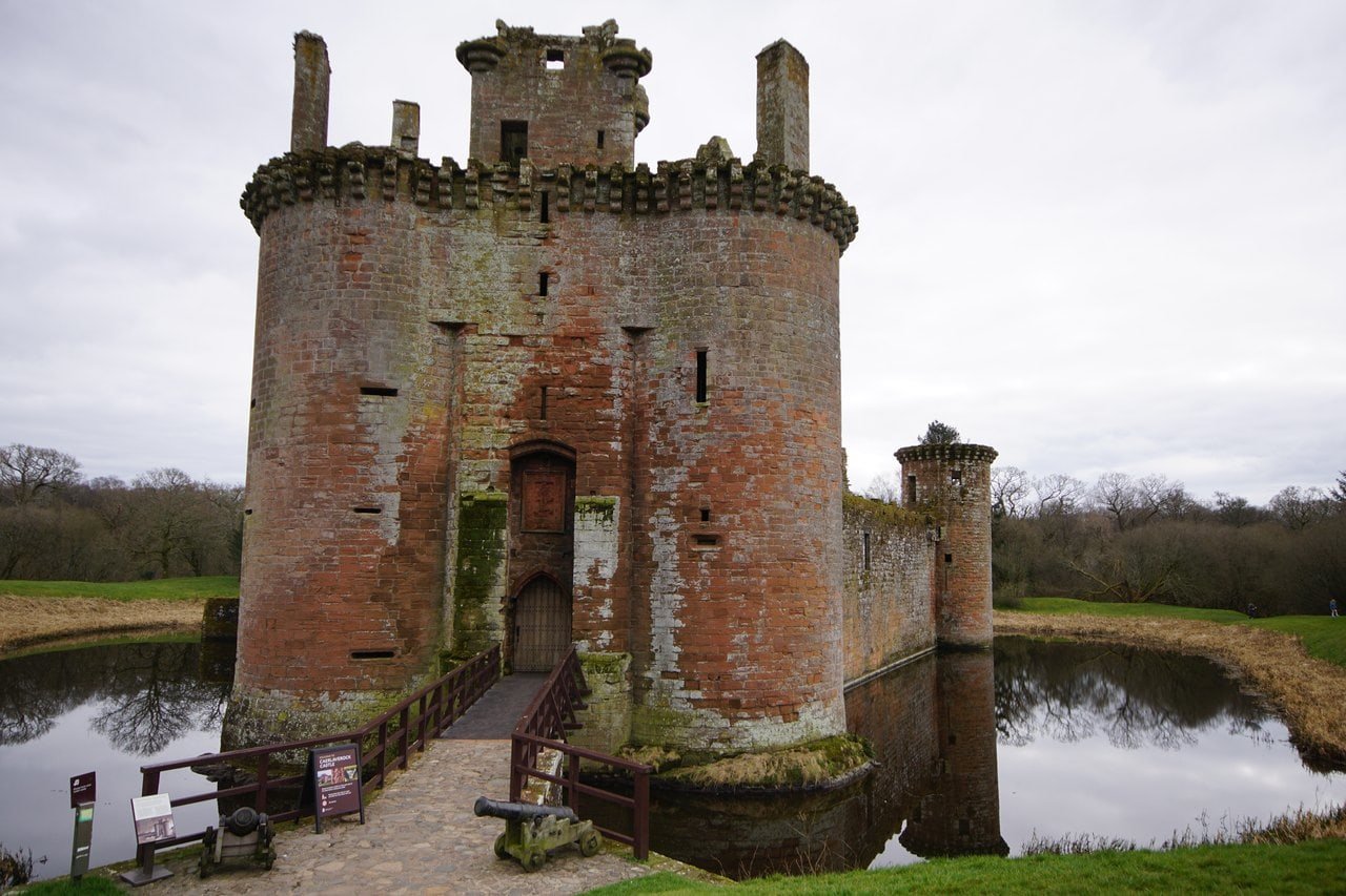
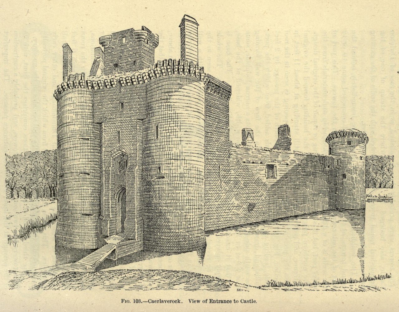
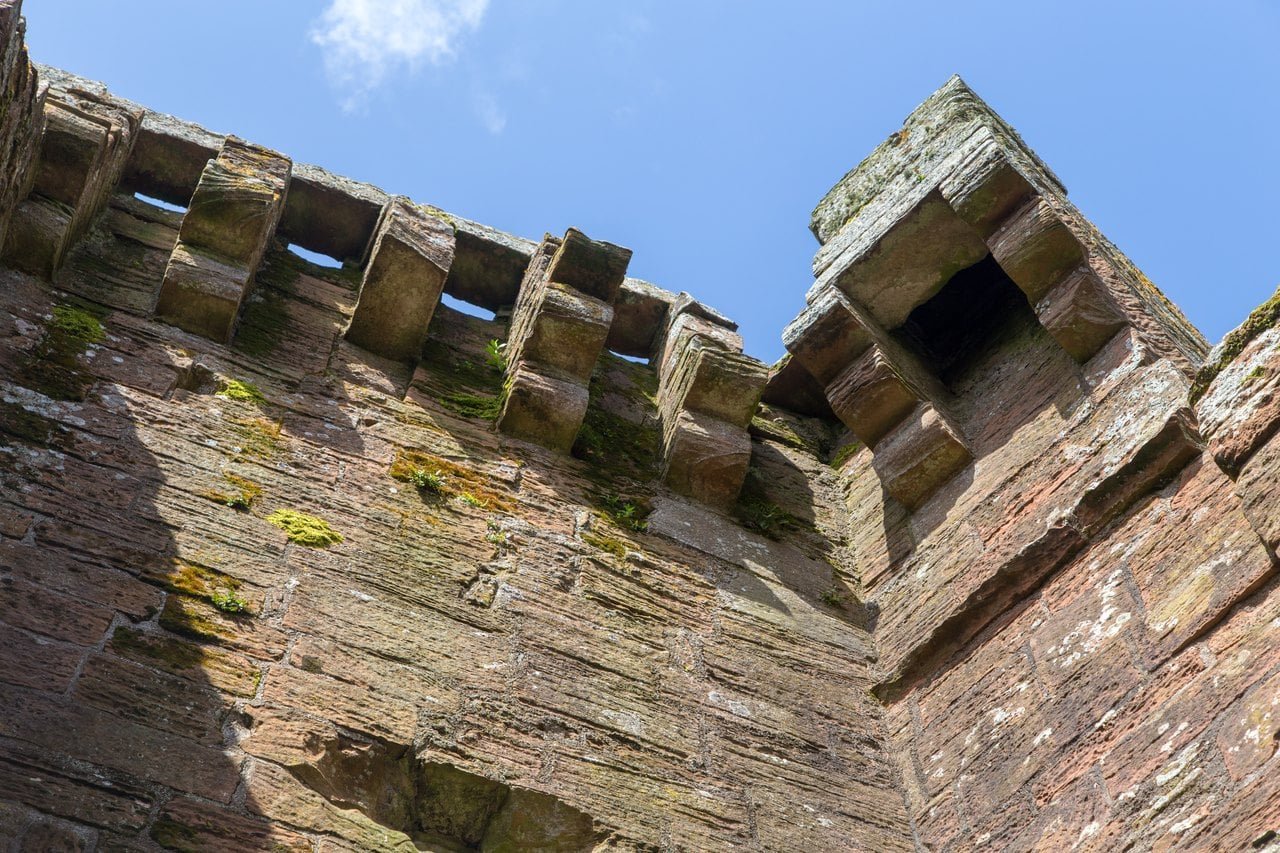
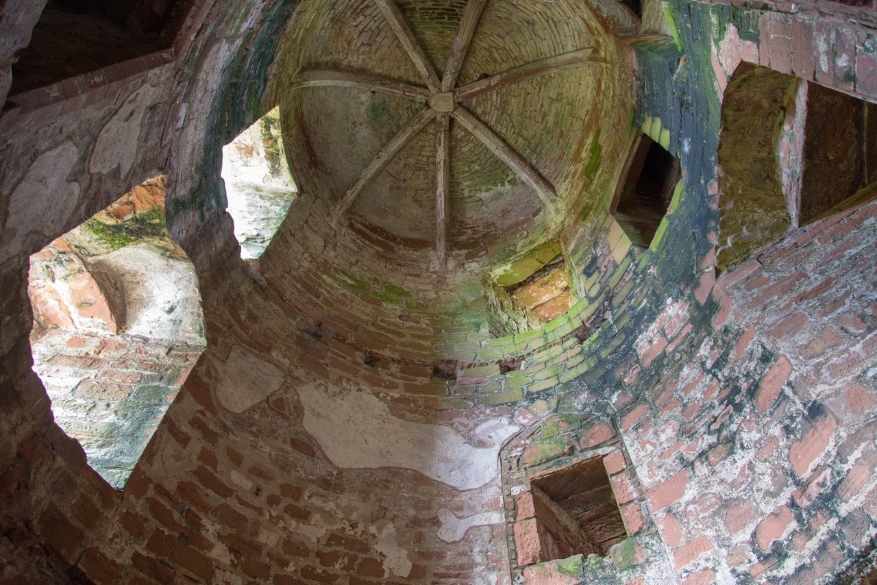
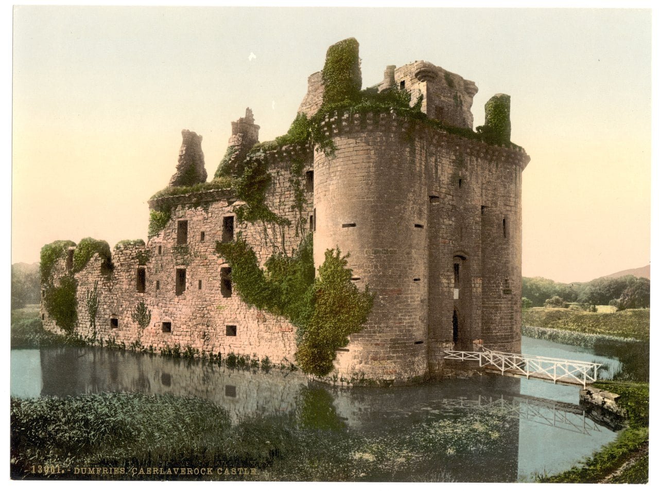
Much of the twin-towered gatehouse is thirteenth-century work, rebuilt and added to; its machicolated parapets are of the fifteenth century, and its wide-mouthed gunholes later still. Historic Environment Scotland calls it a keep gatehouse, and it was here, on the castle’s north side, that the Maxwells had their private rooms. Its first-floor lord’s hall still shows where a ribbed stone vault sprang from the side walls, along with the arrangements for working the portcullises and drawbridges.
Only the gatehouse is built on bedrock; the rest of the triangle stands on ground raised for it, the site falling away to the south. The gunholes are of a type introduced to Scotland after 1513, and their varied shapes hint that they were cut at different times. The decorative cap-house at the gatehouse top may belong to the works of the 1590s.
Murdoch’s Tower and the Ranges
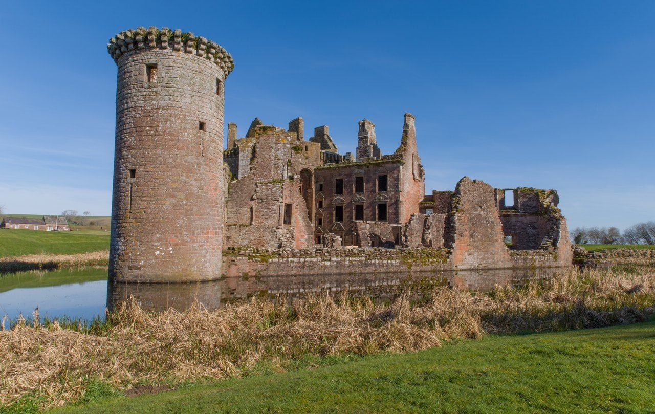
Of the two round towers at the base of the triangle, the south-western one, known as Murdoch’s Tower, still stands to its wall-head; only the base of the south-east tower survives, and O’Neil’s official guide dated its outer face to the first half of the fourteenth century, on a plan of the late thirteenth. In 1920 the Royal Commission on the Ancient and Historical Monuments and Constructions of Scotland recorded the south-western tower “surmounted at a height of 40 feet above the moat by a corbel course similar to that of the gatehouse.” By tradition it is named for Murdoch, Duke of Albany, who is said to have been held at Caerlaverock in 1425.
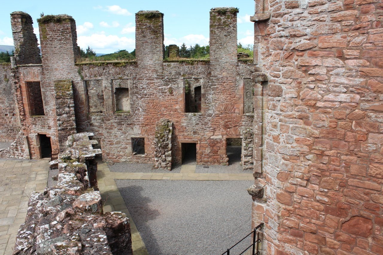
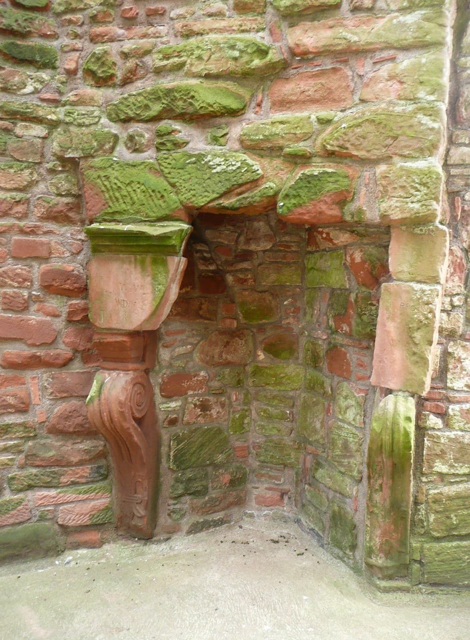
The south curtain and the south-east tower were wrecked in and after the siege of 1640. The same 1920 inventory found that “The greater part of the south curtain wall has been demolished to within 3 feet of the ground. One portion, however, east of the centre, still stands to a height of 25 feet.” Inside the walls, the west range of around 1500 kept its fine first-floor fireplaces.
The Nithsdale Lodging
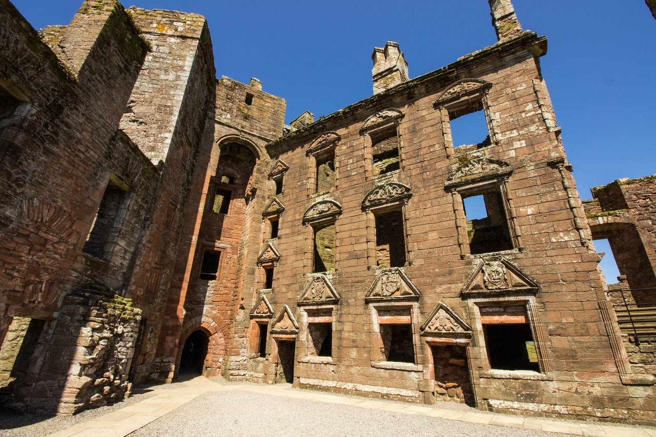
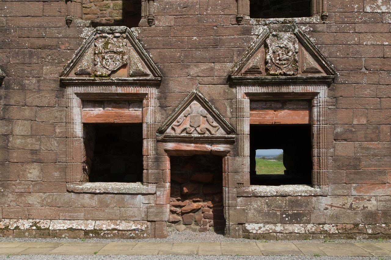
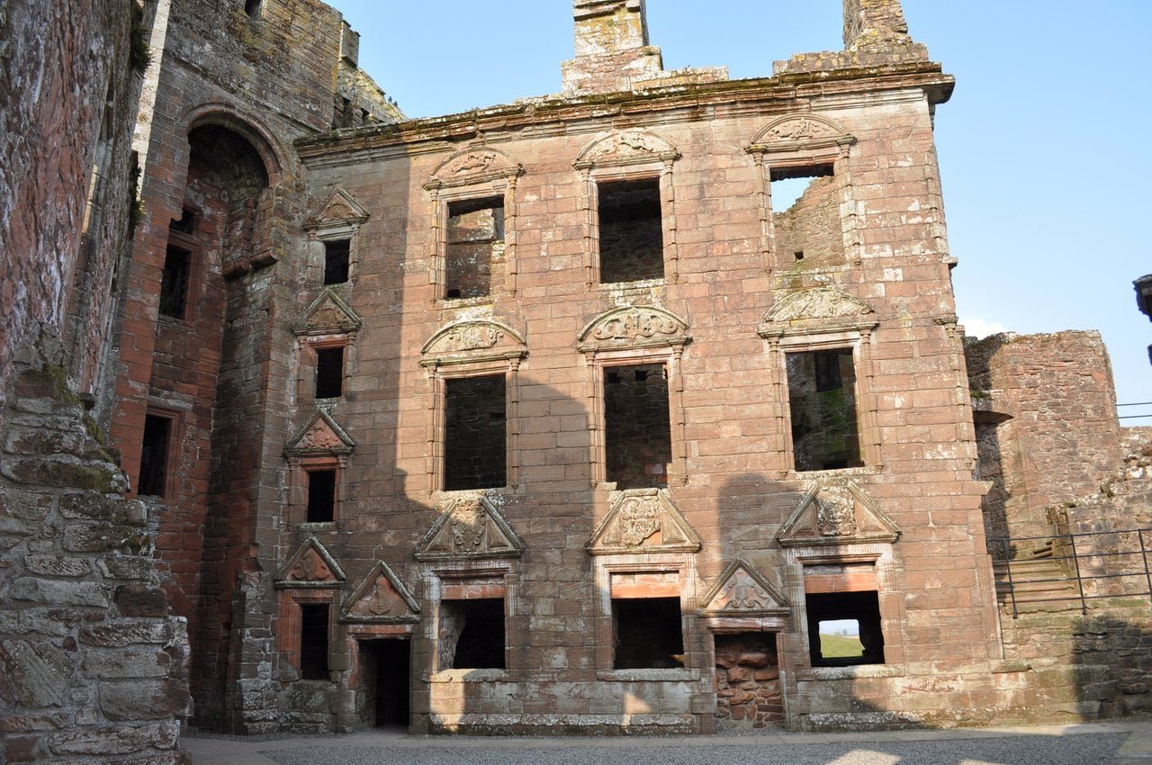
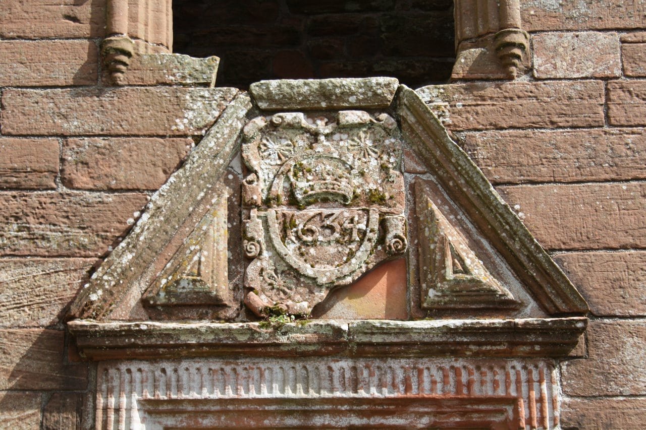
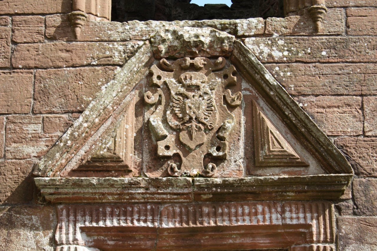
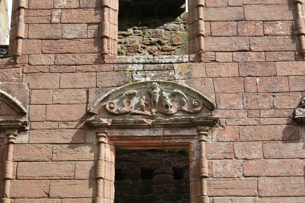
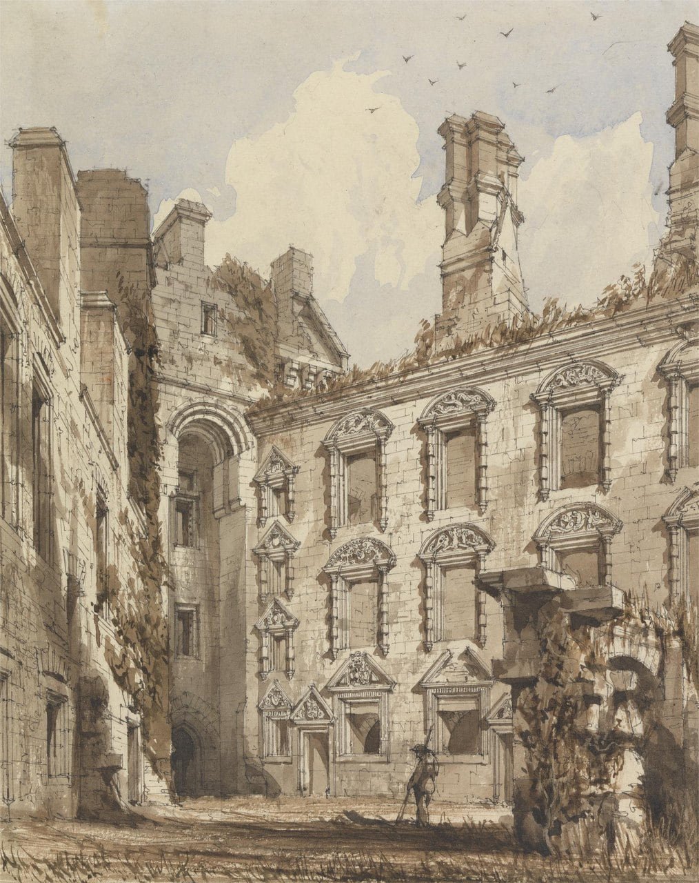
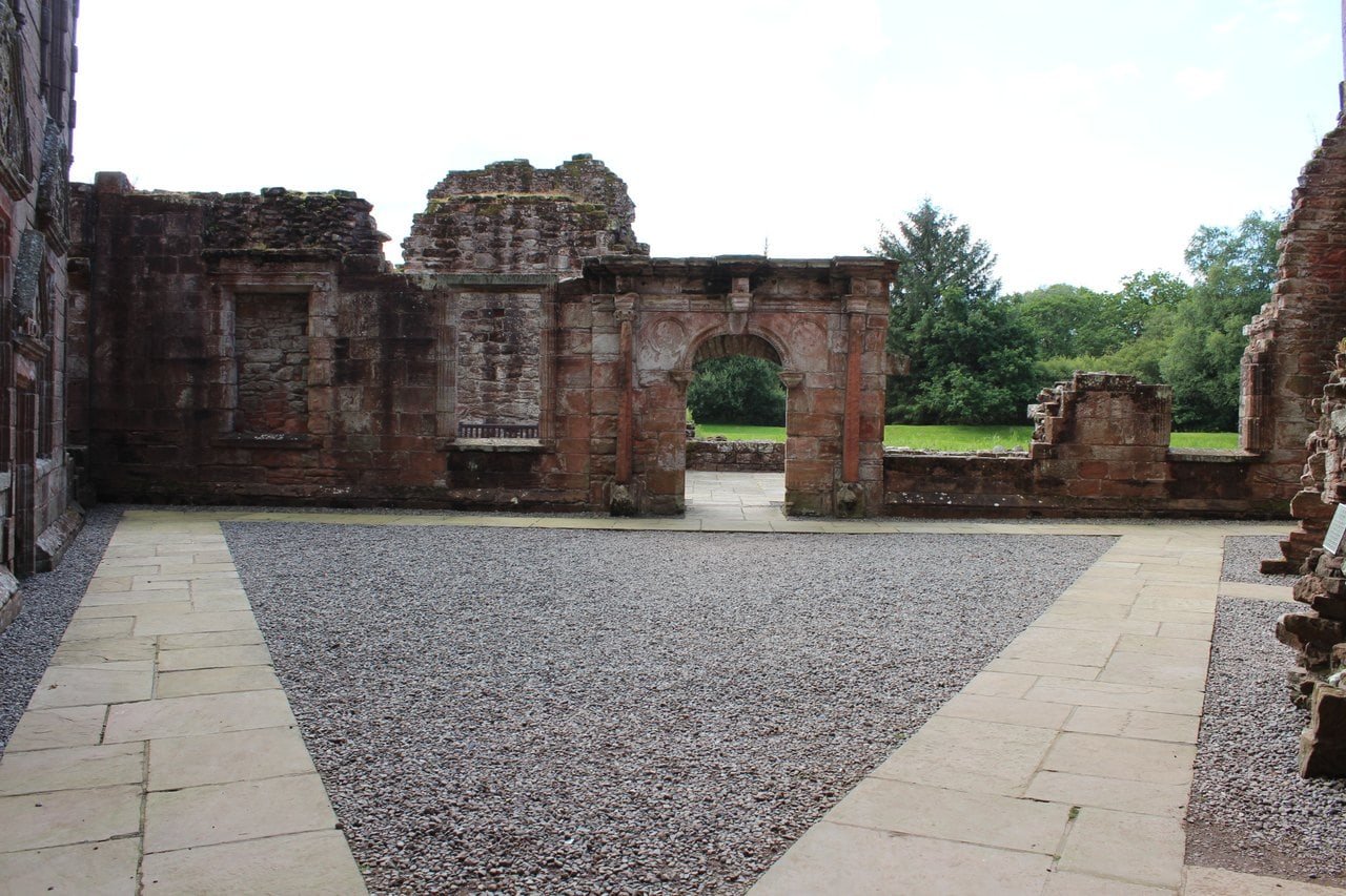
The Nithsdale Lodging of the 1630s faces the courtyard with a symmetrical facade, and Historic Environment Scotland counts it among the finest examples of Renaissance architecture in Scotland. Its window pediments, some triangular and some segmental, carry the arms of the Earl’s and the Countess’s families and, on the upper floors, scenes from classical mythology. Historic Environment Scotland describes the Lodging as an L-shaped mansion along the south and east sides of the courtyard, with the state rooms in the south range; the east range survives largely intact. From outside the walls, Historic Environment Scotland observes, the lodging scarcely proclaimed its presence: “However, once in the courtyard it overwhelmed and still does, despite the fact that the south range has all but disappeared.” In the same document it quotes Cruden’s judgment that this was “the most accomplished and sophisticated Scottish Renaissance building south of the Earl’s Palace, Kirkwall”.
A date stone of 1634 on the surviving east range was found during the consolidation of the castle. Historic Environment Scotland identifies two of the carved scenes as the despoiled body of Patroclus and Prometheus chained. It reports a suggestion that the carvers worked from printed emblem books, though one of those books came out a year after the date stone; William Fraser, in 1873, read the scenes as subjects from Ovid’s Metamorphoses. Over one second-story window he also found two shields hung from carved trees, with initials he read as those of Robert, Earl of Nithsdale, and Elizabeth Beaumont, his Countess, whom Robert had married in 1619, and a lover’s knot on her side.
Visiting Caerlaverock Castle
List the 9 castles on this map
- Caerlaverock Castle — Dumfries and Galloway, Scotland
- Edinburgh Castle — City of Edinburgh, Scotland
- Eilean Donan Castle — Highland, Scotland
- Stirling Castle — Stirling, Scotland
- Urquhart Castle — Highland, Scotland
- Doune Castle — Stirling, Scotland
- Dunnottar Castle — Aberdeenshire, Scotland
- Kilchurn Castle — Argyll and Bute, Scotland
- Dunrobin Castle — Highland, Scotland
Prices, opening hours and the parts of the castle closed for conservation work are in the Admission table below.
Getting there
Caerlaverock Castle is about 8 miles (13 km) south of Dumfries and 14 miles (23 km) west of Annan, Historic Environment Scotland’s figures for the two towns, and its postcode is DG1 4RU. Dumfries has the nearest railway station. From the center of Dumfries the local 6A bus runs out through Kingholm Quay and Glencaple to the stop named Caerlaverock, at Road End, on the B725, a trip of about half an hour. It runs a handful of times a day, Monday to Saturday, with no Sunday service, so check the timetable, including how you will get back, before relying on it. The castle has two car parks and space for coaches, and drivers can drop passengers at the visitor center.
Admission
| Ticket | Price |
|---|---|
| Adult (Historic Environment Scotland prices, checked 30 Oct 2026) | £7.50 |
| Concession | £6 |
| Child (7-15) | £3.50 |
| Historic Scotland member (Historic Environment Scotland’s membership) | Free |
| English Heritage, Cadw or Manx National Heritage member | Free or discounted entry |
| Scots aged 7 to 25 with a Young Scot or National Entitlement Card | £1 |
| Other tickets | Explorer Pass and family tickets are also offered when booking |
| Carers accompanying a disabled visitor (up to two per transaction) | Free |
| Price note | Prices are reduced while parts of the castle are closed for conservation work |
| Closed when checked (30 Oct 2026) | Parts of the castle, including the West Range and two of the towers |
| Hours, 1 April to 30 September | Daily, 9.30am to 5pm |
| Hours, 1 October to 31 March | Daily, 10am to 4pm |
| Last entry | 30 minutes before closing |
| Closed | 25 and 26 December, 1 and 2 January |
| Booking | Book online with Historic Environment Scotland in advance to guarantee entry |
Suggested route
Historic Environment Scotland’s own suggested order works well: walk around the outside of the moat first, then cross into the courtyard and climb to the remains of the south range for the view over the east range and the moat, and finish with the short nature trail to the foundations of the old castle. For families, its Castle Quest app invites visitors to “Meet the characters of the Castle and discover what their lives were like in 1312 …”
Best time to visit
The castle is open every day of the year apart from a few days over Christmas and New Year, with longer hours from April to September than in winter. Historic Environment Scotland has put on a summer weekend event here in late July in recent years (jousting in 2023 and 2024, living history in 2025), with dates on its What’s on page. In the October school holidays of 2024, 2025 and 2026 there was a family trail around the site. Autumn and winter are also the season for the barnacle geese and whooper swans at WWT Caerlaverock.
Historic Environment Scotland posts occasional short closures, some for maintenance, on the castle’s page, so check it on the day. In wet weather the gravel track in front of the visitor center can be muddy and has potholes.
Photography
The triangle reads most clearly from the air, and Historic Environment Scotland says as much, but flying a drone recreationally from the site needs its consent in advance (allow at least five working days). From the ground, walk the moat’s edge: a walk around the moat-surrounded fortress, Historic Environment Scotland says, “gives a sense of its strength, economy of form and pleasing geometry.” Inside, the climb to the remains of the south range gives the view Historic Environment Scotland singles out, across to the east range and the moat. The twin-towered gatehouse faces north, so its front is in shadow for most of the day; the west curtain and Murdoch’s Tower take the afternoon light.
Accessibility
The visitor center and shop are step-free. The castle is about 200 m up a slope from the visitor center, over tarmac, paved and grass surfaces, and as you near the castle, after the moat, there is a short but steep (1:6) downward grass section. Inside, the main level route is paved and runs around the courtyard to the remains of the south range; there are steps down into some rooms, though most of them can also be seen from the path, and most have gravel surfaces. Historic stone spiral stairs with handrails lead to the upper levels of the east range, and the path to the old castle crosses its moat by steps. The visitor center has a shop, and there are toilets, with an adapted toilet next to the visitor center, a picnic area, baby-changing facilities and coach parking. A limited number of ear defenders, for adults and children, can be borrowed from staff.
For a stay nearby, Dumfries is the nearest town: see hotels in Dumfries on Booking.com. Tickets for the castle itself are sold by Historic Environment Scotland.
Some links on this page are affiliate links, which means StoneKeep Atlas may earn a small commission, at no extra cost to you, if you book through them.
More Views of Caerlaverock Castle
Common Questions
What was filmed at Caerlaverock Castle?
Part of The Decoy Bride was filmed at Caerlaverock in 2010, according to Historic Environment Scotland. Announcing the castle’s reopening in July 2023, it wrote: “It has also had a starring role on film, notably in The Decoy Bride (2011) with Kelly Macdonald and David Tennant.” That “notably” suggests other productions have used the site, but The Decoy Bride is the one the release names.
Why is Caerlaverock Castle triangular?
Historic Environment Scotland’s answer starts with the ground. Its Statement of Significance notes that “Due to the surrounding boggy landscape, the castle could only be approached on foot or horseback from the north,” and the gatehouse holds that northern point. Historic Environment Scotland also quotes MacIvor and Gallagher, who saw in Caerlaverock’s design “a pleasure in geometry that elsewhere inspired such designs as the pentagon of Holt Castle and, further afield, the octagonal Castel del Monte.”
What is Old Caerlaverock Castle, and can you visit it?
It is the earlier castle, which Historic Environment Scotland’s scheduling record attributes to the Maxwells: a four-sided platform in the woods near the castle that replaced it. After an excavation in 1998-99, directed by Martin Brann, the site was laid out for display and linked to the standing castle by a nature trail, the route visitors take today. Historic Environment Scotland classes it as a medieval moated site and, citing a 1996 historical atlas, counts only about 50 such sites in Scotland against over 5,000 in England and Wales.
Can you go inside Caerlaverock Castle?
Yes. You cross the moat by its bridge into the courtyard, and from there you can enter rooms off it and climb into the east range. Since the early 2020s Historic Environment Scotland has been inspecting and repairing the high-level masonry, and until visitors were let back across the moat in July 2023, only the grounds had stayed open. Parts of the interior have since been closed again in phases. The Admission table in the Visiting section lists what was shut when we checked.
Where do you park at Caerlaverock Castle?
There are two car parks, both on plastic-reinforced grass. The main one is about 100 m from the visitor center, up a tarmac incline; the overflow car park is 25 m from the visitor center, on level tarmac. Drivers can drop passengers at the visitor center, and there is parking for coaches. From the visitor center the castle is a further walk of about 200 m uphill, so allow for that if anyone in your group finds slopes hard.
Are dogs allowed at Caerlaverock Castle?
Dogs are welcome in the outdoor areas, Historic Environment Scotland says; inside roofed areas only assistance dogs are allowed, and those are permitted at all its sites. It also counts 15 habitats in the castle grounds, “including semi-natural ancient woodland, swamp and ponds and unimproved grassland.”
Who owns Caerlaverock Castle today?
Caerlaverock is a property in the care of the Scottish Ministers, run by Historic Environment Scotland under a guardianship arrangement: the state took on its management, not its title. O’Neil’s official guide traced the castle by inheritance through the Herries family to the 16th Duke of Norfolk, who placed it in the guardianship of what was then the Ministry of Works. No published source we have read names the present owner.
Where can you see the swans near Caerlaverock?
The place for them is WWT Caerlaverock, a separate wetland center run by the Wildfowl & Wetlands Trust. The trust says thousands of barnacle geese, whooper swans and other birds arrive there, and that Svalbard barnacle geese “flock to WWT Caerlaverock in their thousands in the autumn and winter …” Next to the castle’s own grounds lies the Caerlaverock National Nature Reserve, and Historic Environment Scotland suggests a stroll in the reserve after a visit.
Beyond Caerlaverock Castle
Murdoch, Duke of Albany, whose name the south-west tower carries by tradition, was the son of Robert Stewart, for whom Doune Castle was raised, and Historic Environment Scotland’s Statement of Significance for Stirling Castle records that it was at Stirling that James I had him executed. Forty-five years after a Covenanting army besieged Caerlaverock, Covenanters were the prisoners at Dunnottar Castle, shut into a vaulted cellar in the summer of 1685. Our guide to how castle moats worked sets Caerlaverock’s water beside the other moats you can still visit. These Scottish castles are gathered in our guide to the castles of Scotland.
Conclusion
Caerlaverock Castle is easiest to understand from its shape. The triangle was laid out around 1277 with its gatehouse at the northern point, the one part of the castle set on bedrock. The poet of 1300, most likely one of Edward I’s heralds, described the same outline as a shield. In the 1630s the Earl of Nithsdale set his lodging inside the walls, its window pediments carrying the arms of his family and his Countess’s; the siege of 1640 ended the castle’s life as a lordly home. The south curtain is now largely gone and Murdoch’s Tower still stands to its wall-head. A short walk through the woods leads to the first castle, probably abandoned because its walls were moving, and back to the water-filled moat that still frames the whole design.
Principal Sources
- Ardill, Thomas, revised by Matthew Imms. “Tour of Scotland for Scott’s Poetical Works 1831.” J.M.W. Turner: Sketchbooks, Drawings and Watercolours, Tate Research Publication, 2012. tate.org.uk
- bustimes.org. “6A – Glencaple circular – Dumfries.” Timetable data from the Traveline National Dataset. bustimes.org
- Fraser, William. The Book of Carlaverock: Memoirs of the Maxwells, Earls of Nithsdale, Lords Maxwell & Herries. Vol. I. Edinburgh: privately printed, 1873. archive.org
- Historic Environment Scotland. “Caerlaverock Castle.” historicenvironment.scot
- Historic Environment Scotland. “Caerlaverock Castle and Old Castle, castles, courtyards and harbour.” Scheduled Monument SM90046. portal.historicenvironment.scot
- Historic Environment Scotland. “Caerlaverock Castle has re-opened to visitors.” News release, 27 July 2023. web.archive.org
- Historic Environment Scotland. Caerlaverock Castle Statement of Significance. Last reviewed 2015, minor update 2021. historicenvironment.scot
- Historic Environment Scotland. “Caerlaverock Castle: History and stories.” historicenvironment.scot
- Historic Environment Scotland. “Caerlaverock Castle: Plan your visit.” historicenvironment.scot
- Historic Environment Scotland. “Using drones at Historic Scotland sites.” historicenvironment.scot
- Maxwell, Sir Herbert (trans.). The Chronicle of Lanercost, 1272-1346. Glasgow: James Maclehose and Sons, 1913. archive.org
- Nicolas, N. Harris (ed.). The Siege of Carlaverock in the XXVIII Edward I, A.D. MCCC. London: J. B. Nichols, 1828. archive.org
- O’Neil, B. H. St J. Caerlaverock Castle. Ministry of Works official guide. Edinburgh: HMSO, 1952 (7th impression, 1972).
- Paul, Sir James Balfour (ed.). The Scots Peerage. Vol. VI. Edinburgh: David Douglas, 1909. archive.org
- Royal Commission on the Ancient and Historical Monuments and Constructions of Scotland. Seventh Report with Inventory of Monuments and Constructions in the County of Dumfries. Edinburgh: HMSO, 1920. archive.org
- Scottish Government. Historic Environment Scotland Act 2014, Explanatory Notes, section 4. legislation.gov.uk
- Trove (formerly Canmore) / RCAHMS. Site record 66100, Caerlaverock Castle. trove.scot
- Trove (formerly Canmore) / RCAHMS. Site record 66101, Old Caerlaverock Castle. trove.scot
- Wildfowl & Wetlands Trust. “Wildlife.” WWT Caerlaverock. wwt.org.uk
- Wright, Thomas (ed.). The Roll of Arms of the Princes, Barons, and Knights who attended King Edward I. to the Siege of Caerlaverock in 1300. London: J. C. Hotten, 1864. archive.org
Image credits. Hero, the gatehouse, curtain and corner tower across the moat: Photo: Heartland Arts / Adobe Stock; the castle from the air, with the Solway Firth: Photo: rphfoto / Adobe Stock; the foundations of the old castle: Photo: Humphrey Bolton, CC BY-SA 2.0; Turner’s view, engraved by Goodall: After J. M. W. Turner, engraved by Edward Goodall, British Library, public domain; the triangular plan from the air: Photo: Duncan / Adobe Stock; MacGibbon and Ross’s first-floor plan: David MacGibbon and Thomas Ross, 1887, public domain; the outer earthworks: Photo: Humphrey Bolton, CC BY-SA 2.0; the gatehouse and its bridge: Photo: Duncan / Adobe Stock; MacGibbon and Ross’s view of the entrance: David MacGibbon and Thomas Ross, 1887, public domain; the corbelled parapet from below: Photo: Tom Parnell, CC BY-SA 2.0; a ribbed vault, looking up: Photo: Tom Parnell, CC BY-SA 2.0; the courtyard from above: Photo: Billy McCrorie, CC BY-SA 2.0; the Nithsdale Lodging facade: Photo: Marieke / Adobe Stock; the lodging’s carved pediments: Photo: Tom Parnell, CC BY-SA 2.0; the gatehouse through an archway: Photo: Tom Parnell, CC BY-SA 2.0; the moat from the upper works: Photo: Richard Nevell, CC BY-SA 4.0. Source: Caerlaverock Castle, October 2024 08, Wikimedia Commons; the gatehouse reflected in the moat: Photo: susanne2688 / Adobe Stock; a round tower across the moat: Photo: jeremyabaxter / Adobe Stock; the castle in snow: Photo: Terence A R Watts / Adobe Stock; the castle under a summer sky: Photo: Afunbags / Adobe Stock; the Nithsdale Lodging, frontal: Photo: Alfi / Adobe Stock; a pediment with a crowned shield: Photo: Jonathan Oldenbuck, CC BY-SA 3.0. Source: Caerlaverock IMG 6329, Wikimedia Commons; a pediment with a double-headed eagle: Photo: Jonathan Oldenbuck, CC BY-SA 3.0. Source: Caerlaverock IMG 6330, Wikimedia Commons; a curved, figured pediment: Photo: Jonathan Oldenbuck, CC BY-SA 3.0. Source: Caerlaverock IMG 6333, Wikimedia Commons; inside Murdoch’s Tower: Photo: Dave Croker, CC BY-SA 2.0. Source: The south-western tower of Caerlaverock Castle - geograph.org.uk - 7871896, Wikimedia Commons; a carved fireplace: Photo: Humphrey Bolton, CC BY-SA 2.0. Source: Fireplace in Caerlaverock Castle - geograph.org.uk - 2098226, Wikimedia Commons; a modern siege-engine replica on the lawn: Photo: Emily_M_Wilson / Adobe Stock; the gatehouse in a photochrom of about 1890-1900: Photochrom, Photochrom Print Collection, Library of Congress, public domain; Billings’s courtyard drawing: Robert William Billings (1813-1874), Yale Center for British Art, CC0; the courtyard and its archway: Photo: Billy McCrorie, CC BY-SA 2.0. Source: Caerlaverock Castle Courtyard - geograph.org.uk - 4064235, Wikimedia Commons; the gatehouse in low sunlight: Photo: Michael Walsh, CC BY 3.0. Source: Caerlaverock Castle - panoramio (2), Wikimedia Commons. Freely licensed images are resized to fit; any other change, such as a crop, is named in the credit.